DFW today Sunny. Highs in the mid 90s. South winds 10 to 20 mph, becoming 15 to 20 mph with gusts up to 30 mph this afternoon. -William
DFW today Sunny. Highs in the mid 90s. South winds 10 to 20 mph, becoming 15 to 20 mph with gusts up to 30 mph this afternoon. -William

Here’s a look at Local Radar and Live Temperatures across North Texas.
DFW the rest of tonight: Mostly clear. Lows in the lower 70s. South winds 10 to 15 mph.


William’s North Texas Hazardous Weather Forecast this Evening:
Isolated storms are possible this afternoon and evening along and northwest of a line from Gainesville to Cisco. Gusty winds may accompany these storms.

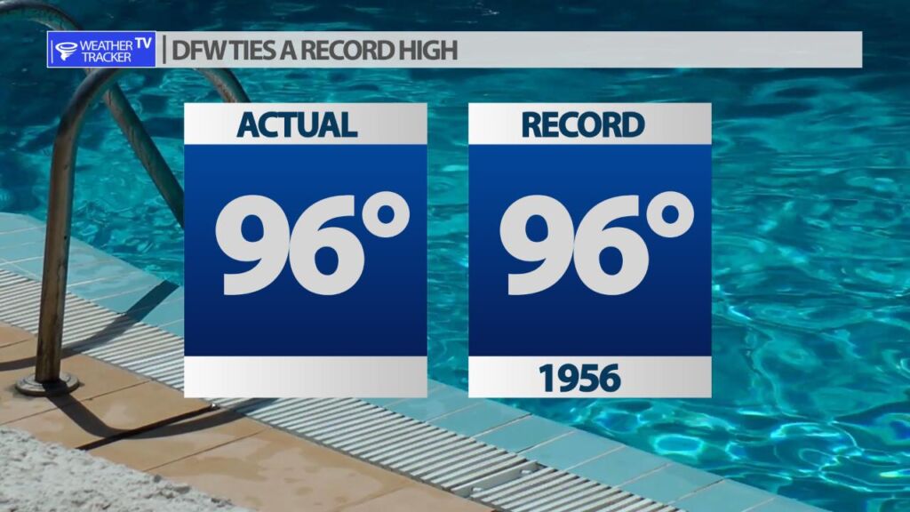
DFW came within a degree of setting a new record high for today’s date. 96 was the official high recorded at DFW. The record for today’s date was also 96 set back in 1956 – so we tied the record. Either way – it was a hot afternoon across North Texas!
DFW tonight Mostly clear. Lows in the lower 70s. South winds 10 to 15 mph. -William


Here’s a look at Live Temperatures across North Texas, Local Radar and the Updated Forecast Map.
DFW this afternoon Mostly sunny. Highs in the mid 90s. South winds 15 to 20 mph with gusts up to 30 mph. -William


Here’s a look at Live Temperatures across North Texas, Local Radar and the Updated Forecast Map.
DFW today Mostly cloudy with a slight chance of sprinkles this morning, then mostly sunny this afternoon. Highs in the mid 90s. South winds 10 to 20 mph, becoming 15 to 20 mph this afternoon. -William
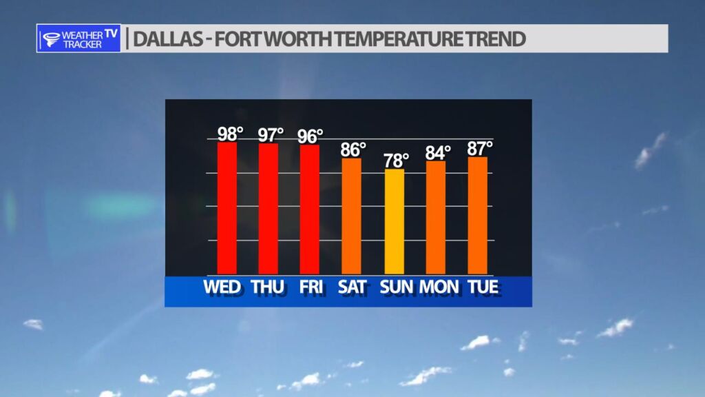
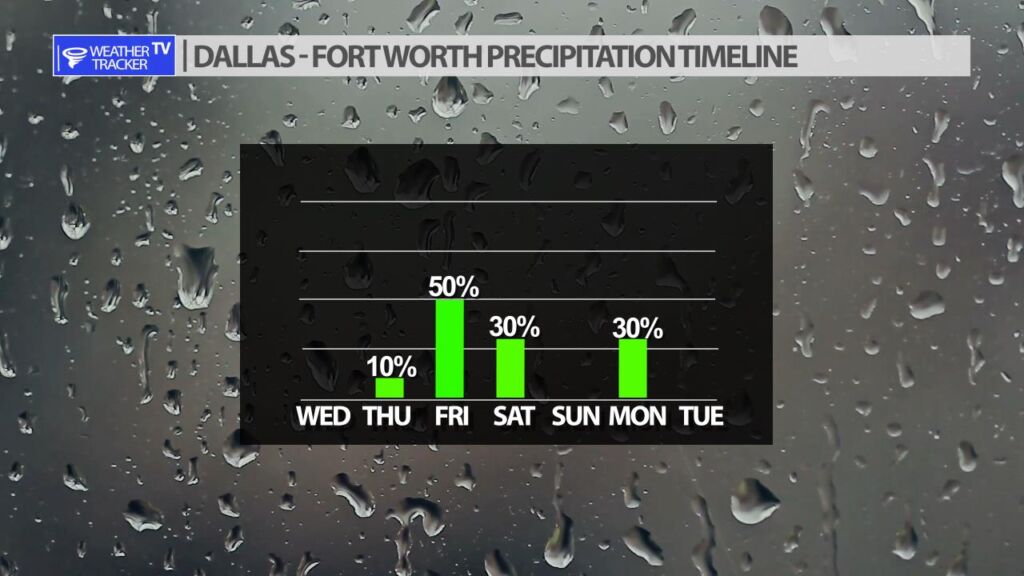
After a very hot stretch of weather in North Texas – daytime highs running 10 – 15 degrees above normal over the last two weeks. A pattern change starts late Friday into the weekend, and it will bring heat relief in the form of a cold front, and also storm chances.
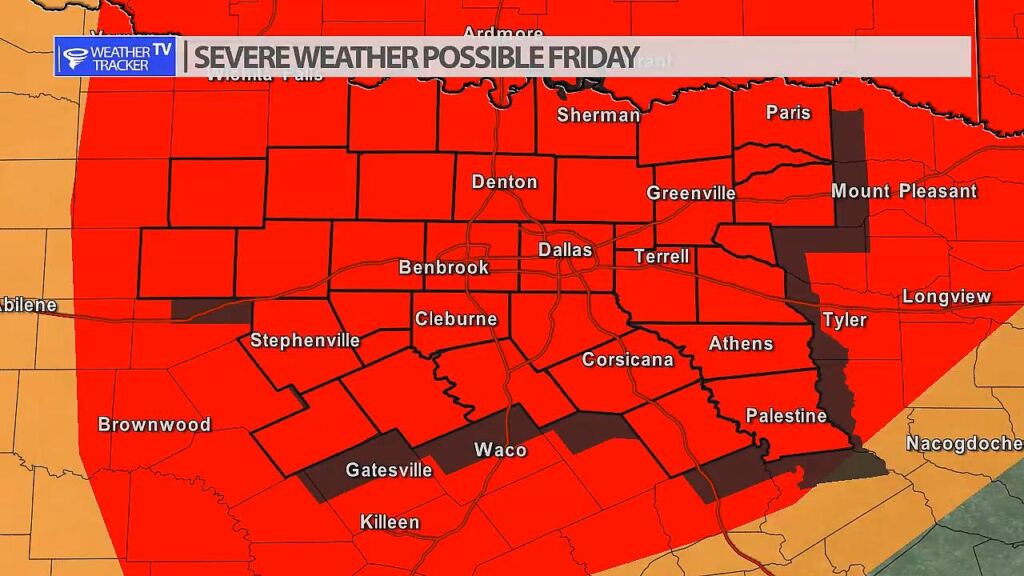
Storm chances are increasing on Friday as the first piece of our pattern change arrives. A dryline will set up in our western counties and late day storms will form. Those initial storms will then push east and fill into a broken line or full line of storms as they cross the I-35 corridor. Severe is possible with any of the activity on Friday. Hail and wind is a concern, but also a few tornado warnings would be possible.