
Current Set Up Across the Nation
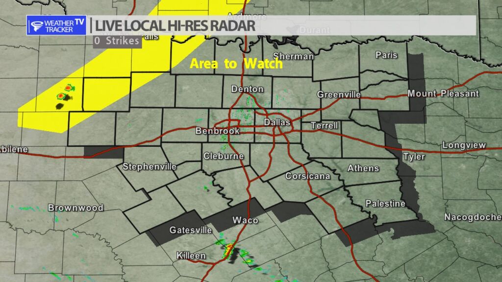
We are watching for any thunderstorm development near a dryline in our western counites this evening. A few showers or updrafts have tried to develop but the cap or lid in the atmosphere so far has held and suppressed the development. We’ll continue to monitor that area over the next couple of hours for any activity.
DFW tonight Partly cloudy with a 20 percent chance of showers and T-Storms in the evening, then mostly cloudy after midnight. Lows in the mid 70s. South winds 15 to 20 mph, diminishing to 10 to 15 mph after midnight. -William


Here’s a look at Live Temperatures across North Texas, Local Radar and the Updated Forecast Map.
DFW this afternoon Sunny. Highs in the mid 90s. South winds 15 to 20 mph. -William


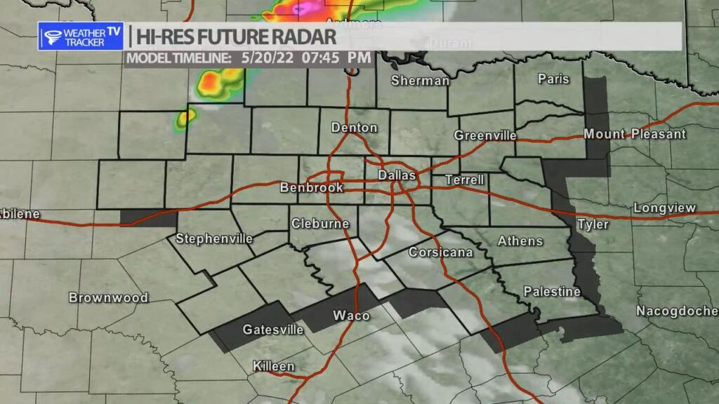
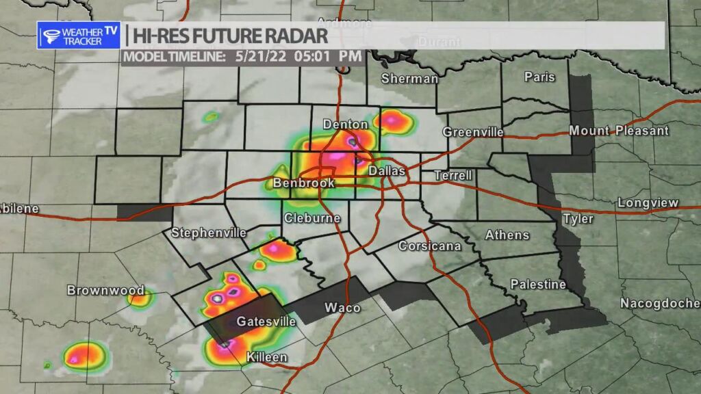
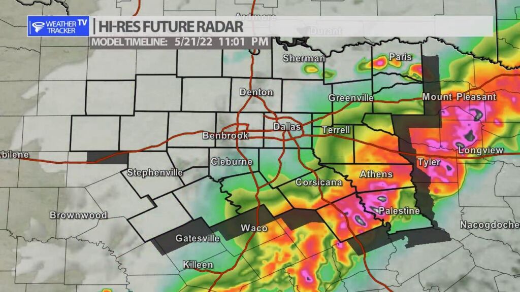
Two rounds of severe weather are possible in North Texas over the next 48 hours. Round one is today with a dryline setting up in our western counites. A piece of Jetstream energy will also be moving through the area. A few storms will try and form in our northwestern counites after 4 pm near the dryline – half dollar sized hail and winds to 65 mph would be the primary concern with that activity – it will weaken after sunset and most likely stay confined to only our northwestern counites. Round two arrives tomorrow with a cold front that comes sweeping through North Texas. After 3 pm storms initiate very close to the Metroplex and then a line of storms will congeal as the activity pushes south into the evening. Half dollar sized hail and winds to 65 mph will be a concern with that activity as well.
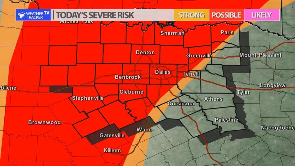
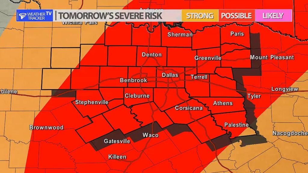


William’s North Texas Hazardous Weather Forecast for Friday:
Storm chances return to North Texas this afternoon and evening along and east of a dryline. Large hail and damaging winds will be the main threats.

DFW today Sunny. Highs in the mid 90s. South winds 15 to 20 mph. -William