

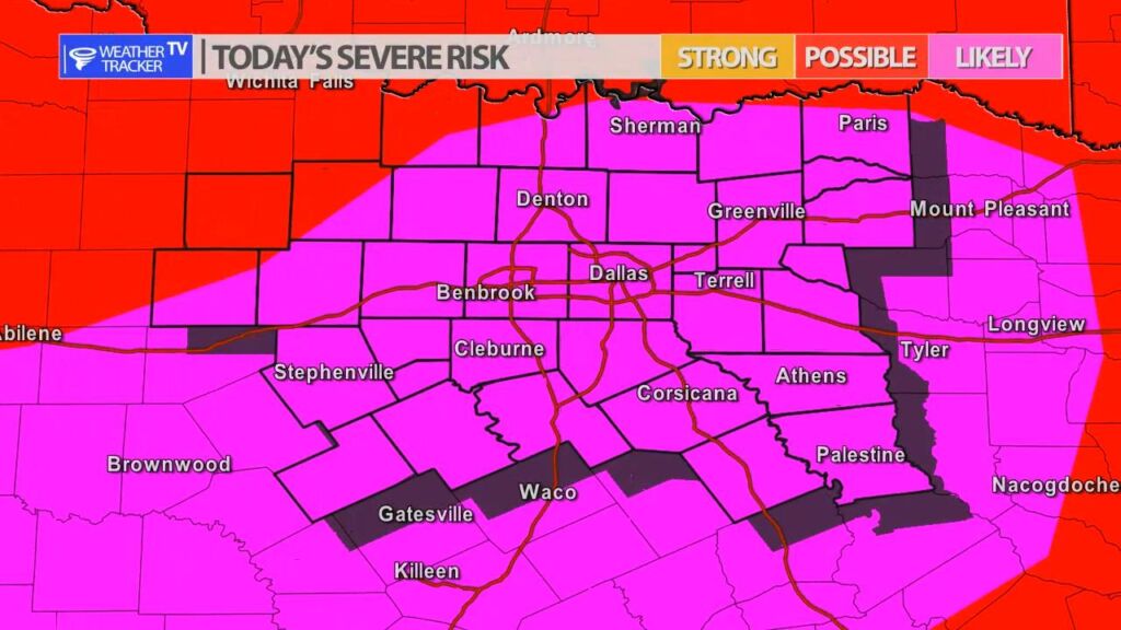
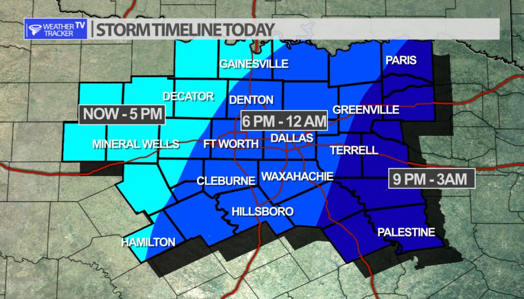
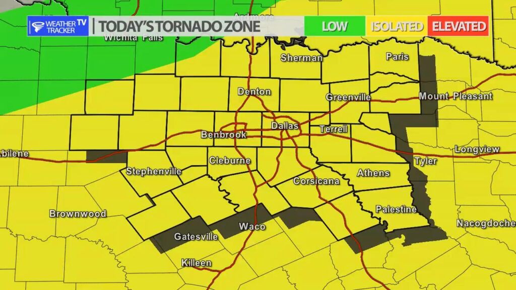
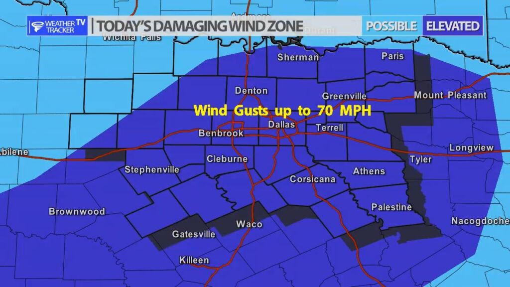
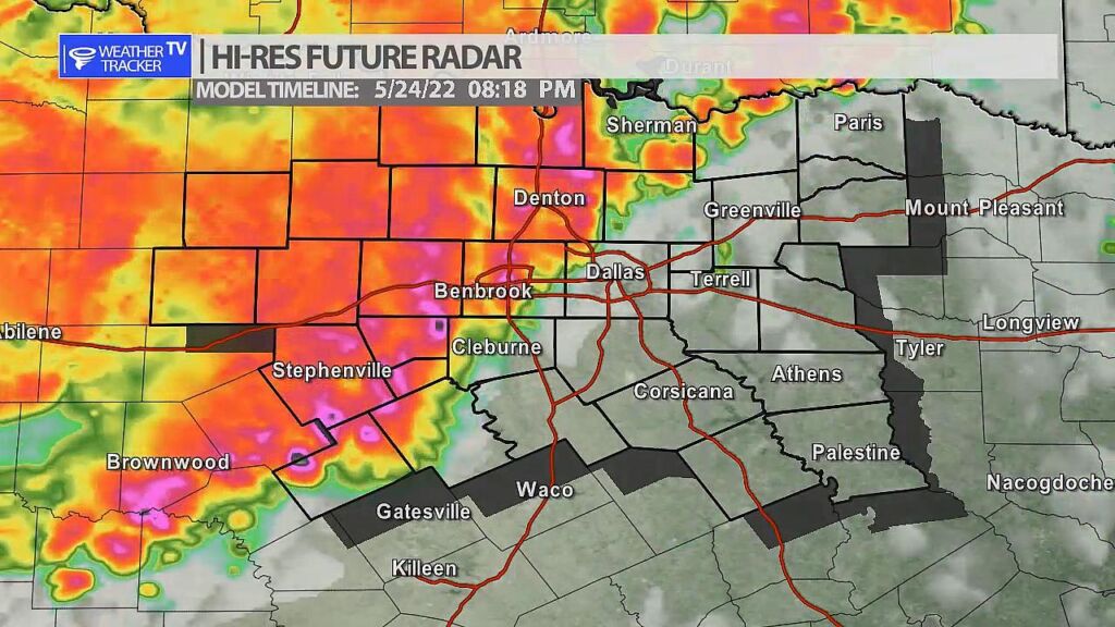
Severe weather is likely across North Texas today – or more specifically late afternoon and evening. Scattered rain and T-Storms will be possible through the afternoon but as a cold front begins to push through the area by late afternoon we’ll see a line of storms organize first in our western counites and push into the Metroplex after 6 pm. This line of storms or squall line will be capable of damaging wind gusts over 65 mph, hail up to the size of half dollars, flooding and even isolated quick spin up tornadoes.
Make sure you are staying weather alert through the afternoon and as always we’ll have more updates on our mobile and channel as the day progresses.


William’s North Texas Hazardous Weather Forecast for Tuesday:
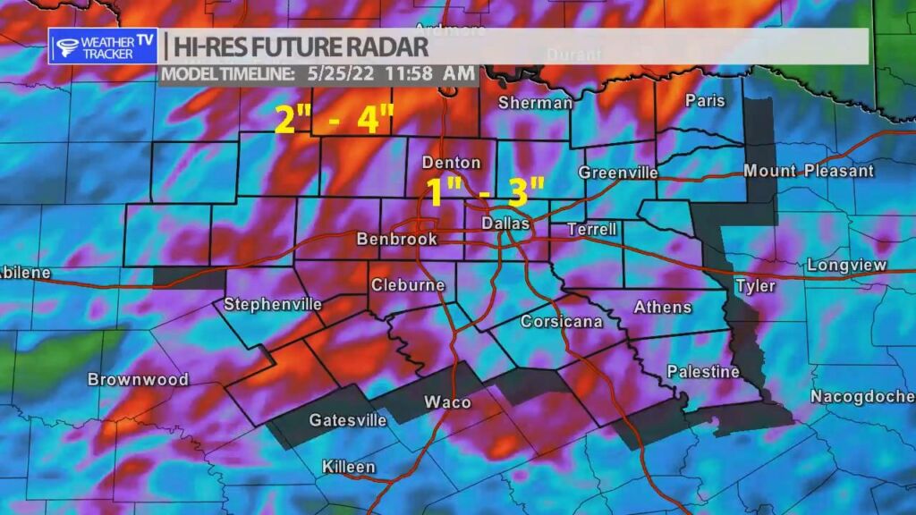
Scattered to numerous T-Storms are expected later today and through this evening ahead of a cold front. Some storms may be severe with large hail and damaging wind gusts. A few spin-up tornadoes can’t be ruled out. Storms should exit the area overnight Tuesday night or Wednesday morning.


DFW today Cloudy. A chance of showers and T-Storms this morning, then showers and T-Storms likely this afternoon. Highs in the upper 70s. Southeast winds 10 to 15 mph, becoming south 15 to 20 mph this afternoon. Chance of rain 70 percent. -William

Here’s a look at Local Radar and Live Temperatures across North Texas.
DFW the rest of tonight: Mostly cloudy. A chance of showers and T-Storms late this evening, then showers and T-Storms likely. Lows in the upper 60s. Southeast winds 5 to 10 mph. Chance of rain 70 percent.


From William Cole: A strong T-Storm will impact portions of southeastern Bosque and southwestern Hill Counties through 915 PM
At 838 PM , Live Radar was tracking a strong T-Storm near Valley Mills, or 9 miles east of Clifton, moving northeast at 20 mph.
Penny Size Hail. Minor Damage To Outdoor Objects Is Possible.
Stay with William Cole and Weather Tracker TV Dallas – Fort Worth for continuing coverage, online, on our app and on TV. Let’s stay safe together.

William’s North Texas Hazardous Weather Forecast this Evening:
Scattered storms are ongoing across the Big Country, moving toward western portions of North and Central Texas. Lightning and locally heavy rainfall will be the main threat with any storms tonight.