
Here’s a look at Live Temperatures across North Texas, Local Radar and the Updated Forecast Map.
DFW this afternoon Mostly cloudy with a 30 percent chance of showers and T-Storms. Highs in the lower 80s. South winds 15 to 20 mph. -William


Here’s a look at Live Temperatures across North Texas, Local Radar and the Updated Forecast Map.
DFW this afternoon Mostly cloudy with a 30 percent chance of showers and T-Storms. Highs in the lower 80s. South winds 15 to 20 mph. -William

From William Cole: Strong T-Storms will impact portions of Young and Jack Counties through 1115 AM
At 1044 AM , Live Radar was tracking strong T-Storms along a line extending from near Newport to near Graham. Movement was northeast at 40 mph.
Penny Size Hail. Minor Damage To Outdoor Objects Is Possible.
Stay with William Cole and Weather Tracker TV Dallas – Fort Worth for continuing coverage, online, on our app and on TV. Let’s stay safe together.

From William Cole: A Severe T-Storm Warning continues for for Jack County in North TX until 10:45 AM.
At 1027 AM , a severe T-Storm was located near Jacksboro, moving northeast at 30 mph.
Primary Threats: Half Dollar Size Hail.
Stay with William Cole and Weather Tracker TV Dallas – Fort Worth for continuing coverage, online, on our app and on TV. Let’s stay safe together.


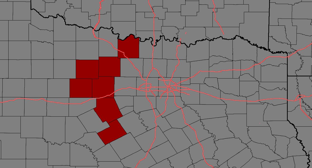
From William Cole: A T-Storm Watch has been issued in the Weather Tracker TV DFW coverage area for the following counties until 6:00 PM Sunday. Collin, Cooke, Delta, Denton, Fannin, Grayson, Hunt, Jack, Lamar, Montague, Palo Pinto, Stephens, Wise & Young.
We’ll have Live Severe Weather Coverage on the channel – which includes Texas’ #1 Storm Chasing Team – as needed. Be sure to download our free Weather Tracker TV DFW mobile app and add our Live channel to your Roku, Apple or Amazon Fire TV device.
Stay with William Cole and Weather Tracker TV Dallas – Fort Worth for continuing coverage, online, on our app and on TV. Let’s stay safe together.

From William Cole: A Severe T-Storm Warning has been issued in the Weather Tracker TV DFW coverage area for Jack County in North TX until 10:45 AM.
At 1005 AM , a severe T-Storm was located near Bryson, or 11 miles west of Jacksboro, moving northeast at 30 mph.
Hometowns Impacted: Jacksboro, Bryson And Newport.
Primary Threats: Half Dollar Size Hail.
Stay with William Cole and Weather Tracker TV Dallas – Fort Worth for continuing coverage, online, on our app and on TV. Let’s stay safe together.
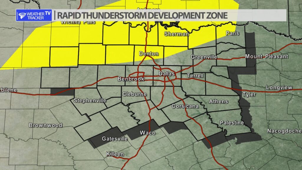
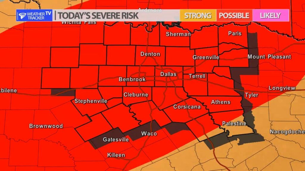
The Storm Prediction Center says a weather watch may be issued for parts of North Texas over the next few hours.
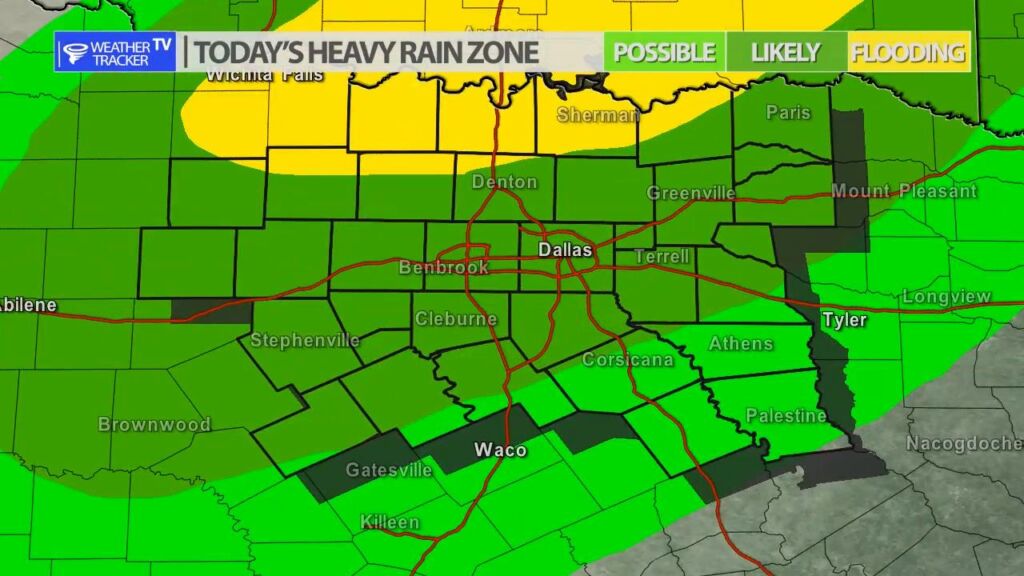
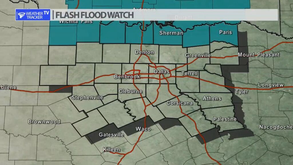
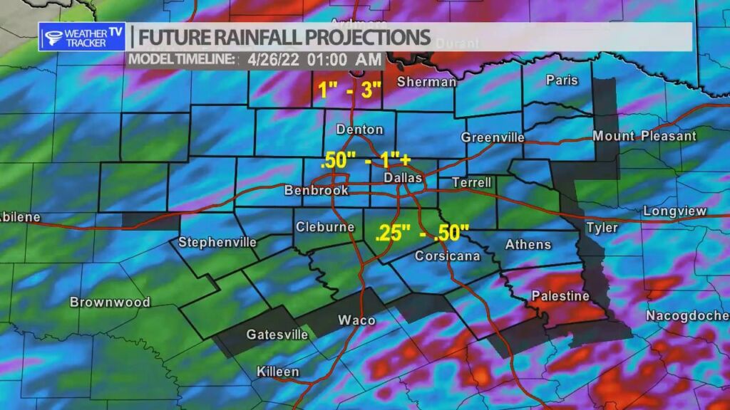
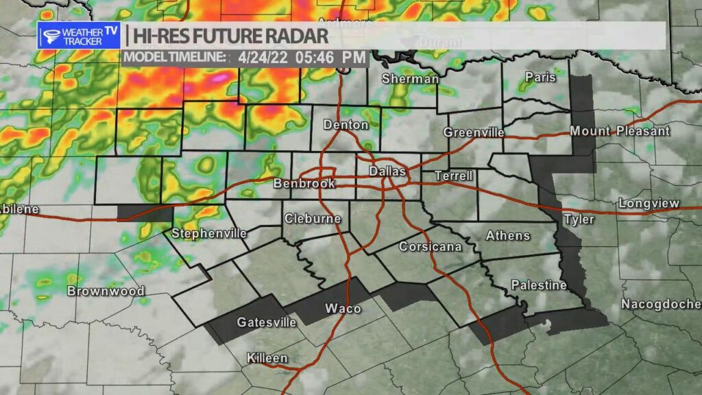
A slow moving cold front along with a strong upper level storm system will be the focus of rain and storms across North Texas today and tonight. Heavy rain with localized flooding will be a concern. A few storms will also be severe with a hail up to half dollar sized threat and wind gusts up to 60 mph. Rain chances stay fairly low in the Metroplex for most of the afternoon but quickly begin to increase by late day into the evening.

From William Cole: A Severe T-Storm Warning continues for for Jack & Young Counties in North TX until 10:15 AM.
At 941 AM , a cluster of severe T-Storms were located near and west/northwest of Graham, moving northeast at 35 mph.
Primary Threats: Half Dollar Size Hail.
Stay with William Cole and Weather Tracker TV Dallas – Fort Worth for continuing coverage, online, on our app and on TV. Let’s stay safe together.
From William Cole: A Severe T-Storm Warning has been issued in the Weather Tracker TV DFW coverage area for Jack & Young Counties in North TX until 10:15 AM.
At 925 AM , a cluster of severe T-Storms were located west and southwest of Graham, moving northeast at 40 mph.
Hometowns Impacted: Graham, Olney, Bryson, Elbert And Newcastle.
Primary Threats: Half Dollar Size Hail.
Stay with William Cole and Weather Tracker TV Dallas – Fort Worth for continuing coverage, online, on our app and on TV. Let’s stay safe together.