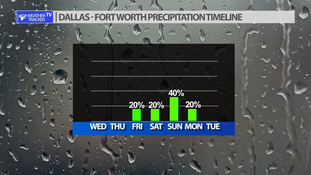
Spotty rain and storm chances will return for the weekend. Friday, a dryline moves into our far western counties and may trigger a storm or two. The cap or lid that suppress thunderstorm development will be very strong on Friday so it’s only a 20% probability a storm is even able to form. If a storm were to form it would be severe with a hail and wind threat. Saturday, a few showers are possible but most of us stay dry. Sunday, as a cold front stalls near the Red River Valley – an area of rain and storm will try and form. If you’re making weekend plans stay plugged into the Sunday forecast – it’s still several days away and the details will change, but severe weather would be possible with any activity.


