
DFW today Mostly cloudy this morning, then becoming partly sunny. Highs in the mid 80s. South winds 10 to 20 mph, becoming 15 to 20 mph with gusts up to 30 mph this afternoon. -William
DFW today Mostly cloudy this morning, then becoming partly sunny. Highs in the mid 80s. South winds 10 to 20 mph, becoming 15 to 20 mph with gusts up to 30 mph this afternoon. -William

Here’s a look at Local Radar and Live Temperatures across North Texas.
DFW the rest of tonight: Partly cloudy. Lows in the upper 60s. South winds 10 to 15 mph.


William’s North Texas Hazardous Weather Forecast this Evening:
No hazardous weather is expected at this time.

DFW tonight Partly cloudy in the evening, then becoming mostly cloudy. Lows in the upper 60s. South winds 10 to 15 mph. -William


Here’s a look at Live Temperatures across North Texas, Local Radar and the Updated Forecast Map.
DFW this afternoon Partly sunny. Highs in the lower 80s. South winds 15 to 20 mph. -William


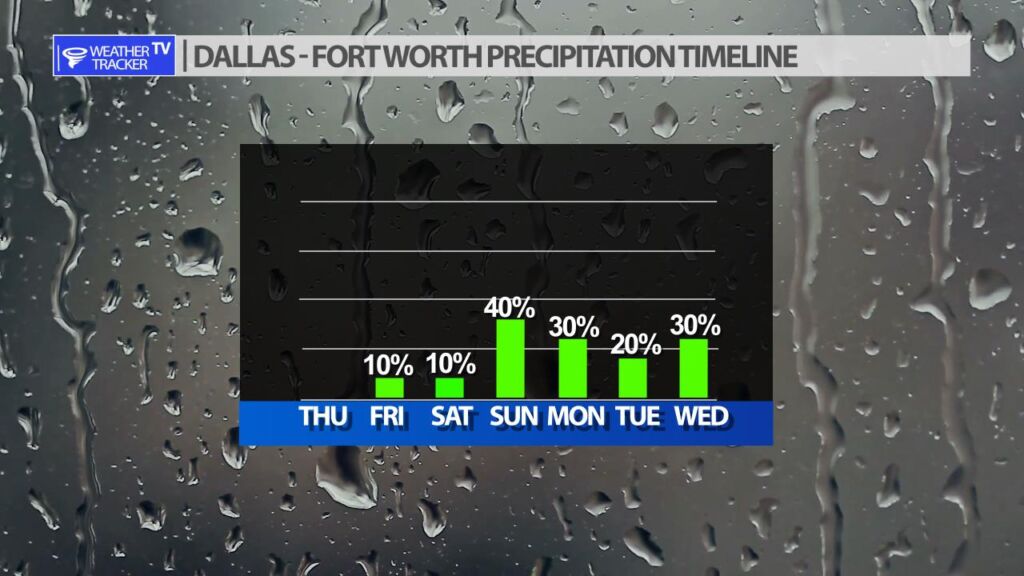
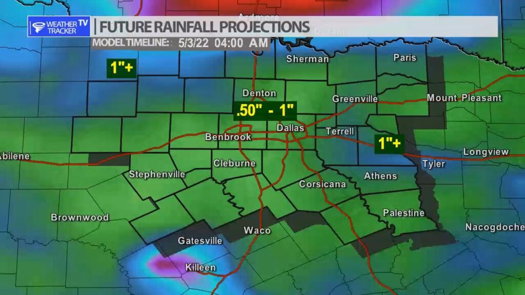
Storm chances appear to be increasing to end your weekend and into the first part of next week. As a strong upper level storm system moves through the Great Plains it will push a cold front down into North Texas. The front will essentially stall in the area and seesaw back and forth. As that happens there will be a chance of scattered rain and storms. Severe weather may also be possible. Storm chances taper off Monday night but another system arrives by Wednesday.
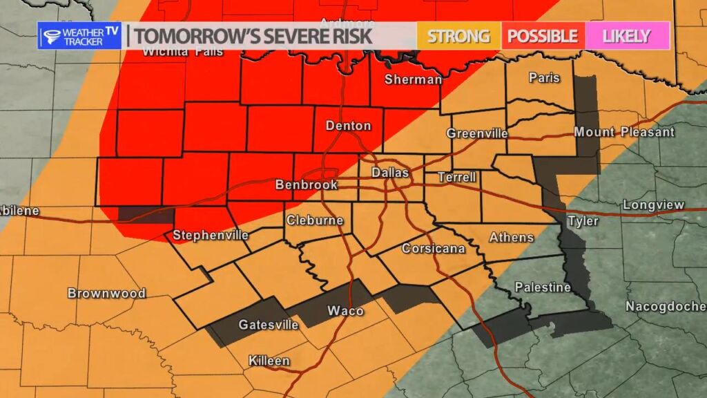
A dryline will set up in our western counties tomorrow (Friday). There is a slight chance we see a couple of isolated thunderstorms form. The cap or the “lid” in the atmosphere will be very strong and will try and suppress any thunderstorm development – so we may not see any activity, but if a storm were to form it would be severe with a golf ball+ sized hail threat.

