Isolated Severe Risk Today Northwest

Today’s severe risk map.

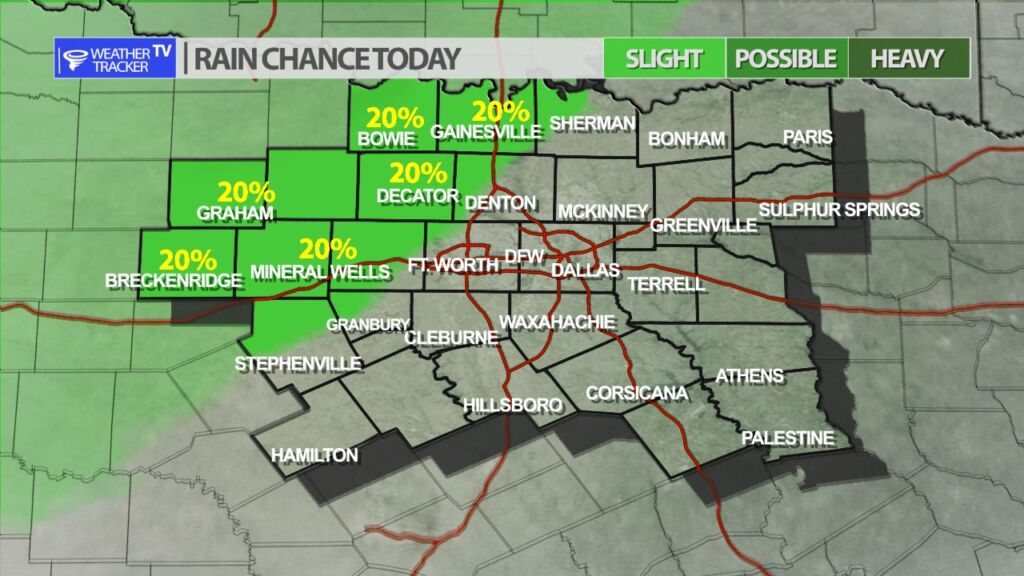
It will be warm, windy and humid across North Texas today. In our far northwestern counties there is a slight chance of a late day thunderstorm – if a storm were to form in that area – it could be severe with hail up to the size of golf balls and wind gusts up to 65 mph. The latest data continues to show most if not all of the activity stays up in Oklahoma. As always, we’ll be watching it and have updates on the app and channel as needed.

Today’s tornado zone remains up in Oklahoma.
Future Radar shows most if not all of the activity stays up in Oklahoma today.
Isolated storm chance today in our northwestern counties.

North Texas Overnight Update

Texas Weather Tracker TV Alert

Here’s a look at Local Radar and Live Temperatures across North Texas.

DFW the rest of tonight: Partly cloudy late this evening, then becoming mostly cloudy. Lows in the mid 60s. South winds 15 to 20 mph with wind gusts up to 35 mph are possible.

Texas Weather Tracker TV Alert