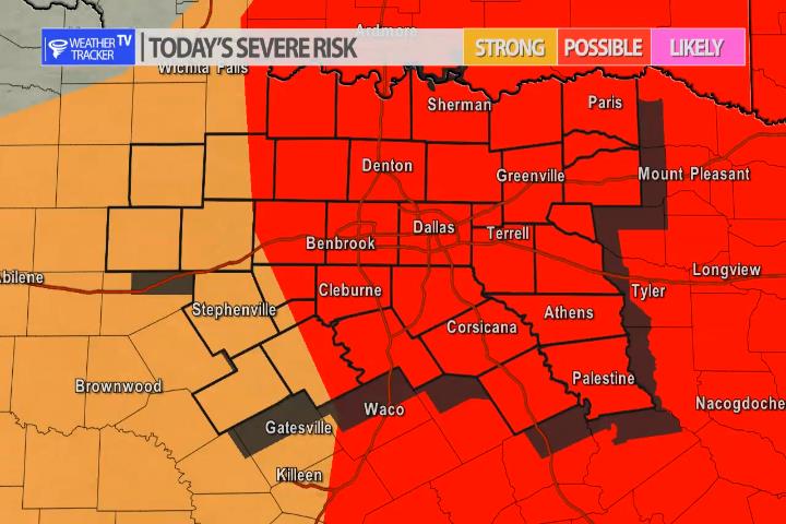
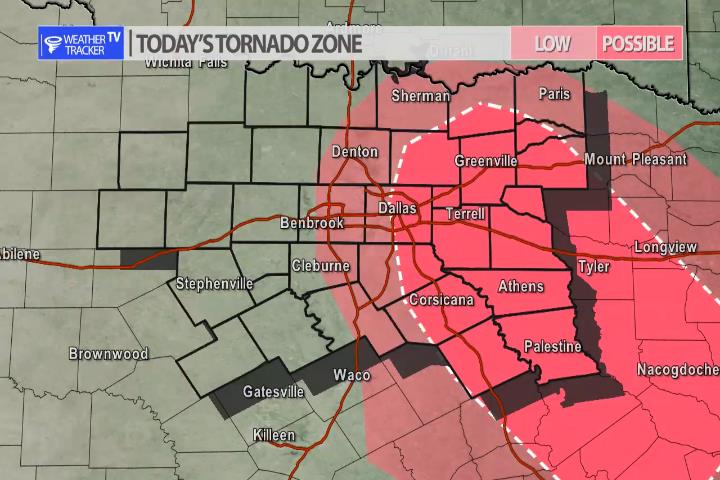
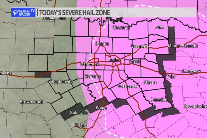
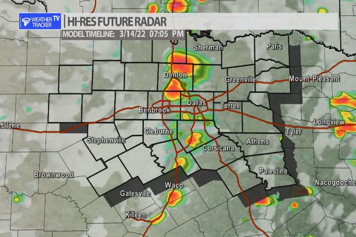
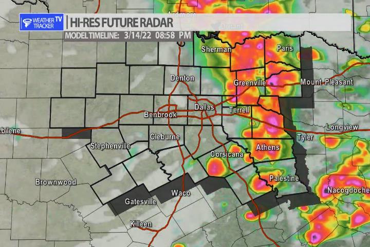
The risk of severe weather returns to North Texas late this afternoon and evening. As a dryline sets up just west of the I-35 corridor – along with a very dynamic Jetstream storm system approaching – storms will quickly develop over the Metroplex and near I-35. Storms may form as early as 5 pm but it appears as though a broken line of storms should rapidly develop after 6 pm and then push east through the evening. The primary concern is hail up to the size of golf balls and wind gusts over 60 mph. An isolated tornado can’t be ruled out, but tornado probabilities are low today. As always we’ll have updates on our mobile app all afternoon and live severe weather coverage on the channel this evening as needed.
You must be logged in to post a comment.