
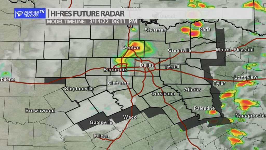
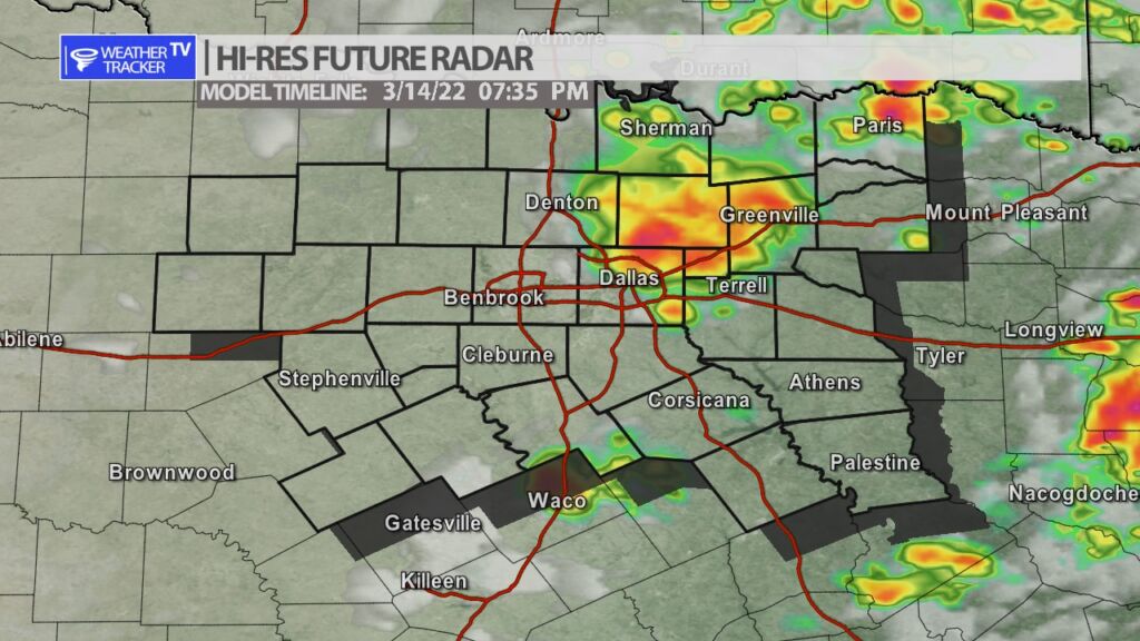
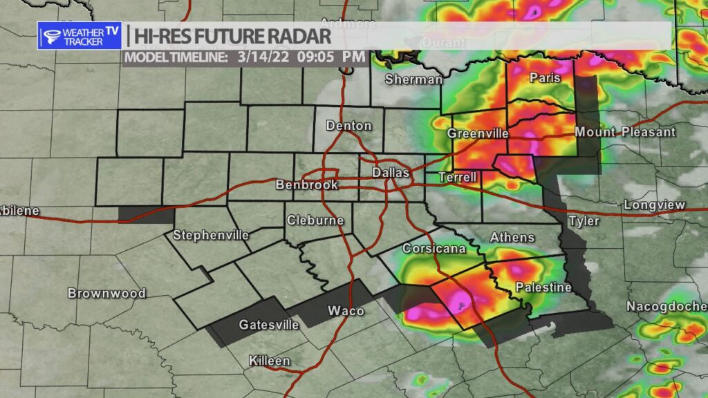
The risk of severe weather returns to North Texas tomorrow by late afternoon and early evening. Gusty south winds today and tomorrow will help to pump the Gulf of Mexico moisture back into the area. At the same time a windy cold front will approach the area by late day tomorrow and a Jetstream storm system will also cross the area. All of that combined gives us the opportunity of early spring T-Storms and a few storms will be strong to severe. Rain and storm chances are essentially from the I-35 corridor to the east with the storm coverage increasing the further east the activity gets. Quarter to half dollar sized hail and winds to 60 mph are the main concerns.
You must be logged in to post a comment.