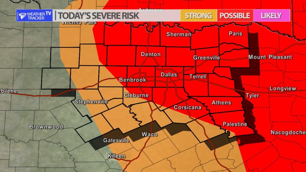
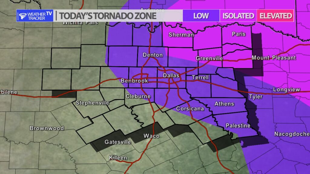
A strong upper level storm system is approaching from the west, and that combined with increasing Gulf of Mexico moisture this afternoon are a few of the weather pieces of the puzzle that are now quickly coming together to offer parts of North Texas a chance of severe weather this evening. Storms will initial form after 4 pm northwest of Dallas – Fort Worth and then track east through the evening. The severe weather probabilities are not incredibly high but severe weather should be expected. The main concern is wind gusts over 60 mph, hail up to the size of golf balls and there is a chance of a tornado warning or two. If you’re making Wednesday evening plans stay alert to changing weather conditions – especially if you will be on area roads – because of the hail and severe weather concerns. As always, we will have more updates here and live severe weather coverage on the channel as needed.
You must be logged in to post a comment.