Good Monday Morning, North Texas!
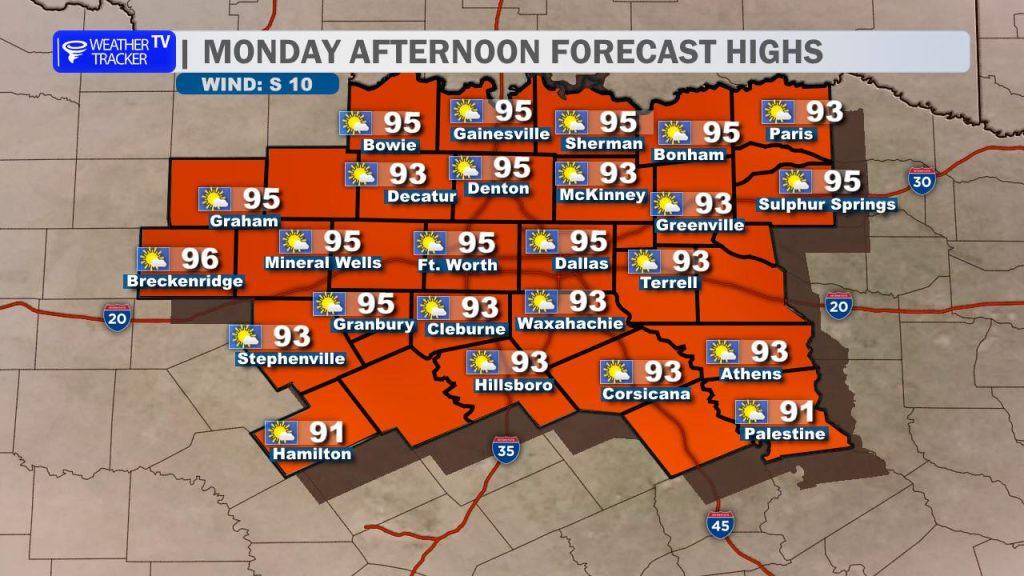
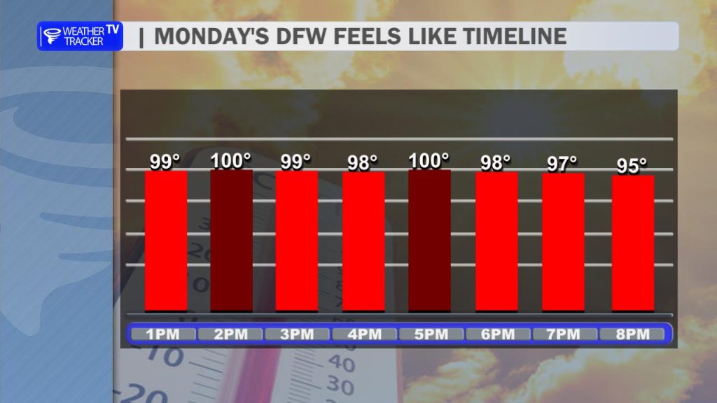
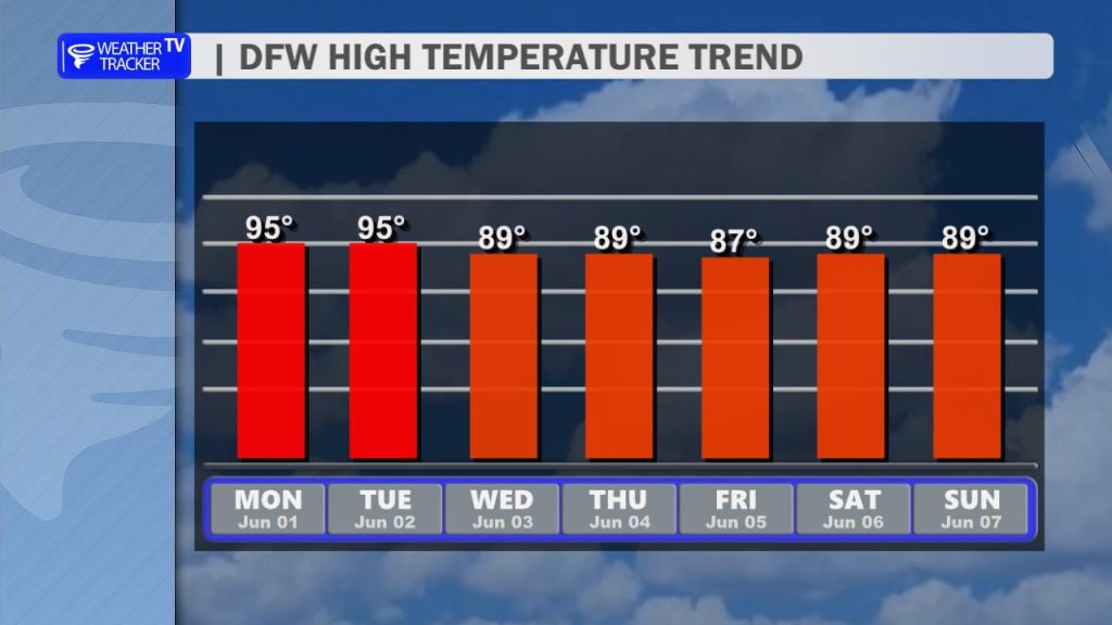
It is June 1st, and today marks the official kickoff of meteorological summer. True to the calendar, the forecast is right on schedule, bringing us a hot and humid afternoon. High temperatures today will push into the mid-90s. When you factor in that sticky Gulf moisture, our feels-like heat index numbers will climb toward 100 degrees across the Metroplex. Be sure to practice your heat safety precautions if you are spending time outdoors this afternoon.
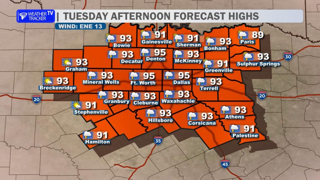
Tomorrow will bring more of the same to start. Expect a hot and humid Tuesday morning and midday with highs back in the mid-90s and heat index values flirting with the triple digits. However, a weak backdoor cold front will slide toward the area from the northeast by late afternoon. While it won’t offer a dramatic drop in temperatures, it will act as the focal point for scattered showers and thunderstorms late Tuesday afternoon and evening.
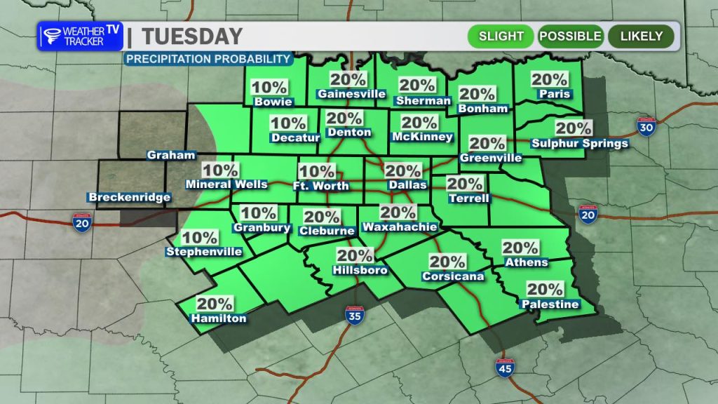
Given the intense daytime heating, a few of these storms could become strong to isolated severe, capable of frequent lightning, heavy downpours, and localized wind gusts up to 50 mph. Because this activity will be widely scattered, we are capping the rain probability at 20 to 30 percent for any one location.
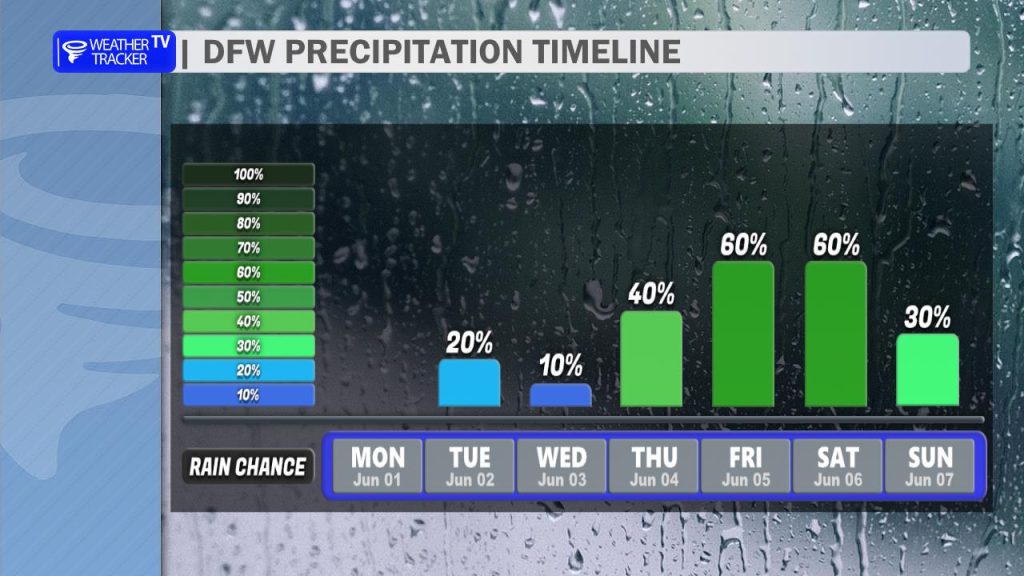
Our weather pattern remains unsettled as we head deeper into the workweek. An upper-level disturbance moving out of Mexico will keep daily, scattered storm chances in the forecast through Thursday, before a stronger system brings our best widespread rain and storm chances Friday into early Saturday. On the bright side, the accompanying increase in cloud cover and rainfall will trend our afternoon highs back down into the upper 80s by the end of the week.
You must be logged in to post a comment.