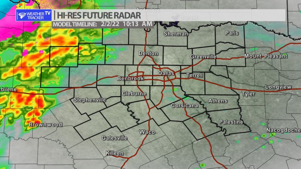
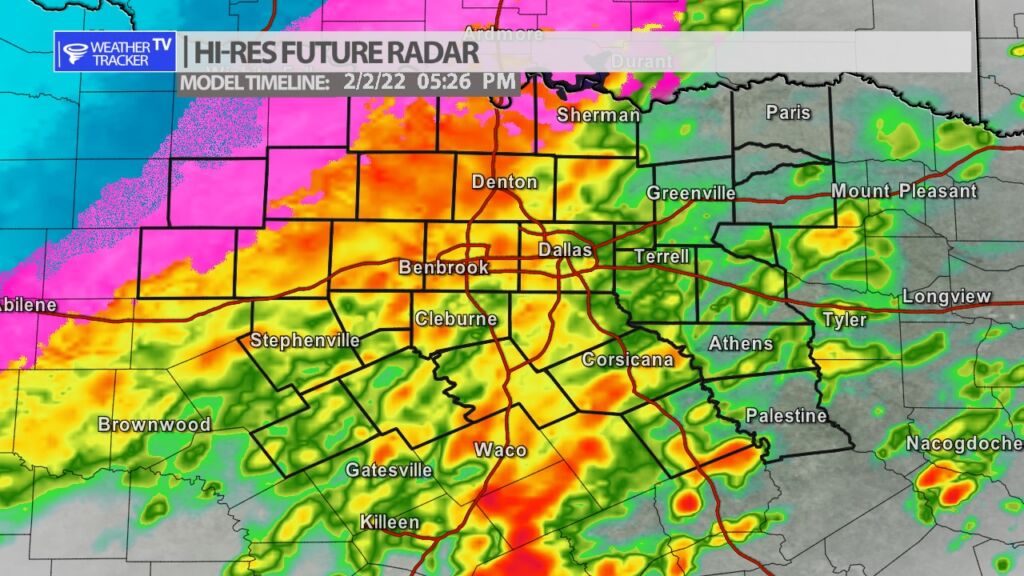
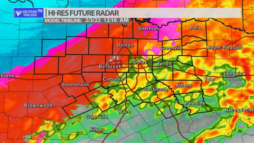
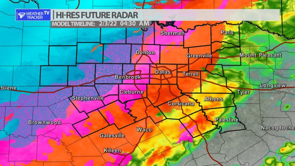
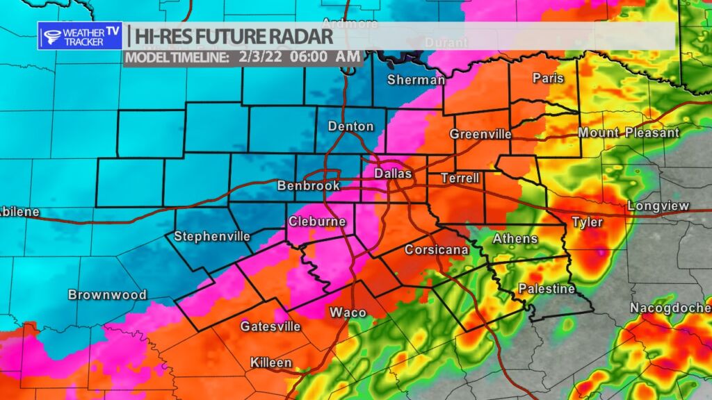
The details and timing of our impending winter storm in North Texas have not changed much overnight. Rain will develop as we go through the day on Wednesday – some heavy rain is possible. An Arctic front will also be pushing through North Texas. Temperatures will be dropping through the day. As temperatures hit and drop below 32 degrees – first in our northern Red River counties and then eventually the Metroplex – the rain will transition over to a freezing rain. Freezing rain then continues all of Wednesday night and into parts of Thursday in the Dallas – Fort Worth area. The freezing rain will transition over to a bit of a wintry mix Thursday afternoon before ending. Northwest of the Metroplex there is a better opportunity of accumulating snow. Roadways will be slick and hazardous and any travel will be very difficult on Thursday. Ice storms unfortunately always bring a chance of power disruptions. Make the necessary plans today for you and your family for the possibility of a power disruption and also the hazardous travel conditions.

You must be logged in to post a comment.