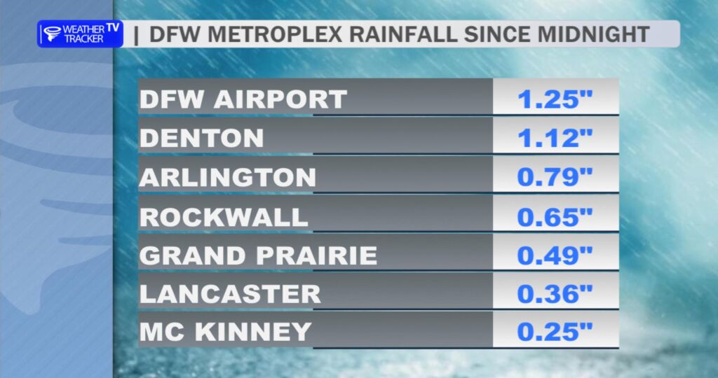
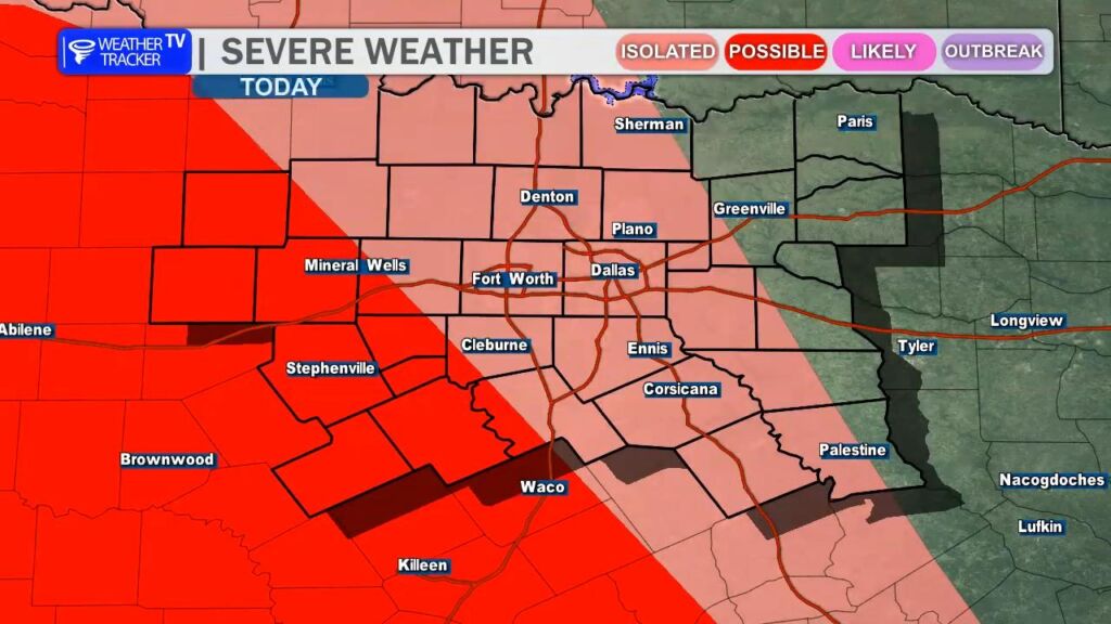
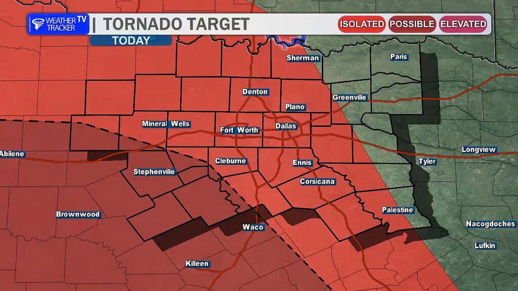
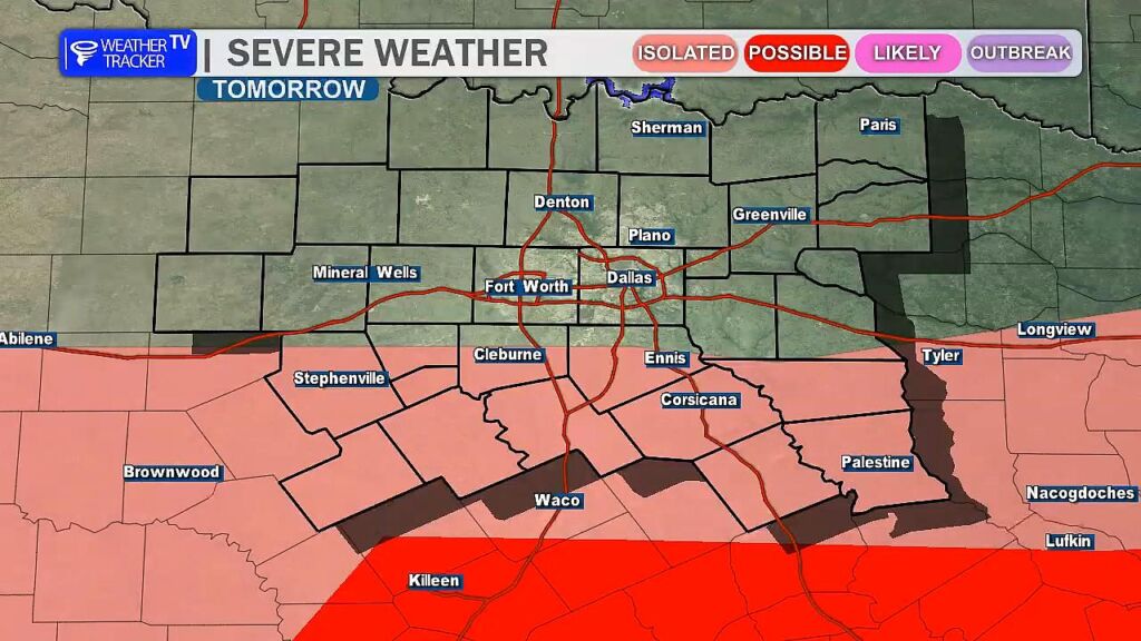
North Texas is in the middle of a stormy stretch, with the first round of rain and thunderstorms sweeping through last night. While not everyone received precipitation, those who did saw generous amounts—DFW Airport, for example, recorded 1.25 inches. Scattered showers remain possible this afternoon, but the next round arrives tonight, bringing heavy rain and the potential for severe weather, especially in our western counties where a complex of storms could produce quarter- to half-dollar-sized hail, winds up to 60 mph, and a brief tornado cannot be ruled out. Heavy rain will become the primary concern overnight, with localized flooding possible. That activity clears out before the third and final round moves in on Saturday, delivering more heavy rain and the chance for hail. Skies will clear on Sunday, ushering in improving weather.
You must be logged in to post a comment.