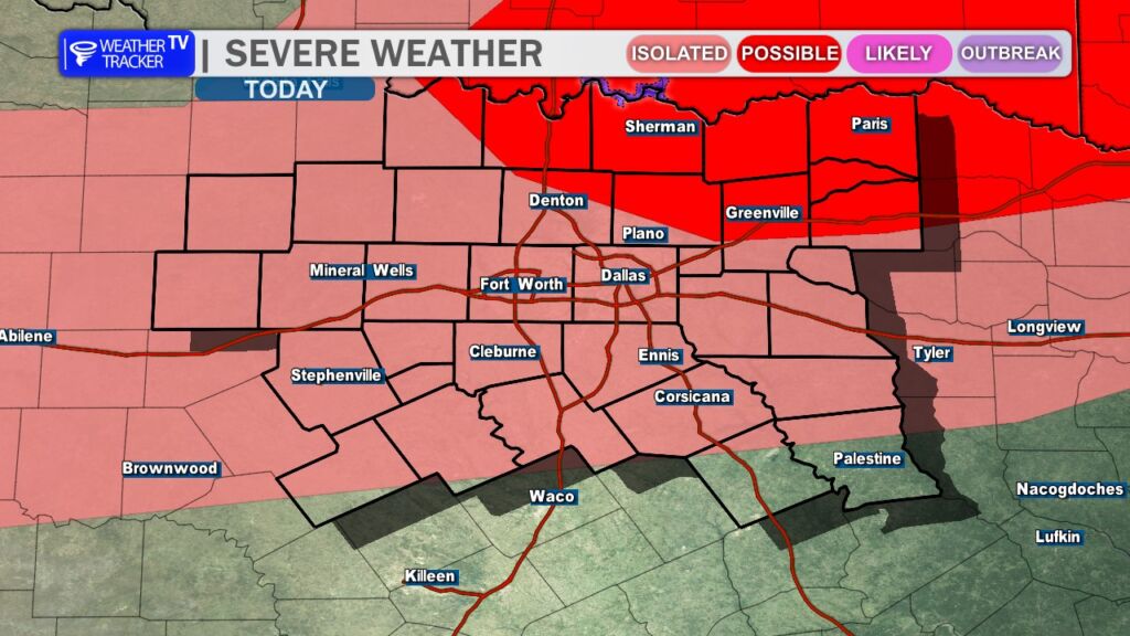
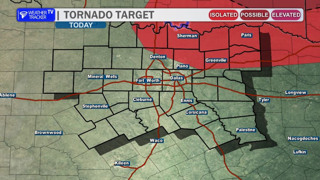
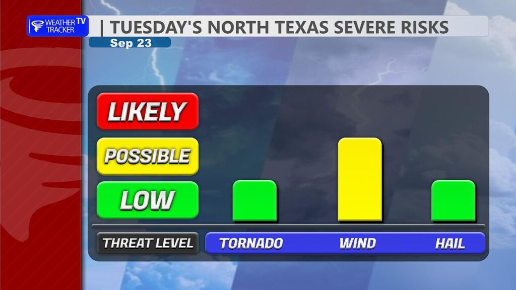
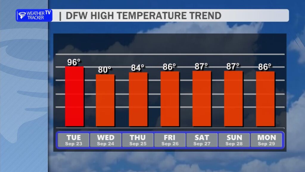
Dallas, Texas – A cold front moving into North Texas this evening and overnight will trigger scattered thunderstorms, posing risks of damaging winds, large hail, and isolated tornadoes. The National Weather Service’s Storm Prediction Center has placed parts of the Dallas-Fort Worth metroplex and nearby areas under a Marginal to Slight Risk for severe weather. Storms are expected to develop near the cold front northwest of Dallas-Fort Worth around 5 p.m., intensifying as they move southeast after sunset. A second wave of heavy rain overnight into Wednesday morning may cause flash flooding in urban areas, prompting caution for drivers to steer clear of flooded roads. While the front brings relief from recent early Fall heat, it also carries a significant weather threat.
You must be logged in to post a comment.