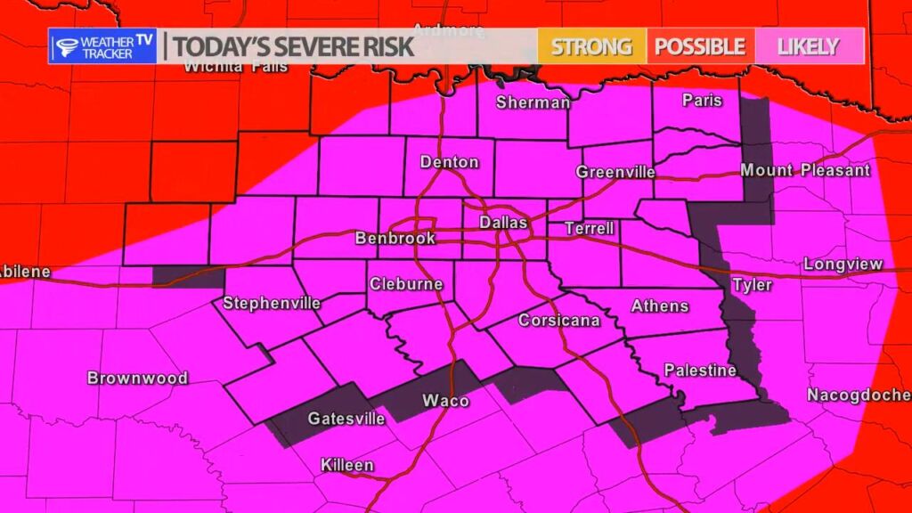
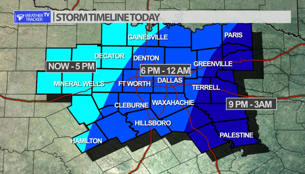
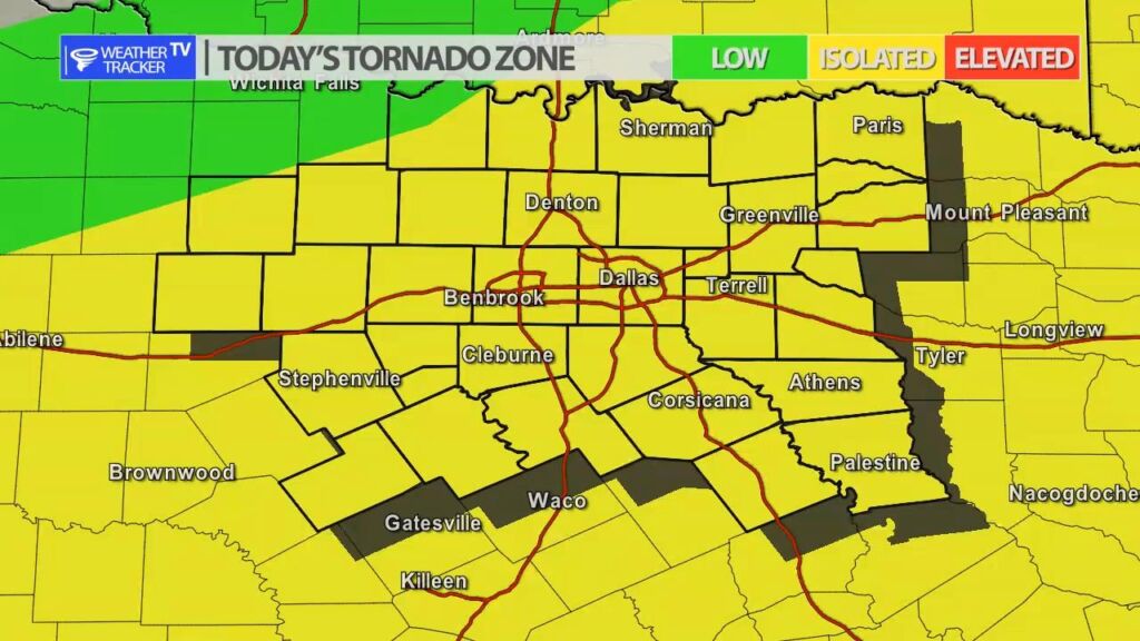
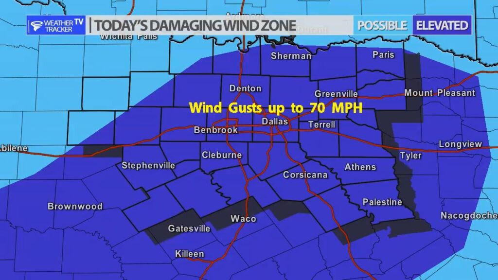
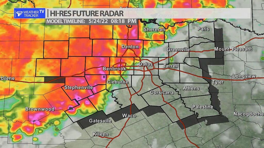
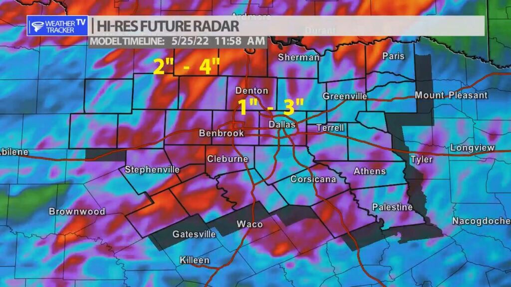
Severe weather is likely across North Texas today – or more specifically late afternoon and evening. Scattered rain and T-Storms will be possible through the afternoon but as a cold front begins to push through the area by late afternoon we’ll see a line of storms organize first in our western counites and push into the Metroplex after 6 pm. This line of storms or squall line will be capable of damaging wind gusts over 65 mph, hail up to the size of half dollars, flooding and even isolated quick spin up tornadoes.
Make sure you are staying weather alert through the afternoon and as always we’ll have more updates on our mobile and channel as the day progresses.
You must be logged in to post a comment.