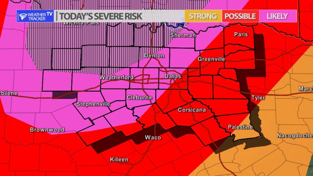
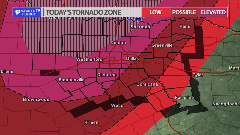
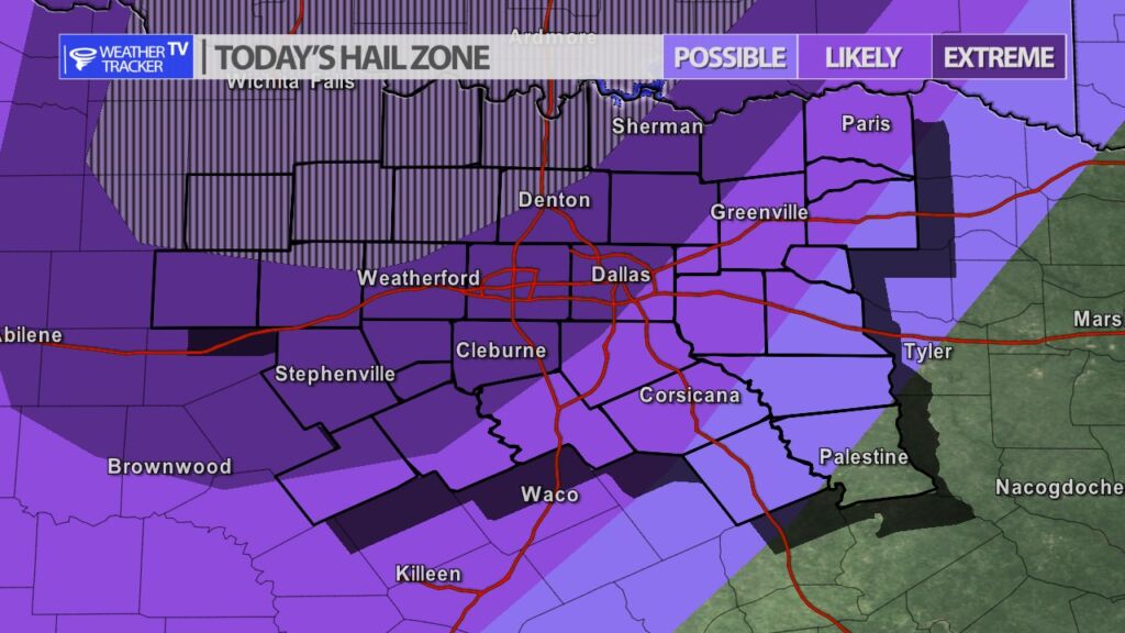
Today is a North Texas weather alert day. The risk of severe is increasing across North Texas for this afternoon, this evening and overnight. The risk today will come in two waves or two opportunities. The first wave starts around 3 PM. A dryline will push into the area and will be the trigger for supercell storms to develop – these initial storms may develop quickly and will go up rotating. The initial round of storms will pose a very large hail threat, and hook echoes are possible with tornado warnings also being possible. Review your severe weather safety plans with your family and make sure you know what to do if a tornado warning is issued for your area.
The second wave will be a line of storms that will push into our western counties around 11 PM. The line of storms will move across North Texas through the overnight. Damaging wind gusts up to 70 MPH will be possible, large hail and a tornado warning or two is still possible during this time.
You must be logged in to post a comment.