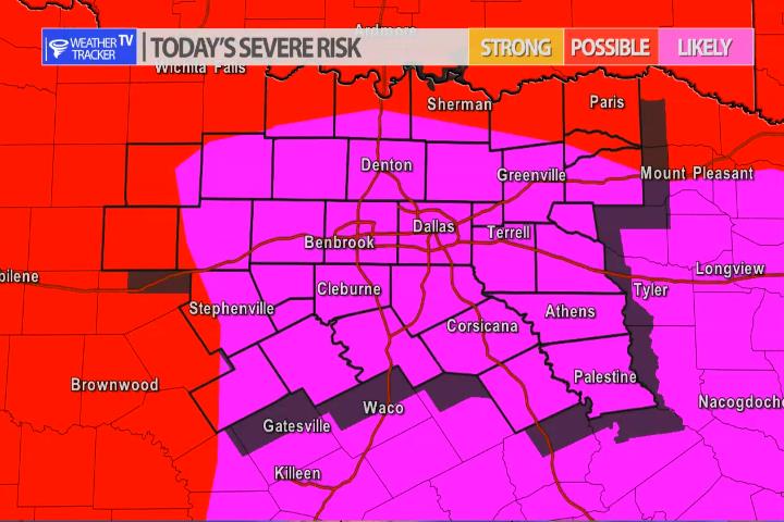
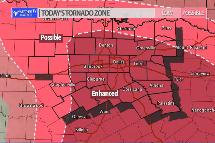
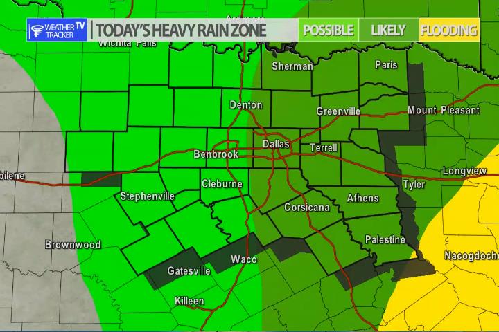
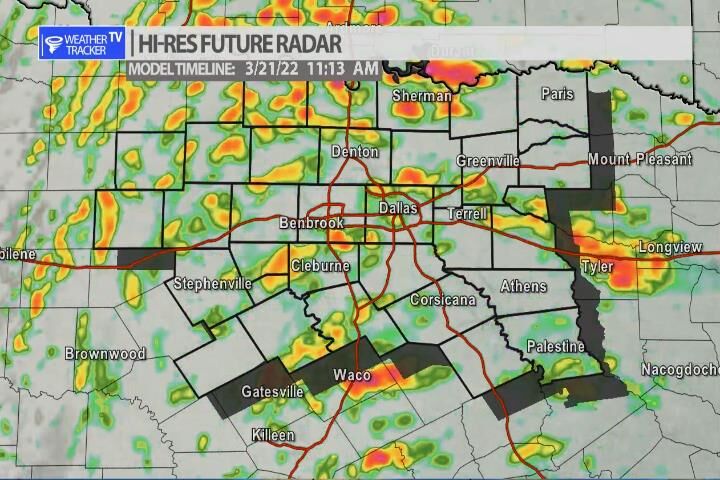
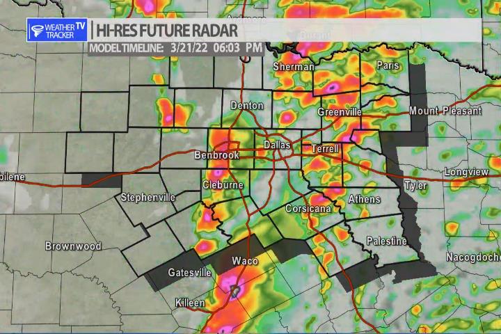
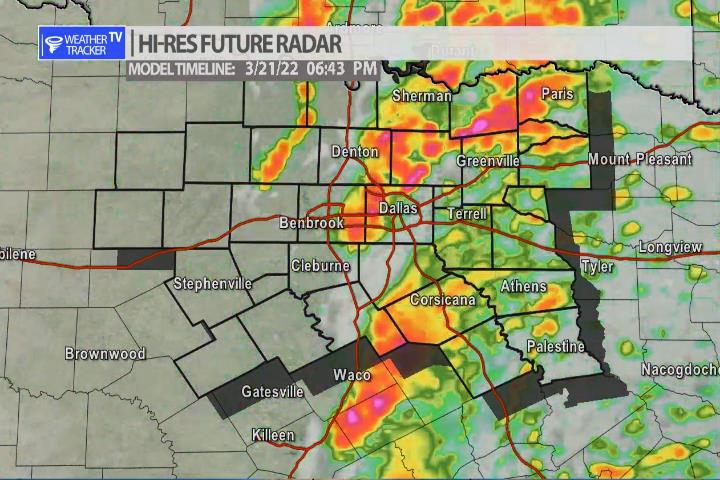
The risk of severe weather across North Texas today appears to be increasing. As a warm front lifts north through the area bringing warmer and more unstable air into the area and a strong storm system approaches from the west – the ingredients for severe weather will come together. Scattered showers and T-Storms will be ongoing through most of the afternoon – that is not the main severe concern. The main concern develops after 4 pm with a broken line of supercells. This broken line will pose a threat of large hail – bigger than golf balls possible – damaging winds and a tornado or two. The timeline for the Metroplex is 4 pm to 7 pm – have a severe weather safety plan ready for you, your family and your kids – you know where you will be during that time. Don’t be caught off guard by severe weather. Also, keep in mind your vehicles with the hail threat. We’ll have more on the mobile app through the day and live severe weather coverage as needed on the channel.
You must be logged in to post a comment.