Good Saturday morning, North Texas!
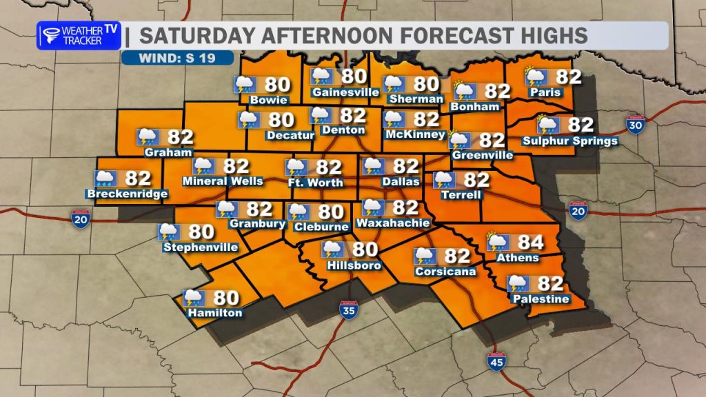
We are off to a mild and cloudy start this morning with extensive low cloud cover across the region. Expect a warm and humid afternoon as we see a mix of sun and clouds. Highs for most North Texas hometowns will push toward 80° with a steady southeast breeze gusting up to 20–25 mph.
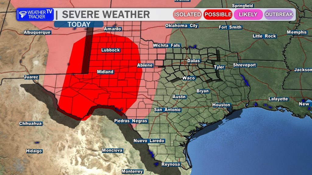
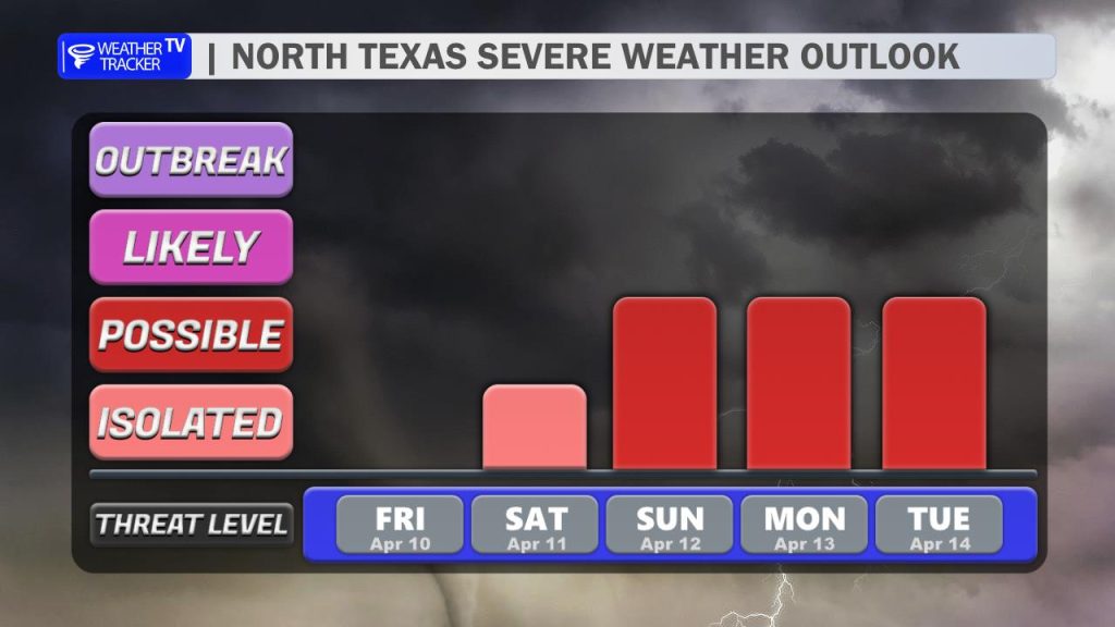
The Evening & Overnight Timeline: We are closely watching a line of storms expected to form this afternoon along the dryline in West Texas. This activity will track east through the Big Country this evening. Current data suggests these storms will try to hold together as they approach North Texas late tonight. While the overall severe threat tonight remains low, we can’t rule out a few “pulse” severe storms. The primary threat with any robust cells that make it into our western counties will be gusty winds (up to 60 mph) and perhaps some small hail.
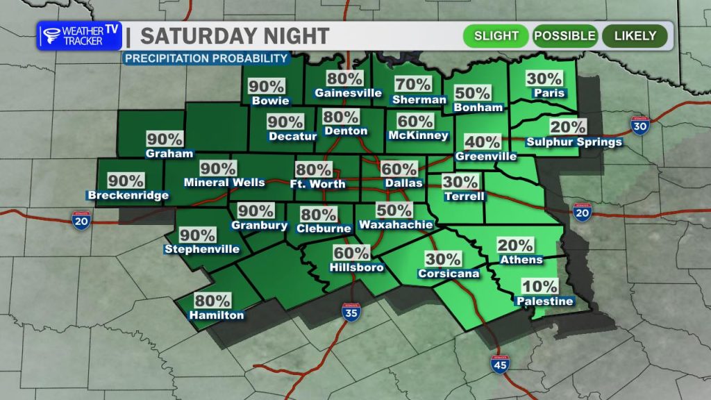
The Sunday “Weather Ready Day” Scenario: Tonight’s activity is the “wild card” for Sunday. If widespread rain and clouds linger into Sunday morning, the atmosphere will stay stabilized (cooler and “capped”), making it harder for storms to fire later in the day. However, if tonight’s activity is limited or clears out early, the atmosphere will rapidly destabilize.
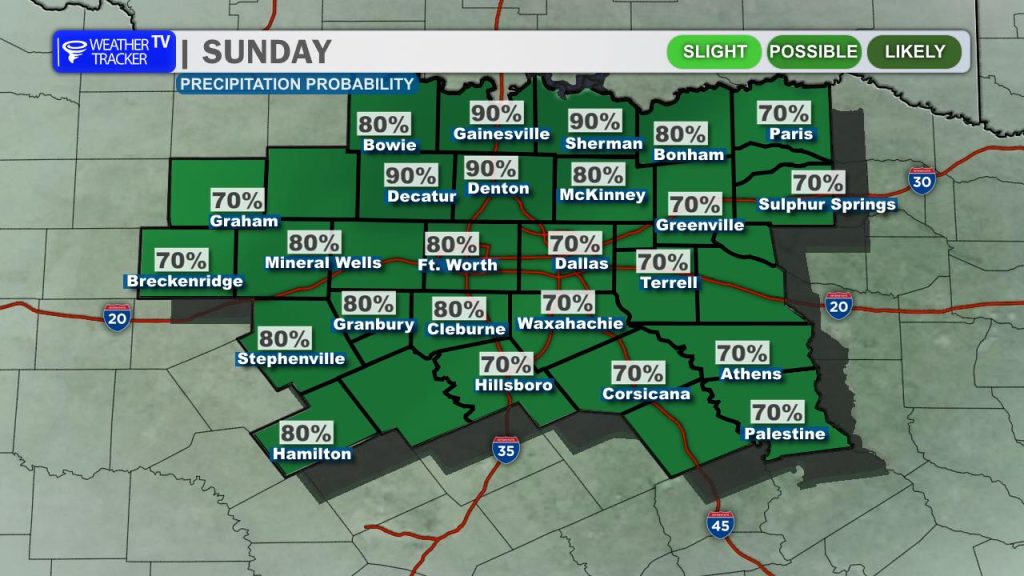
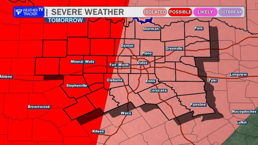
Regardless of the morning outcome, we expect redevelopment Sunday afternoon—likely starting in Central Texas and lifting northeast. Sunday is a day to stay weather-aware. Any storms that develop will have access to high instability and strong wind shear, bringing a risk for:
- Large hail
- Damaging wind gusts
- Isolated tornadoes
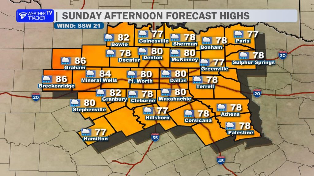
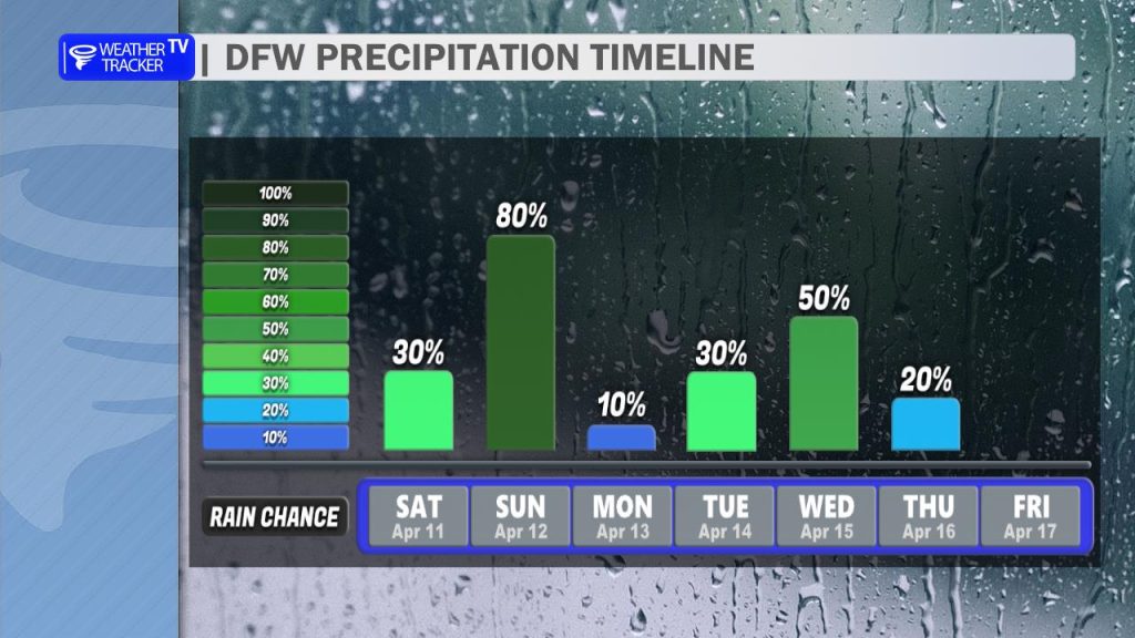
Looking Ahead: Highs on Sunday will again hover near 80° under mostly cloudy skies. The active pattern doesn’t stop there; rain and storm chances linger well into next week. Tuesday and Wednesday currently look like the next windows for organized severe weather as the main upper-level system moves closer.
You must be logged in to post a comment.