Good Thursday morning, North Texas!
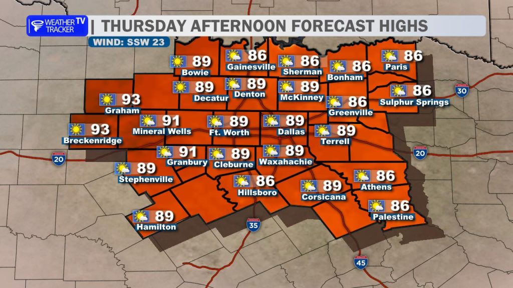
We’re in for another very warm day across the region as temperatures climb well above average this afternoon. Morning cloud cover will gradually break apart, giving way to increasing sunshine through the day.
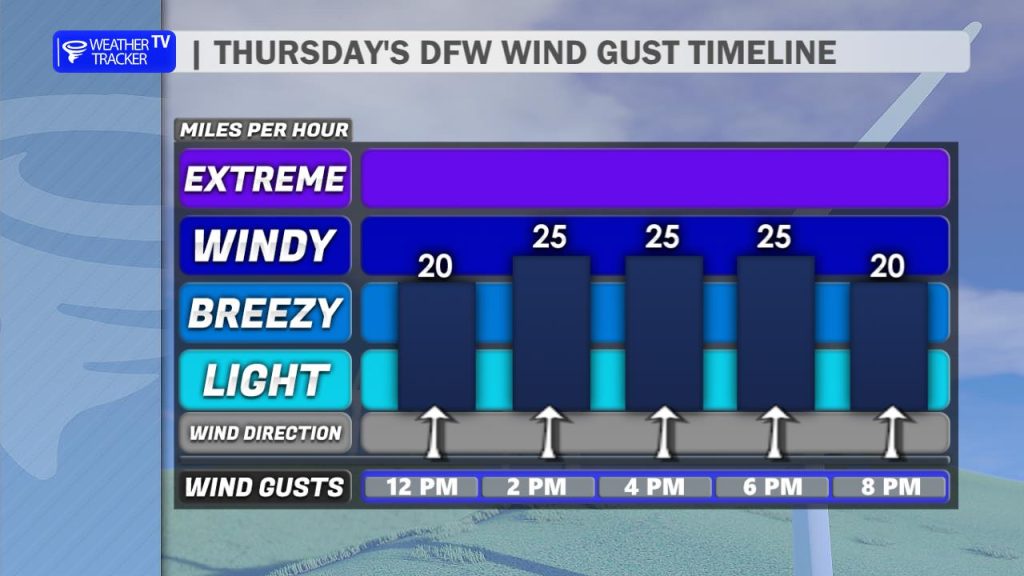
High temperatures will push into the 80s and even low 90s in some spots. Winds will also become a factor this afternoon, turning breezy out of the south with gusts between 20 and 25 mph at times.
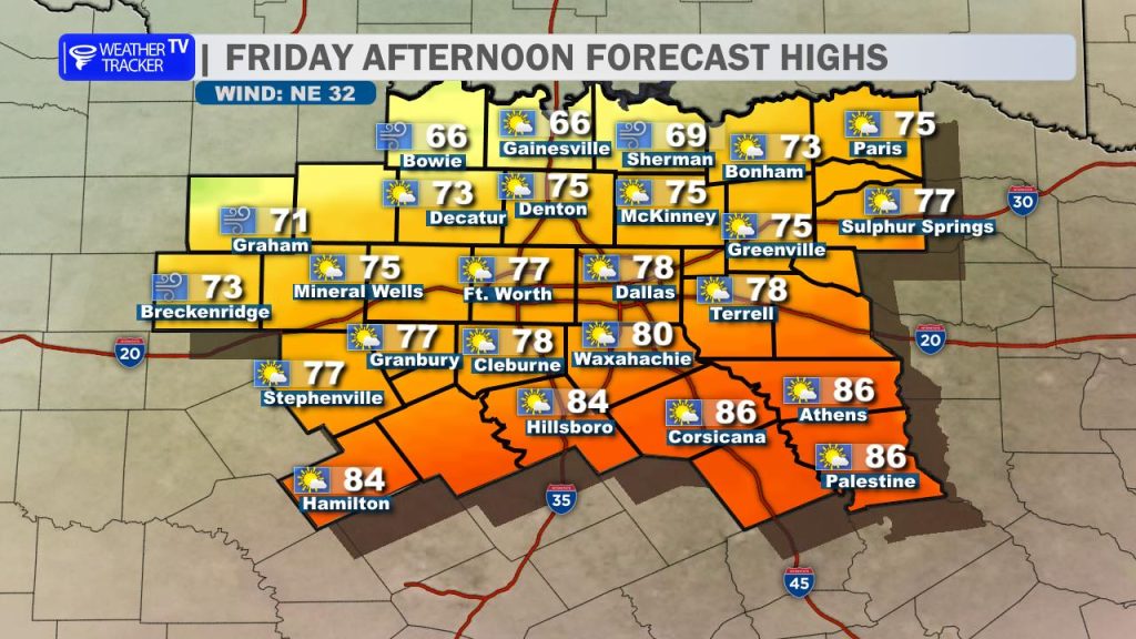
A change in the pattern arrives tomorrow as a cold front moves into North Texas. Timing right now brings the front through the Metroplex between 11 AM and 2 PM. Ahead of the front, temperatures will still warm into the 70s, but once it passes, you’ll notice a quick drop in temperatures along with a shift to a gusty north wind.
For the evening commute on Friday, expect temperatures falling into the 60s with increasing cloud cover and a brisk north breeze making it feel even cooler.
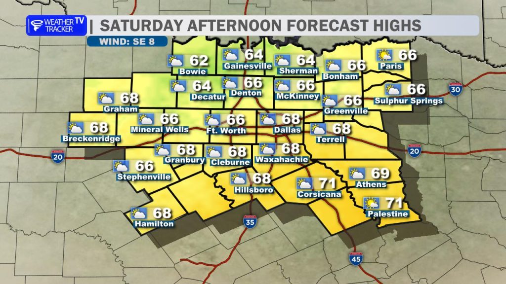
That sets the stage for a noticeably cooler day on Saturday. Highs will only reach the 60s across North Texas with a continued north wind and a mix of sun and clouds throughout the day.
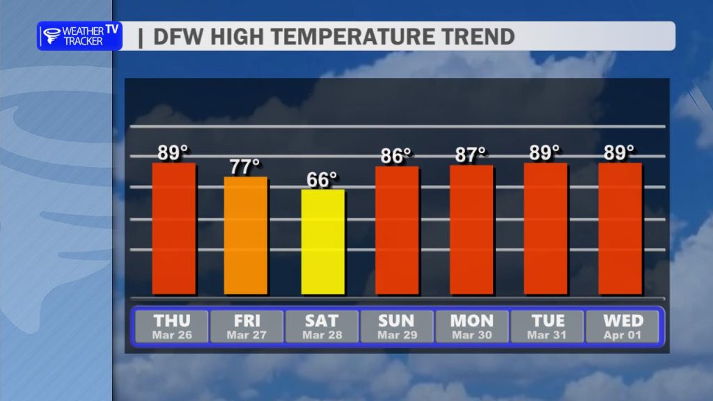
The cooldown is short-lived, though. By Sunday, temperatures rebound quickly back into the 80s, and that warming trend continues into next week. Highs will generally range from the 80s to near 90 degrees as we close out the month.
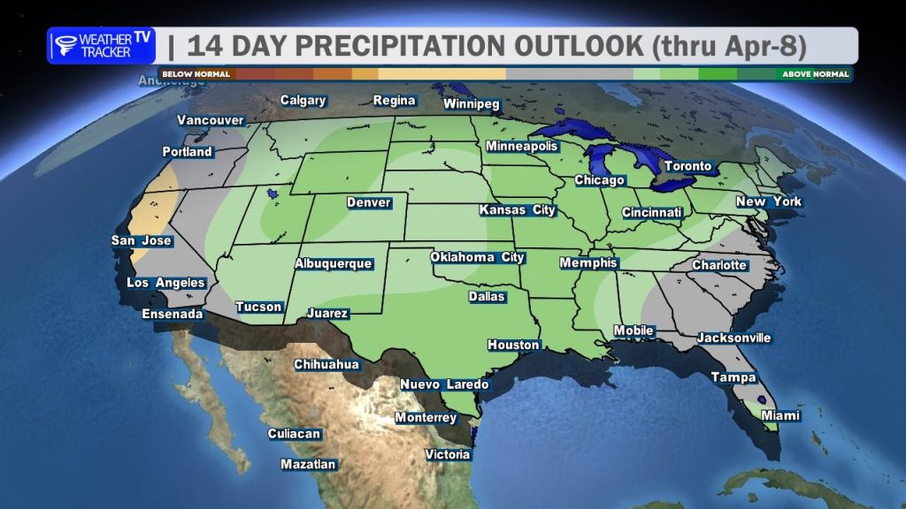
Looking ahead, there are still signals pointing toward a pattern shift by the first of April. The ridge of high pressure that has kept our weather warm and dry is expected to shift east, opening the door for increasing chances of rain and possibly storms returning to the forecast.