Good Thursday morning, North Texas!
A significant winter storm is still on track to impact the region beginning tomorrow and lasting through the weekend. This system will bring a combination of wintry precipitation and dangerously cold temperatures, creating potentially hazardous conditions across much of North Texas.
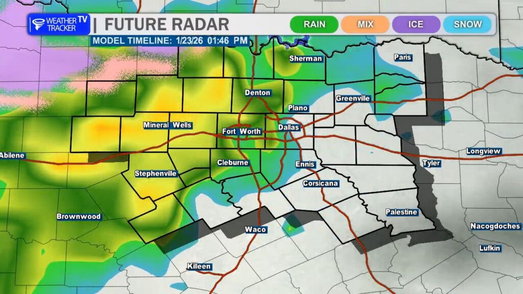
We’ll start off Friday morning with light, scattered showers moving into the area. For much of the day, temperatures will remain just above freezing, allowing precipitation to fall mainly as rain. However, conditions will begin to change late Friday afternoon as a strong Arctic front pushes south out of Oklahoma.
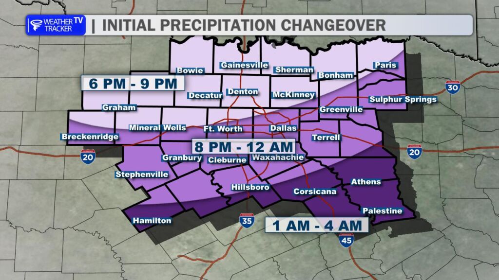
As this front moves through, temperatures will quickly drop to freezing, causing rain to transition over to freezing rain. For the Dallas–Fort Worth Metroplex, that changeover is expected after 6 p.m. Friday, with areas north and west of the Metroplex seeing freezing rain even earlier.
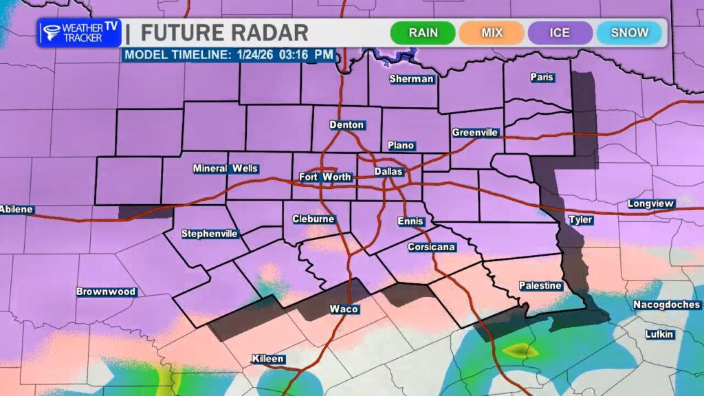
Freezing rain is expected to continue through Friday night and into Saturday. As colder air deepens, there is the potential for a transition to sleet on Saturday, which would further worsen travel conditions. A mix of freezing rain and sleet may persist into Saturday night. On the back side of the system, a brief burst of snow is possible early Sunday morning before precipitation comes to an end.
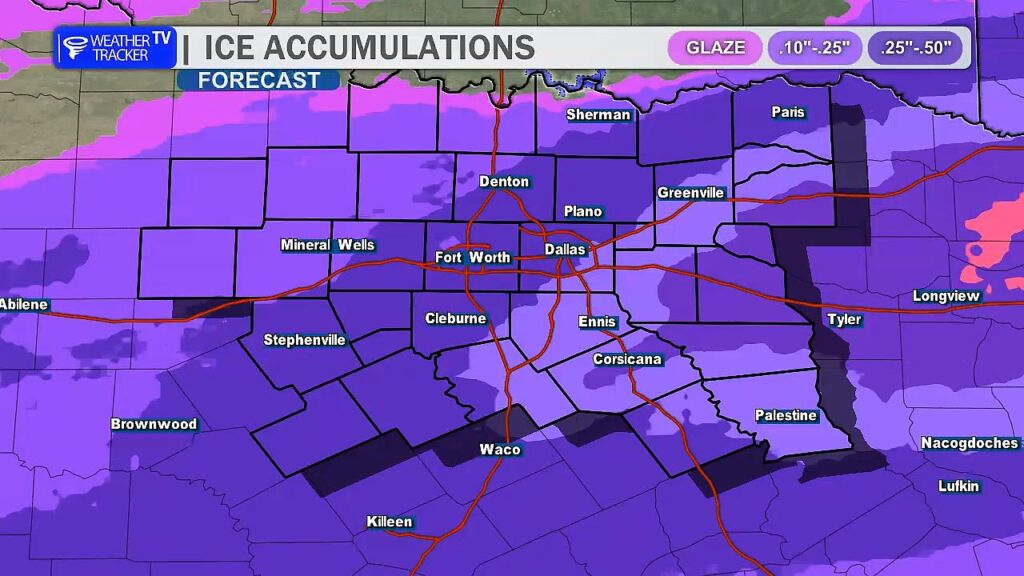
With freezing rain likely to be a primary precipitation type, ice accumulation will be a concern. Even light glazing on roads, bridges, power lines, and tree branches can lead to dangerous travel and isolated power issues. While widespread power grid disruptions are not expected at this time, localized power outages are always possible during ice events, so it’s important to plan ahead.
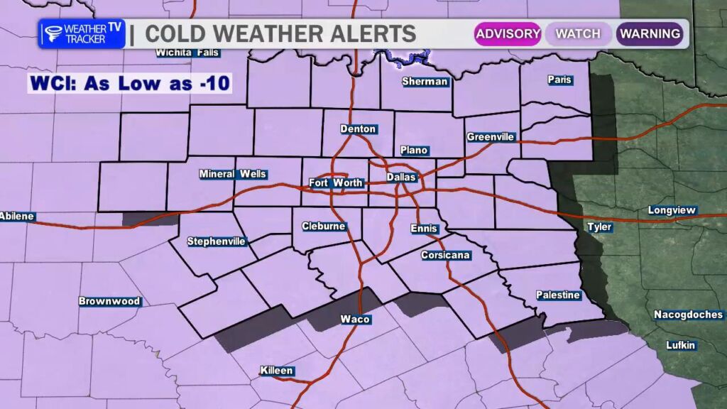
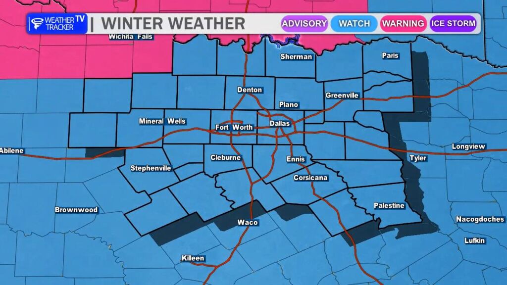
In addition to the wintry precipitation, dangerously cold temperatures will be a major concern. An Extreme Cold Watch is in effect for North Texas. Once temperatures fall below freezing on Friday, they are expected to remain below freezing until at least Tuesday or Wednesday, making this a prolonged, multi-day cold event.
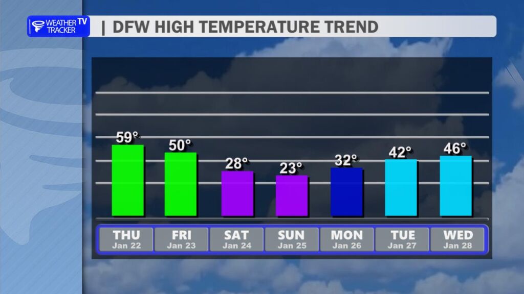
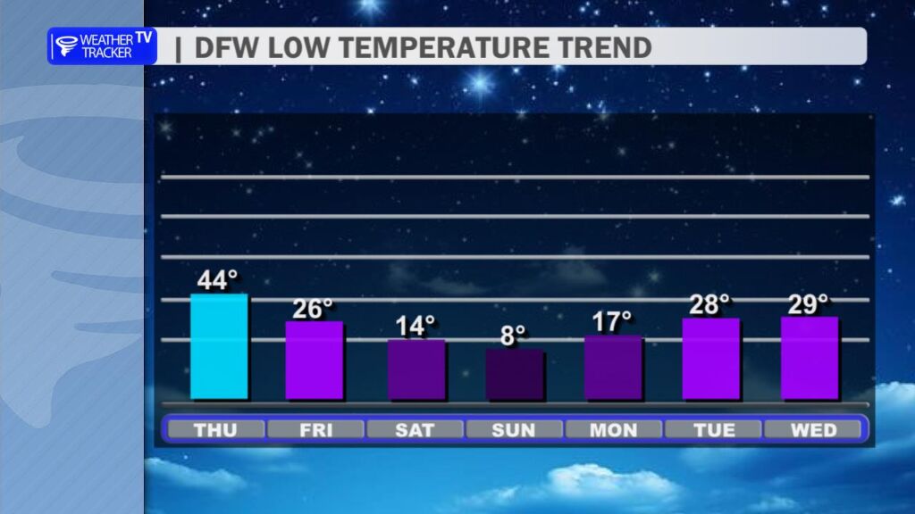
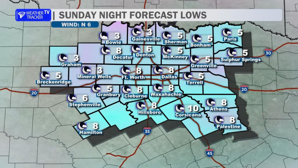
High temperatures this weekend will struggle to reach the 20s, with overnight lows dropping into the teens and single digits. The coldest period looks to be Sunday night into Monday morning, when much of North Texas could see temperatures fall into the single digits.
Be sure to prepare now—protect people, pets, pipes, and plants. We’ll have extended weather coverage Live on Weather Tracker TV DFW through the weekend. -William
You must be logged in to post a comment.