North Texas is wrapping up an unusually toasty December heat wave, and today (December 26, 2025) marked a new milestone for the Dallas-Fort Worth area.
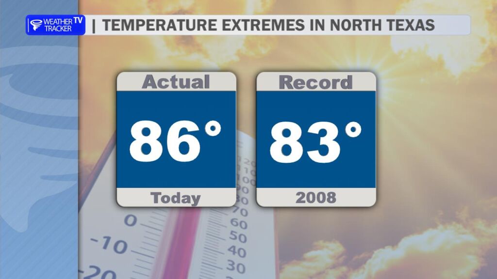
The official high temperature at DFW reached 86° this afternoon, shattering the previous record of 83° set on this date back in 2008. This comes right on the heels of Christmas Day, which tied for the second-warmest on record with a high of 80° (matching 2016; the all-time warmest Christmas remains 82° from 2021).
People across the metroplex enjoyed spring or even summer-like conditions all while the calendar says late December. This warmth is part of a broader pattern driven by a strong high-pressure ridge keeping colder air locked far to the north and allowing mild southern air to dominate.
What’s Next in the Forecast?
More record-challenging heat is on tap for tomorrow:
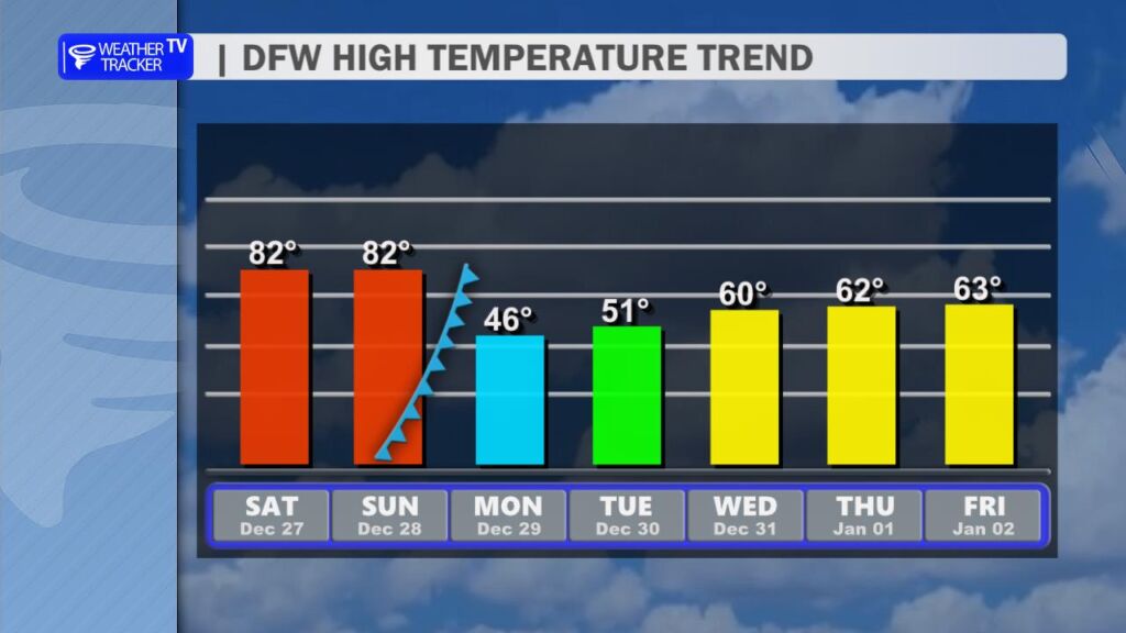
- Saturday, December 27: Expect partly cloudy skies with highs likely climbing into the low-to-mid 80s (I’m forecasting 82° at DFW). This would tie the existing daily record.
- Sunday, December 28: Still quite warm early in the day (highs in the upper 70s to around 80), but a strong cold front is expected to arrive late in the day. This will bring a chance of showers and a sharp wind shift to the north.
By Monday, December 29, temperatures will plunge below normal, with highs only in the 40s and lows dipping into the 30s (wind chills could feel like the teens and 20s early next week). This marks a classic Texas weather whiplash – from near-summer like temperatures to winter chill in a matter of hours.
After the front passes, the pattern looks to settle into more seasonable conditions for the end of the year, with highs gradually warming back into the 60s by New Year’s.
This kind of late-December warmth isn’t unheard of in North Texas, but strings of records like this highlight how variable and sometimes extreme our weather can be.