A stormy stretch of weather begins tonight in North Texas and lingers through Saturday.
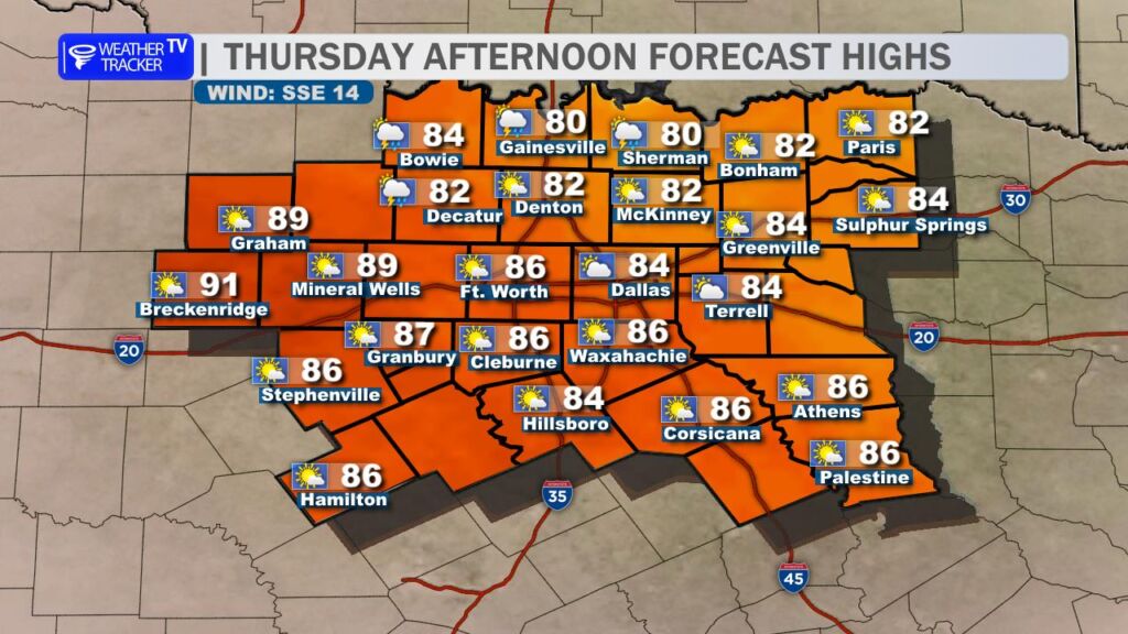
Today (Thursday)
- Conditions: Last dry afternoon before rain returns.
- High: Mid 80s.
- Other: Increasing humidity.
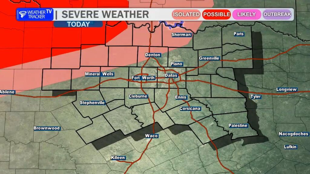
Tonight
- Conditions: Scattered thunderstorms moving in from the northwest.
- Severe Risk: Limited – possible quarter-sized hail (1 inch) and wind gusts to 60 mph.
- Trend: Storms sag south overnight.
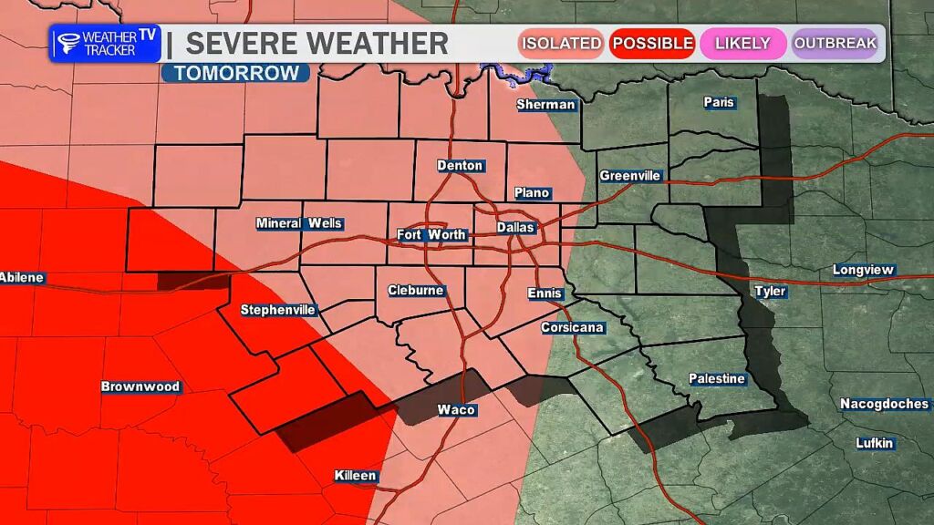
Friday
- Morning (DFW Metroplex): Stormy and wet.
- Afternoon: Scattered thunderstorms possible.
- Evening–Overnight: Complex of storms from the west brings very heavy rain and severe risk (damaging wind gusts to 60 mph). Lingers into Saturday morning.
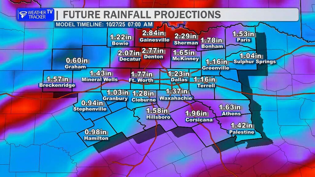
Saturday
- Morning: Lingering heavy rain/storms.
- Afternoon: A few additional showers and thunderstorms redevelop.
Sunday Morning
- Clears out early.
| Time Period | Main Conditions | Severe Risks | Rainfall Potential |
|---|---|---|---|
| Today Afternoon | Dry, warm, humid | None | None |
| Tonight | Scattered T-storms | Hail (1″), winds 60 mph | Isolated |
| Fri Morning | Stormy, wet | Low | Heavy in spots |
| Fri Afternoon | Scattered T-storms | Low | Scattered |
| Fri Eve–Sat AM | Heavy rain, storm complex | Winds 60 mph | Very heavy |
| Sat Afternoon | Showers/T-storms | Low | Light–moderate |
| Sun Early | Clearing | None | None |
Stay alert Friday evening through Saturday morning – heavy rain could lead to flooding, especially in urban areas like DFW. Weather Tracker TV DFW will have live severe weather coverage as needed through this event.
You must be logged in to post a comment.