Fast Facts:
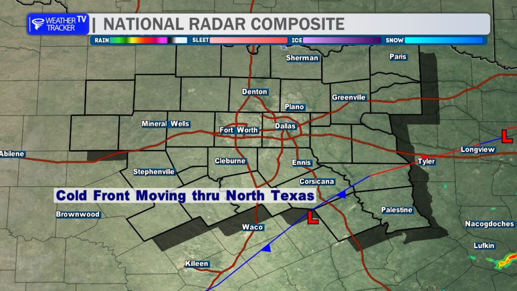
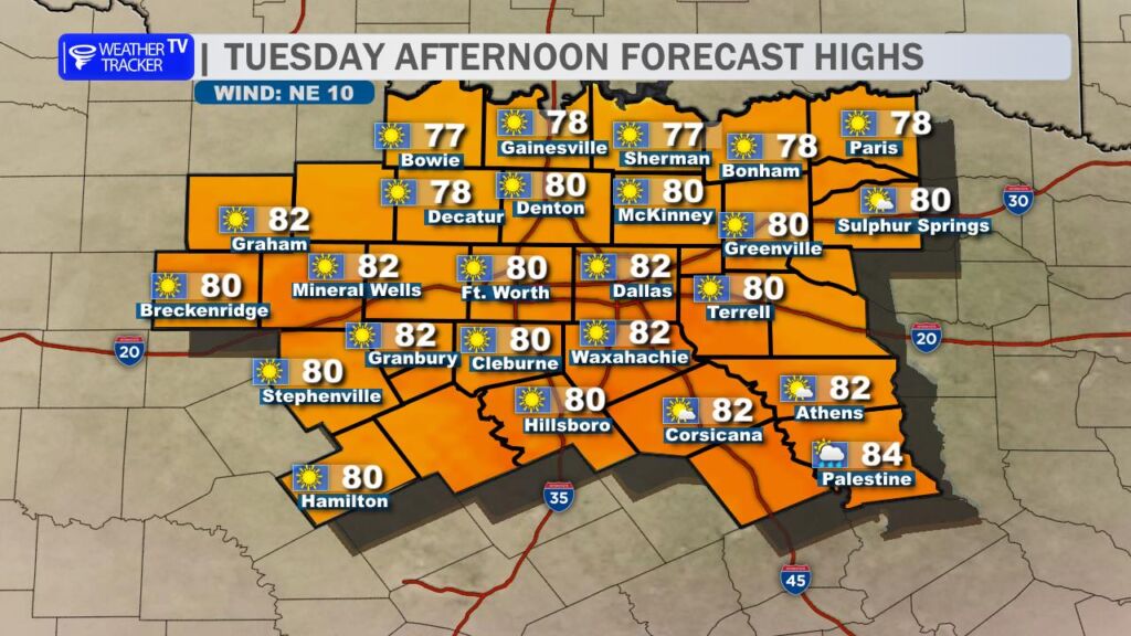
- Cold Front Impact: A cold front is moving through North Texas, bringing less hot afternoon highs near 80°, brisk north winds, and lower humidity, increasing fire danger and prompting discouragement against outdoor burning or spark-causing activities.
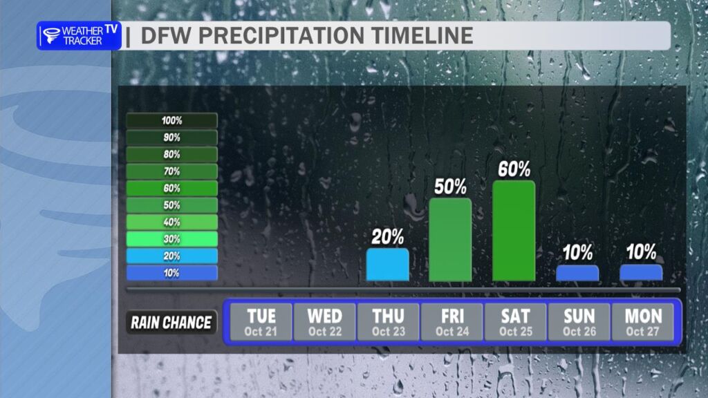
- Upcoming Storm System: A slow-moving storm will bring multiple rain chances from Thursday to Saturday, with potential for severe weather on Friday.
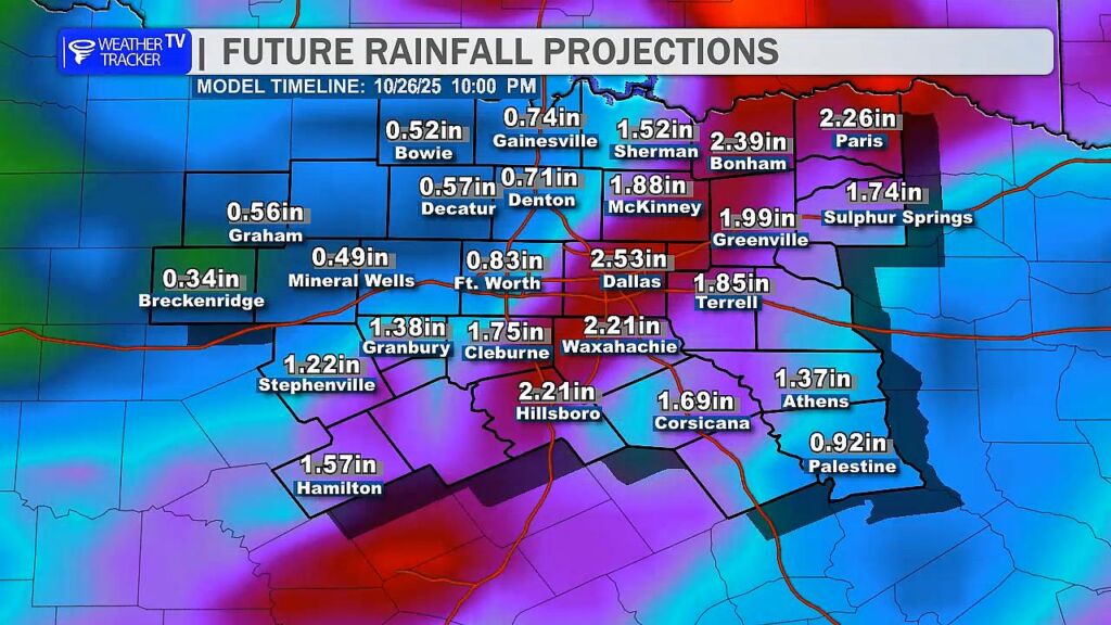
- Rainfall Forecast: Preliminary estimates indicate 0.5 to 2 inches of rain across North Texas from the storm system.
A cold front is moving through North Texas this morning, leading to a less hot afternoon with highs near 80°. Brisk north winds and decreasing humidity will elevate fire danger across the region, so outdoor burning or activities that could spark fires are strongly discouraged.
Looking ahead, a slow-moving storm system will bring multiple chances for rain from Thursday through Saturday. Severe weather is possible on Friday. Preliminary rainfall estimates suggest totals of 0.5 to 2 inches across the area.
You must be logged in to post a comment.