Fast Facts:
- Recent Weather Recap: Yesterday (Sunday) featured pleasant fall-like conditions in North Texas with highs mostly in the 70s.
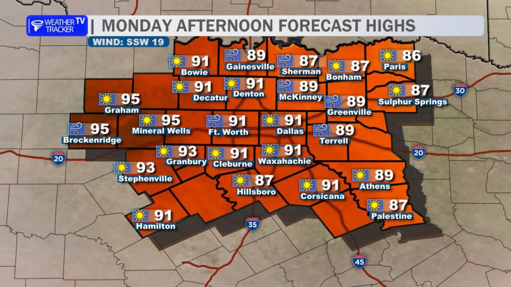
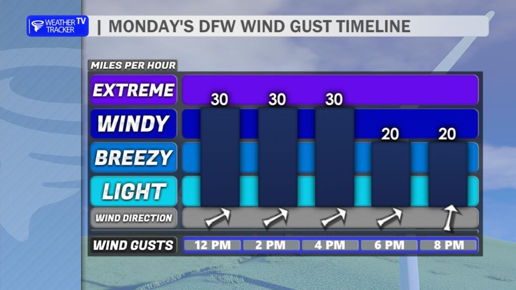
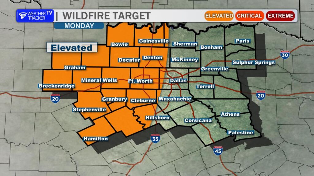
- Today’s Forecast: Temperatures rise to the upper 80s and near 90, accompanied by gusty southwesterly winds that increase heat and elevate grassfire/wildfire risks, especially in western Big Country counties—avoid open flames or spark-producing activities.
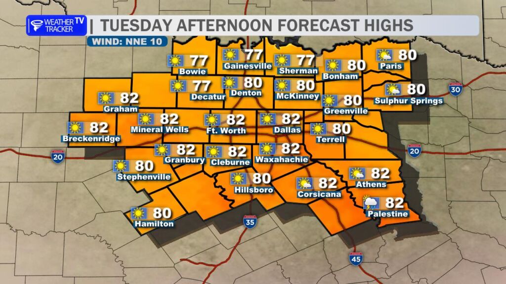
- Upcoming Change: A cold front arrives tonight through early Tuesday, cooling highs back to around 80.
Hopefully you enjoyed yesterday’s (Sunday) fall-like weather across North Texas, with highs mostly in the 70s. Today, temperatures swing back to the upper 80s to near 90. Gusty southwesterly winds will fuel the heat while raising grassfire and wildfire risks across the area, with the greatest wildfire threat focused on our western counties in the Big Country this afternoon. Avoid any open flames or spark-producing activities. The good news: another cold front sweeps in tonight through early Tuesday, dropping highs back to around 80.
You must be logged in to post a comment.