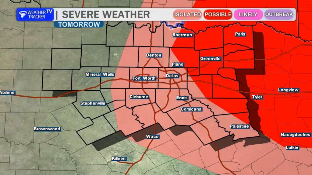
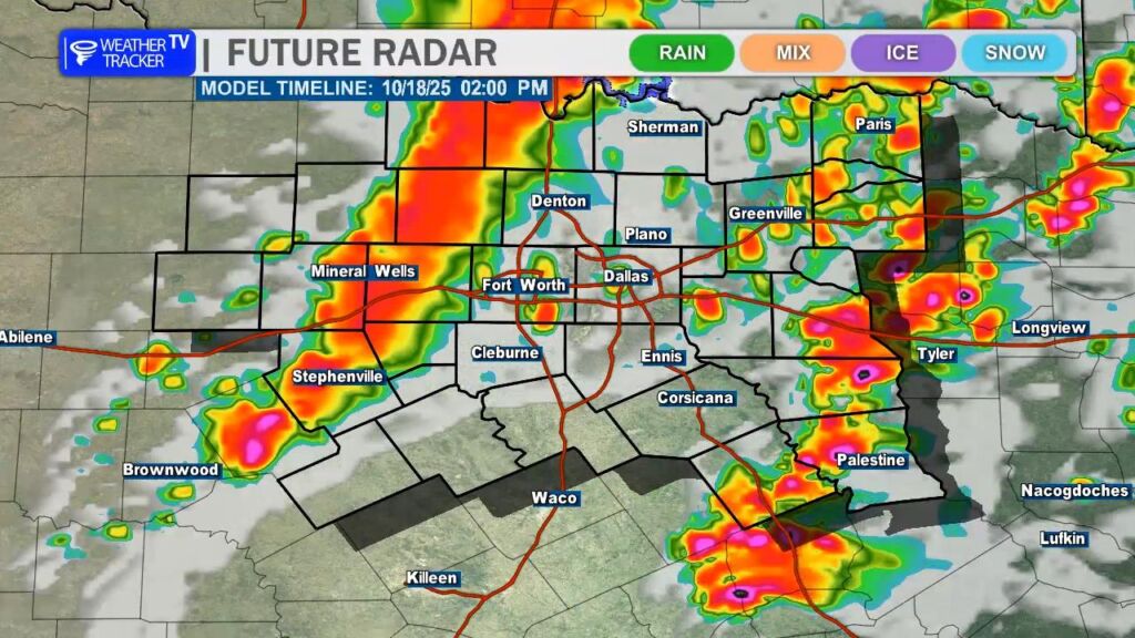
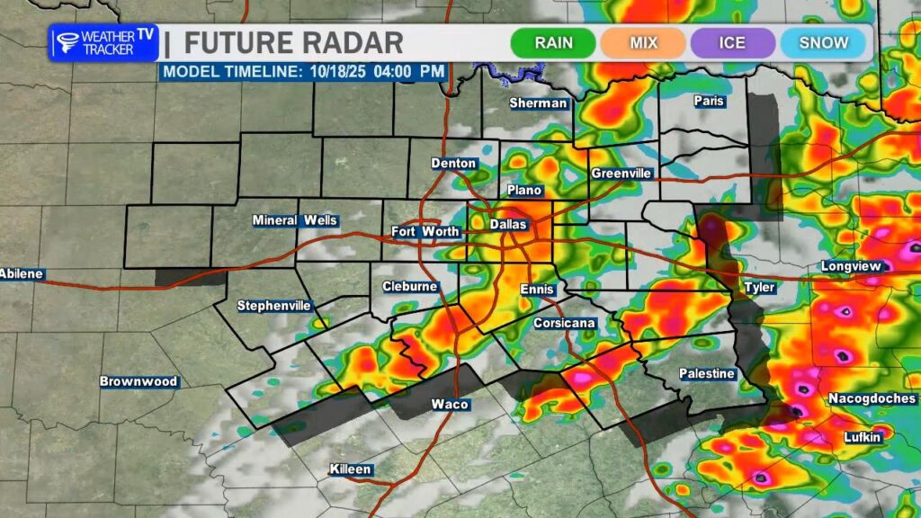
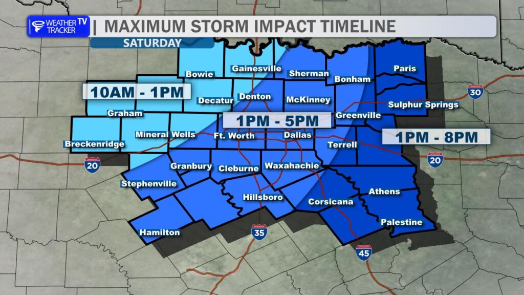
An anticipated cold front will sweep through North Texas on Saturday, bringing notable changes to our weather. As the front approaches, scattered thunderstorms are expected to develop, particularly near and ahead of the boundary. Some of these storms could produce severe weather, including quarter-sized hail and wind gusts up to 60 MPH, along with the potential for locally heavy rainfall that may lead to minor flooding in low-lying areas. The risk of severe weather is greatest in our eastern counties, where conditions are more favorable for intense storm development. The timing for the DFW Metroplex is most likely between 1PM and 5PM (Saturday). Residents are encouraged to stay weather-aware, and keep an eye out for weather alerts and warnings that may be issued. Live severe weather coverage will be provided on Weather Tracker TV as needed.
You must be logged in to post a comment.