July 2023
Monday Night Forecast for the Dallas – Fort Worth Metroplex
4:22 PM | Red Flag Fire Warning until 1:00 AM Wed
From William Cole: A Red Flag Fire Warning has been issued in the Weather Tracker TV DFW coverage area for Bosque, Cooke, Denton, Erath, Hamilton, Hill, Hood, Jack, Johnson, Montague, Palo Pinto, Parker, Somervell, Stephens, Tarrant, Wise & Young Counties in North Texas until 1:00 AM.
AFFECTED AREA Along and west of the I-35 corridor. TIMING Tuesday afternoon and evening. WINDS South 10 to 15 mph. RELATIVE HUMIDITY As low as 20 percent. TEMPERATURES Ranging from 103 to 109. IMPACTS Rapid ignition and spread of wildfires is possible due to persistent hot and dry conditions.
Stay with William Cole and Weather Tracker TV Dallas – Fort Worth for continuing coverage, online, on our app and on TV. Let’s stay safe together.
ALERT 3:09 PM | An Air Quality Alert has been issued for the DFW Metroplex for Tuesday August 1
From William Cole: A Air Quality Alert has been issued for the following counties in North Texas until Tuesday August 1. Collin, Dallas, Denton, Ellis, Henderson, Hunt, Johnson, Kaufman, Parker, Rockwall, Tarrant & Wise.
OZONE ACTION DAY The Texas Commission on Environmental Quality (TCEQ) has issued an Ozone Action Day for the Dallas-Fort Worth area for Tuesday, August 1, 2023. Atmospheric conditions are expected to be favorable for producing high levels of ozone air pollution in the Dallas-Fort Worth area on Tuesday. You can help prevent ozone pollution by sharing a ride, walking, riding a bicycle, taking your lunch to work, avoiding drive-through lanes, conserving energy, and keeping your vehicle properly tuned. For more information on ozone: Ozone: The Facts (www.tceq.texas.gov/goto/ozonefacts) Air North Texas: (www.airnorthtexas.org) EPA Air Now (www.airnow.gov/index.cfm?action.local_state&STATEID=45&TAB=0) Take care of Texas (www.takecareoftexas.org) North Central Texas Council of Governments Air Quality (www.nctcog.org/trans/air/index.asp)
Stay with William Cole and Weather Tracker TV Dallas – Fort Worth for continuing coverage online, on our free mobile app and on TV thru Roku, Apple and Amazon Fire TV.
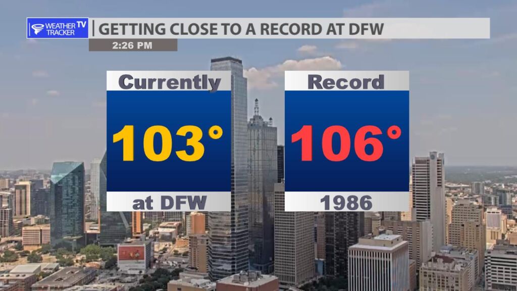
2:25 PM Getting Close to a Record

The current temperature at DFW continues to inch up this afternoon. Currently at 103 nearing the record of 106 from 1986.
37 PM | Excessive Heat Warning until 8:00 PM Tuesday
From William Cole: A Excessive Heat Warning has been issued in the Weather Tracker TV DFW coverage area from now until 8:00 PM Tuesday for Anderson, Bosque, Collin, Cooke, Dallas, Delta, Denton, Ellis, Erath, Fannin, Freestone, Grayson, Hamilton, Henderson, Hill, Hood, Hopkins, Hunt, Jack, Johnson, Kaufman, Lamar, Montague, Navarro, Palo Pinto, Parker, Rains, Rockwall, Somervell, Stephens, Tarrant, Van Zandt, Wise & Young Counties in North Texas.
Dangerously hot conditions with temperatures or heat index values between 105 to 114 degrees.
Stay with William Cole and Weather Tracker TV Dallas – Fort Worth for continuing coverage, online, on our app and on TV. Let’s stay safe together.
DFW Early Monday Afternoon Update
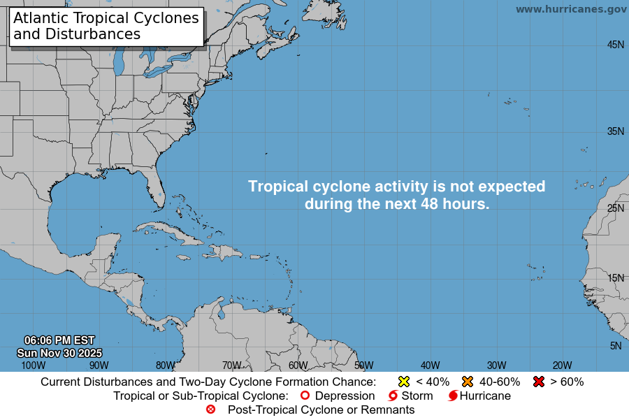
Atlantic Tropical Weather Outlook

From the National Hurricane Center:
For the North Atlantic Caribbean Sea and the Gulf of Mexico:Central Tropical Atlantic (AL96):Shower and T-Storm activity continues in association with anarea of low pressure located about 700 miles east-northeast of thenorthern Leeward Islands. However, the system does not currentlyhave a well-defined center of circulation. Environmental conditionsare forecast to be sufficiently favorable for development over thenext few days, and a tropical depression or storm is likely to formduring the next day or so. The system is expected to movenorthwestward at 10 to 15 mph today, and then turn northward overthe central subtropical Atlantic by late tonight or Tuesday.Additional information on this system, including gale warnings, canbe found in High Seas Forecasts issued by the National WeatherService.* Formation chance through 48 hours high 70 percent.* Formation chance through 7 days high 80 percent.Off the U.S. Mid-Atlantic Coast (AL97):Shower and T-Storm activity has changed little in associationwith an area of low pressure located offshore of theU.S. Mid-Atlantic coast. The system appears to be acquiringnon-tropical characteristics as it begins to merge with a frontalboundary, and its chances of becoming a tropical cyclone appear tobe decreasing. Regardless, the low is expected to begin producinggale-force winds today while it moves quickly toward theeast-northeast at about 30 mph, and additional information on thissystem can be found in High Seas Forecasts issued by the NationalWeather Service.* Formation chance through 48 hours low 20 percent.* Formation chance through 7 days low 20 percent.For more information about marine hazards associated with AL96and AL97, please see High Seas Forecasts issued by the NationalWeather Service found under AWIPS header NFDHSFAT1, WMO headerFZNT01 KWBC, and online atocean.weather.gov/shtml/NFDHSFAT1.phpForecaster Berg
Monday’s National Forecast Maps
Hottest Week of the Summer

The hottest stretch of the summer is coming together this week. Daytime highs will be in record territory with the peak of the heat tomorrow – Tuesday – with a high of 108. Excessive Heat Warnings are in place – make sure you exercise heat caution and don’t forget about your outdoor pets and animals.
