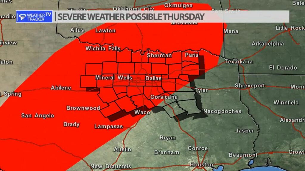
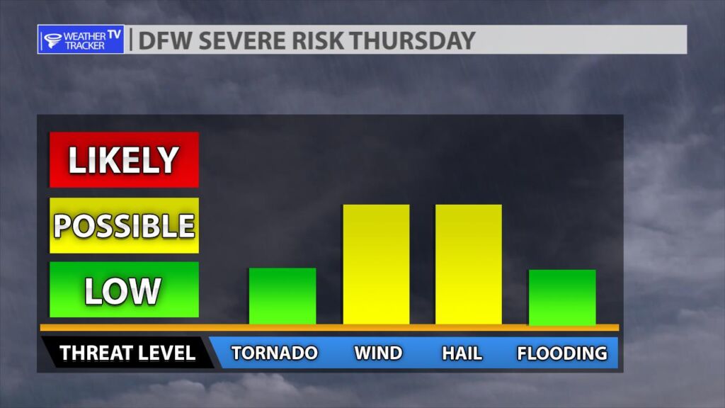
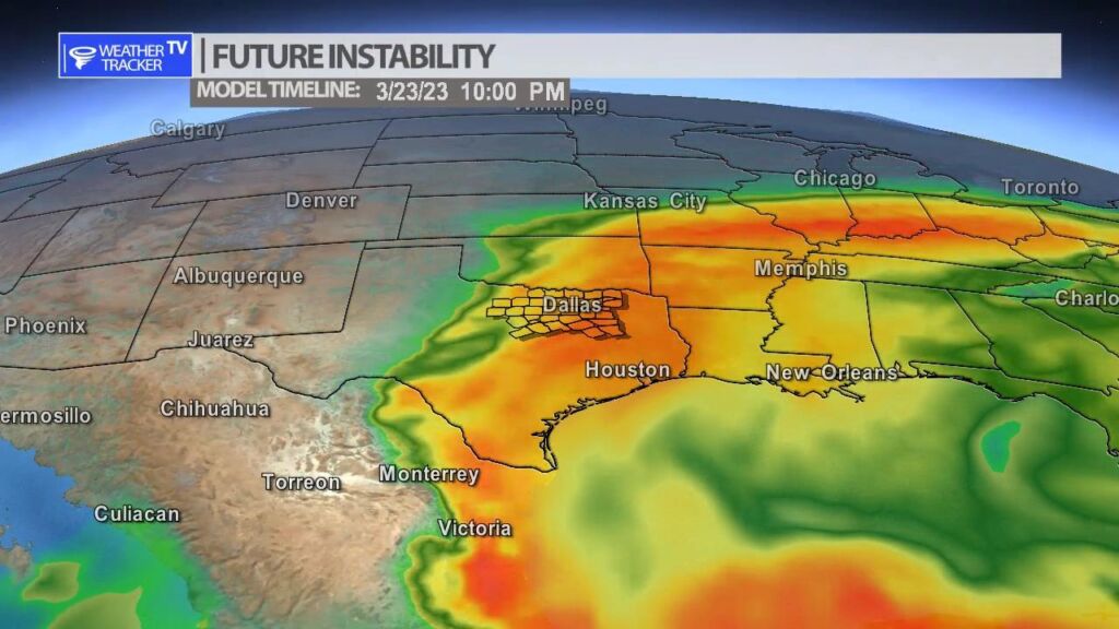
We are still tracking a risk of severe weather on Thursday. As a strong upper level storm system and cold front meet warm and humid air over the southern plains. A dryline will set up out in the Big Country and our western counties. It will be the focus of late afternoon storms. Large hail will be the threat during that time. A cold front will eventually arrive from the north and a broken line of storms will sweep across the area. A damaging wind threat will develop with the line of storms. A tornado warning or two can’t be ruled out.
You must be logged in to post a comment.