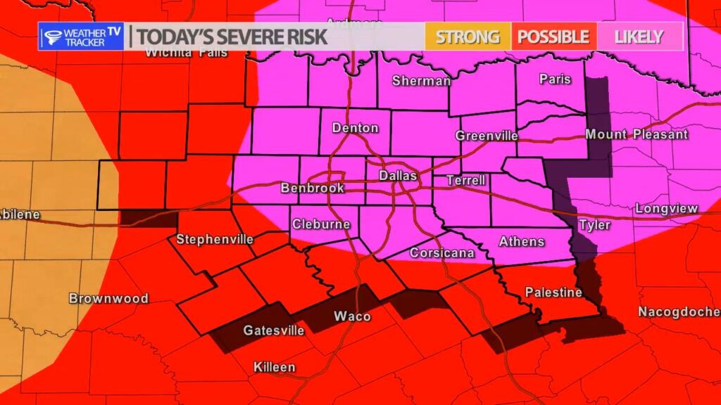
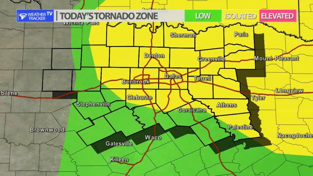
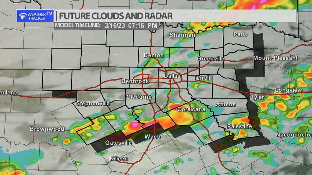
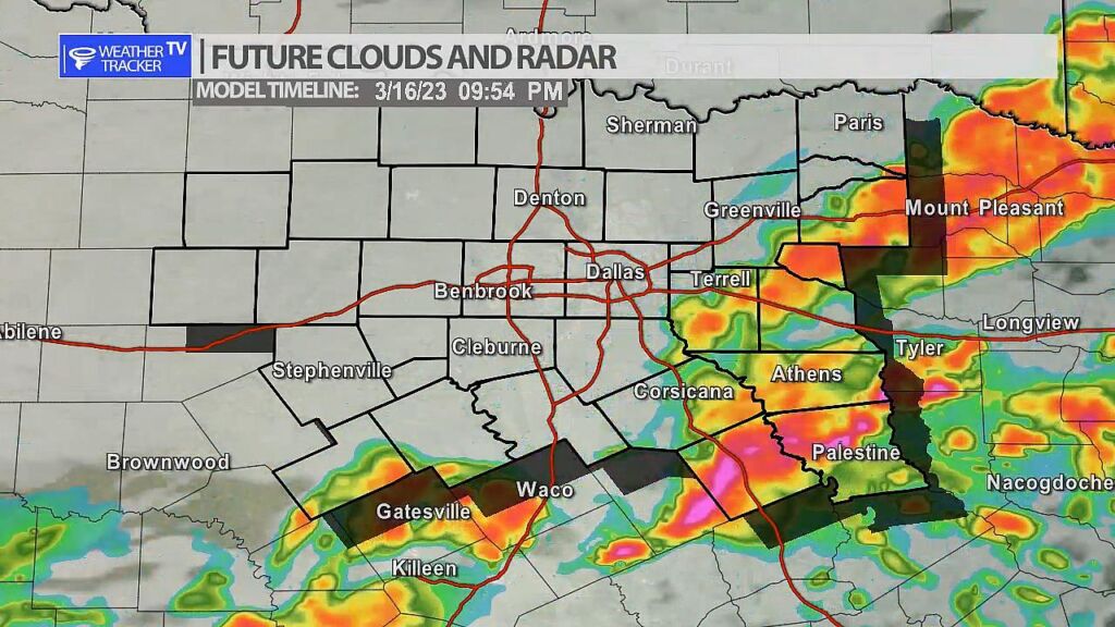
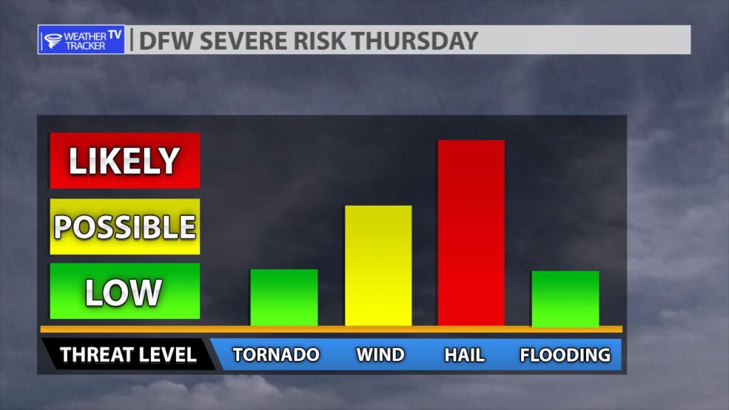
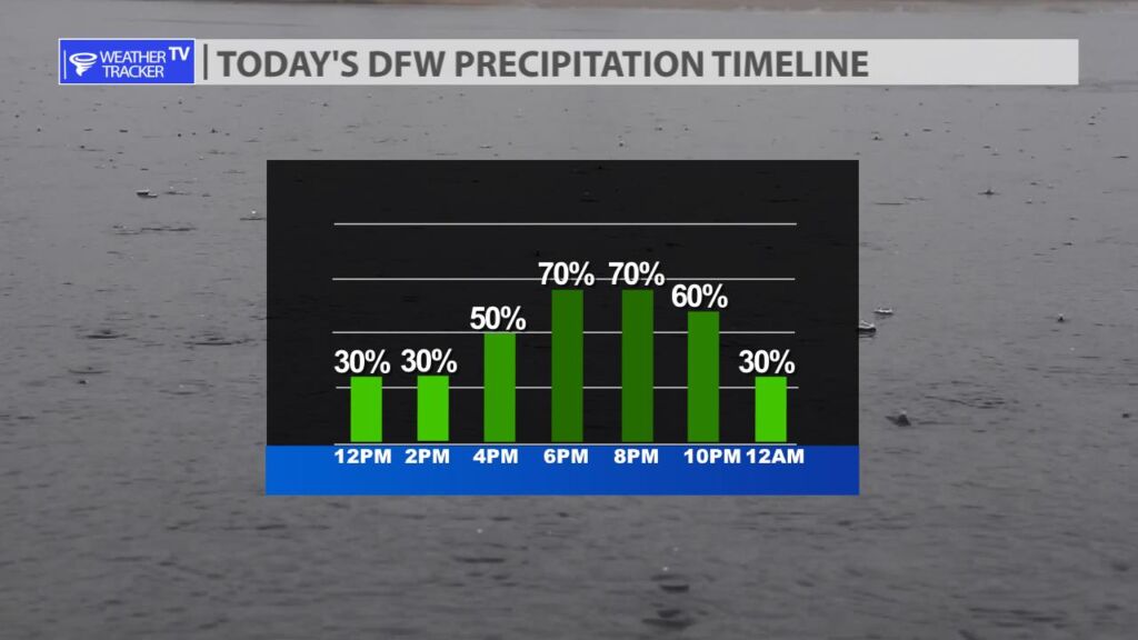
The risk of severe weather returns to North Texas today with large hail, damaging winds and even a few tornado warnings possible. Scattered T-Storms are possible through the afternoon, but the threat of organized severe weather begins today at 4 pm near and west of the I-35 corridor. A dryline will push into the area and will be the focus of T-Storm development. Any storms that form during this time will have a large hail threat (larger than golf balls). A tornado warning or two is also possible. As we progress into the evening hours any scattered activity will begin to form into a line of storms and push through our southeastern counties with a damaging wind threat developing. We will have more updates through the day and as always live severe weather coverage on the channel as needed.

You must be logged in to post a comment.