
Here’s a look at Live Temperatures across North Texas, Local Radar and the Updated Forecast Map.
DFW this afternoon Cloudy with a 40 percent chance of showers. Highs in the upper 40s. North winds around 10 mph. -William


Here’s a look at Live Temperatures across North Texas, Local Radar and the Updated Forecast Map.
DFW this afternoon Cloudy with a 40 percent chance of showers. Highs in the upper 40s. North winds around 10 mph. -William


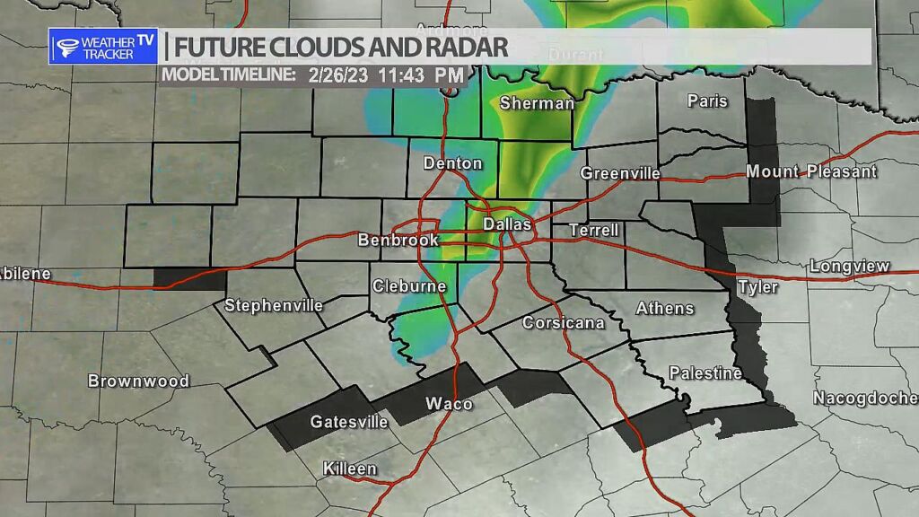
A line of storms is possible late Sunday as a strong upper level storm system moves across the area. Storms will form first in our western counties after 7 pm near a weak cold front – that activity will approach the I-35 corridor by midnight. Severe weather may be possible with the activity including hail, wind and even a tornado warning. We’ll keep you updated on that threat today and through the weekend.
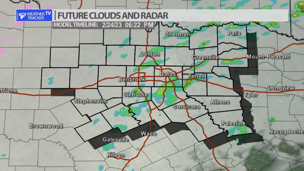
It’s going to be a dreary day across North Texas with light showers and drizzle possible. Temperatures for most of us will hover in the 40s. Areas of patchy fog may also develop later in the day.
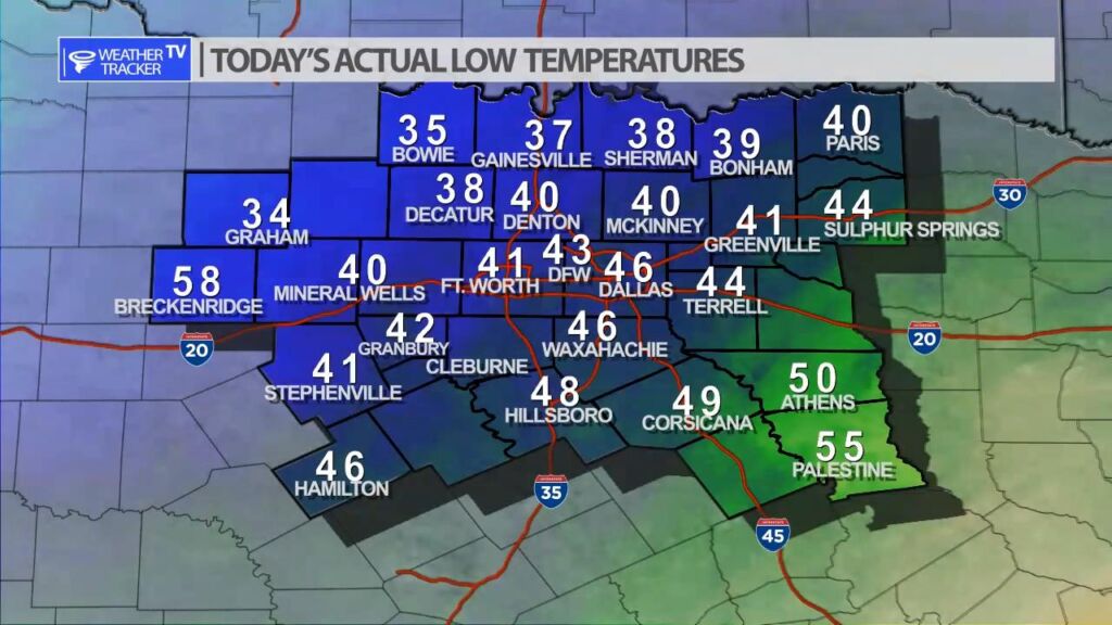
We had wide ranging lows across North Texas this morning. Locations to the northwest of Dallas – Fort Worth were in the 30s while locations southeast were in the 50s.


William’s North Texas Hazardous Weather Forecast for Friday:
No hazardous weather is expected at this time.


DFW today Cloudy with a chance of showers. A slight chance of drizzle this afternoon. Patchy fog this afternoon. Highs in the upper 40s. North winds 5 to 10 mph. Chance of rain 40 percent. -William

Here’s a look at Local Radar and Live Temperatures across North Texas.
DFW OVERNIGHT Mostly cloudy. A 20 percent chance of rain. Occasional sprinkles. Lows around 40. North winds 10 to 15 mph.
