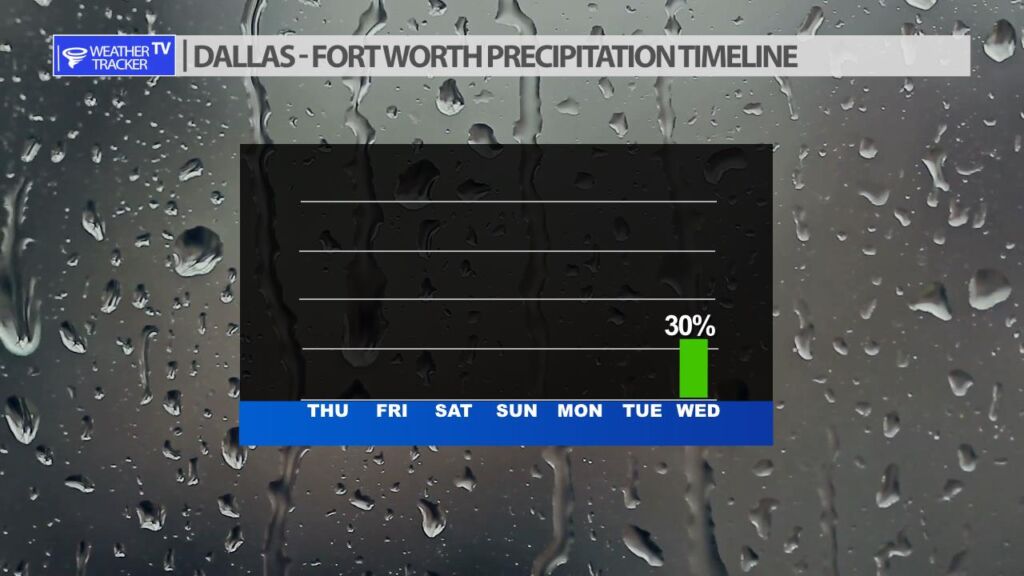
Right now, things appear to stay mostly dry through the middle part of next week. A slow moving storm system coming out of the Southwest will offer North Texas an opportunity of rain and possibly thunderstorms next Wednesday.
Right now, things appear to stay mostly dry through the middle part of next week. A slow moving storm system coming out of the Southwest will offer North Texas an opportunity of rain and possibly thunderstorms next Wednesday.


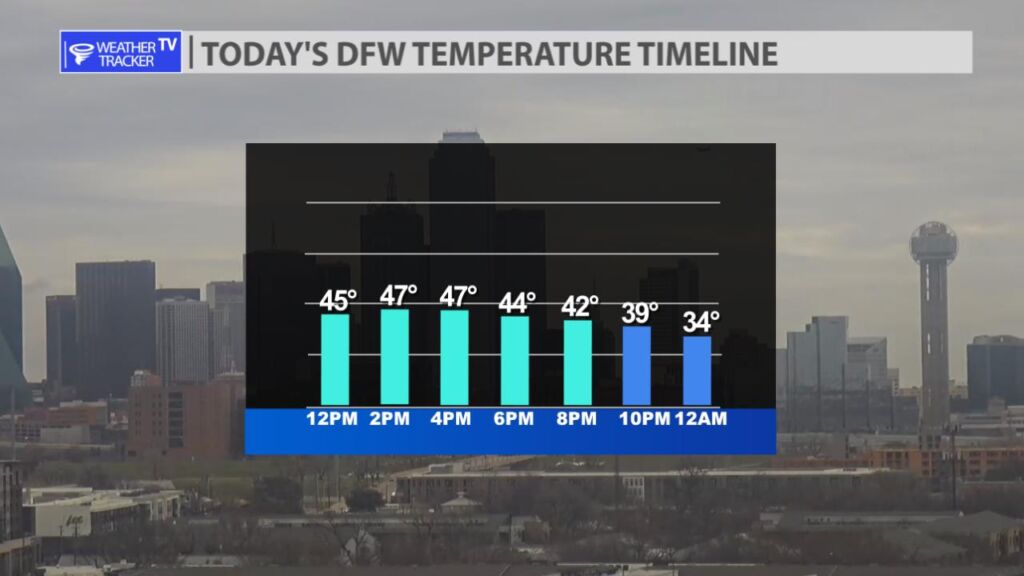
What a difference 24 hours makes. Yesterday warm and humid – today chilly with a blustery north wind. It’s all thanks to a cold front that moved through North Texas overnight. Highs today remain in the 40s.


William’s North Texas Hazardous Weather Forecast for Thursday:
No hazardous weather is expected at this time.


DFW today Mostly cloudy this morning, then becoming partly sunny. Much cooler with highs in the mid 40s. Northwest winds 15 to 20 mph. Gusts up to 30 mph this morning. -William

Here’s a look at Local Radar and Live Temperatures across North Texas.
DFW the rest of tonight: Partly cloudy with a 20 percent chance of showers and T-Storms. Lows in the upper 30s. Southwest winds 15 to 20 mph, becoming northwest with gusts up to 30 mph.


From William Cole: A strong T-Storm will impact portions of Hopkins and northeastern Rains Counties through 230 AM
At 148 AM , Live Radar was tracking a strong T-Storm 9 miles north of Emory, or 11 miles southwest of Sulphur Springs, moving northeast at 40 mph.
Wind Gusts Up To 50 Mph. Gusty Winds Could Knock Down Tree Limbs And Blow Around Unsecured Objects.
Stay with William Cole and Weather Tracker TV Dallas – Fort Worth for continuing coverage, online, on our app and on TV. Let’s stay safe together.
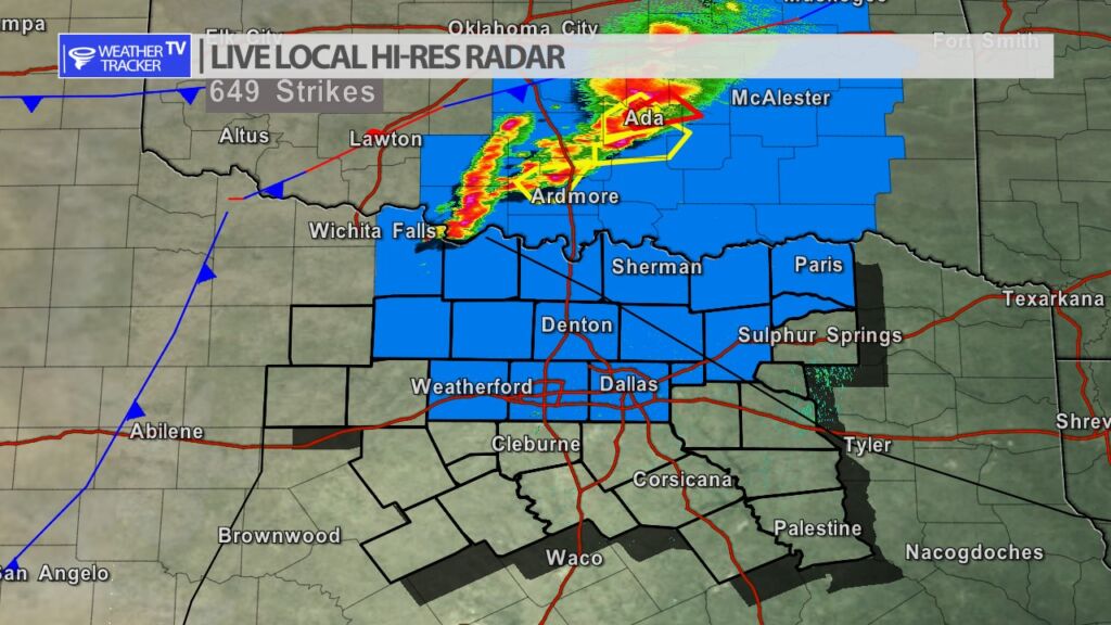
Radar in North Texas remains clear. A Severe Thunderstorm Watch continues until 10 PM. A cap has so far suppressed thunderstorm development in North Texas however, just across the Red River in Oklahoma – severe weather is ongoing.