Current Set Up Across the Nation

DFW today Showers with a slight chance of T-Storms this morning, then sunny this afternoon. Not as warm with highs in the upper 70s. Southwest winds 10 to 15 mph. Gusts up to 30 mph this morning. Chance of rain 90 percent. -William

Here’s a look at Local Radar and Live Temperatures across North Texas.
DFW the rest of tonight: Partly cloudy late this evening, then becoming mostly cloudy. A chance of showers with a slight chance of T-Storms. Breezy with lows in the mid 60s. South winds 20 to 25 mph, diminishing to 15 to 20 mph. Wind gusts up to 35 mph are possible. Chance of rain 50 percent.


The current Burn Ban Map for Texas is posted above.
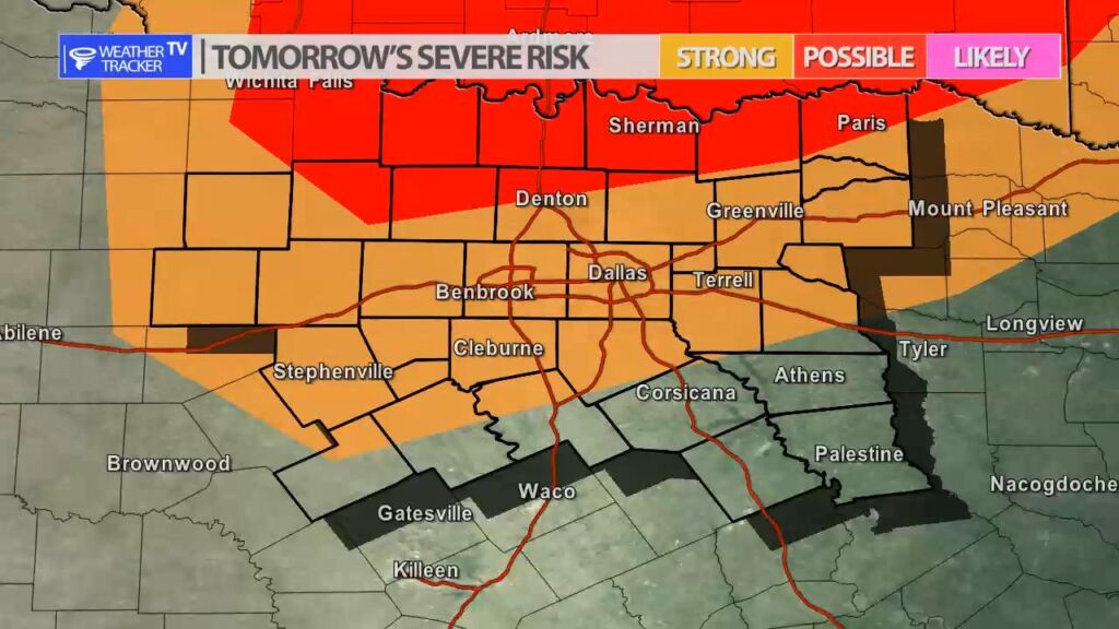
ELEVATED FIRE THREAT WEDNESDAY AFTERNOON WEST OF INTERSTATE 35
…ELEVATED FIRE THREAT WEDNESDAY AFTERNOON WEST OF INTERSTATE 35 * LOCATION…AREAS WEST OF THE INTERSTATE 35 CORRIDOR * TIMING…WEDNESDAY AFTERNOON * WINDS…SOUTHWEST 20 TO 25 MPH WITH GUSTS TO 35 MPH * TEMPERATURES…CLIMBING INTO THE 70S * RELATIVE HUMIDITY…20 TO 25 PERCENT EXTREME CARE IS URGED DURING ALL OUTSIDE ACTIVITIES WHERE THERE IS A POTENTIAL FOR GRASS FIRES TO GET STARTED. AVOID OUTSIDE BURNING AND WELDING. DO NOT TOSS LIT CIGARETTE BUTTS OUTSIDE. REPORT WILDFIRES TO THE NEAREST FIRE DEPARTMENT OR LAW ENFORCEMENT OFFICE QUICKLY.

William’s North Texas Hazardous Weather Forecast this Evening:
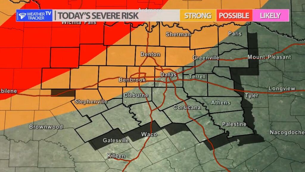
There is a chance for T-Storms beginning late tonight. A few strong to marginally severe storms will be possible near the Red River, with the potential for hail and damaging winds.
DFW tonight Partly cloudy in the evening, then mostly cloudy with a chance of showers with a slight chance of T-Storms after midnight. Breezy with lows in the mid 60s. South winds 15 to 20 mph, increasing to 20 to 25 mph after midnight. Wind gusts up to 40 mph are possible. Chance of rain 50 percent. -William


Here’s a look at Live Temperatures across North Texas, Local Radar and the Updated Forecast Map.
DFW this afternoon Sunny, hot with highs in the mid 80s. South winds 10 to 15 mph. -William


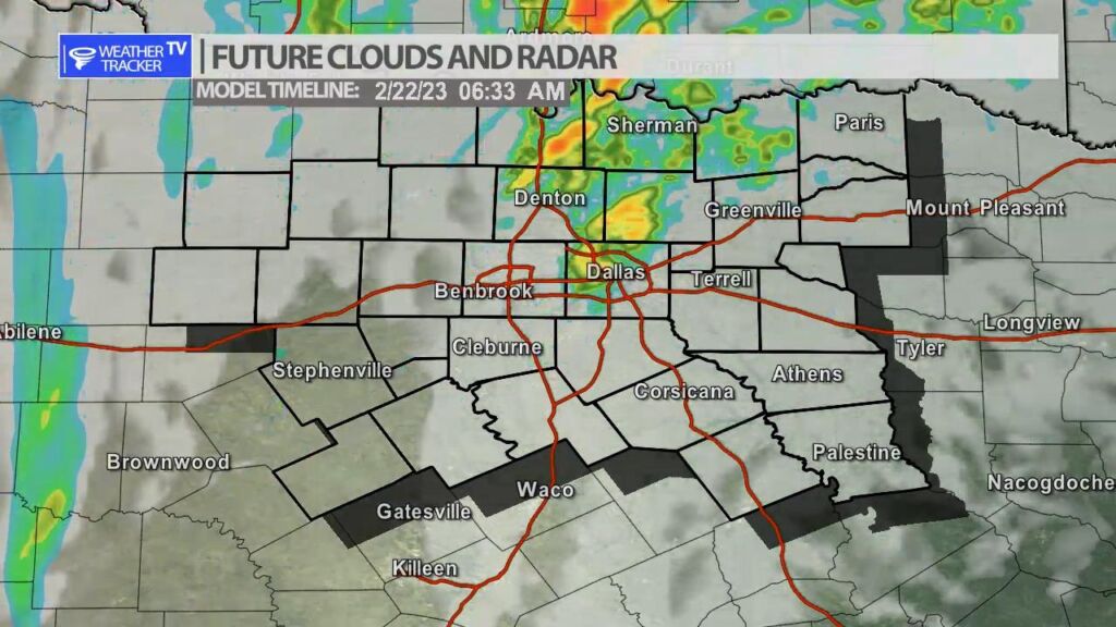
Scattered showers and T-Storms will be possible late tonight and first thing tomorrow morning. The organized severe risk should stay north in Oklahoma. A few storms could be strong in North Texas with thunder and wind gusts over 40 MPH. Scattered T-Storms are possible by 6 AM in the Metroplex so Wednesday mornings commute could be wet.