
William’s North Texas Hazardous Weather Forecast this Evening:
No hazardous weather is expected at this time.
William’s North Texas Hazardous Weather Forecast this Evening:
No hazardous weather is expected at this time.

DFW tonight Clear. Lows in the mid 50s. Southwest winds 5 to 10 mph. -William


Here’s a look at Live Temperatures across North Texas, Local Radar and the Updated Forecast Map.
DFW this afternoon Sunny. Highs in the upper 70s. Southwest winds 15 to 20 mph with gusts up to 30 mph. -William


Rain chances have ended today but low end rain chances linger through the weekend as a large storm system organized to our west. Rain and storm coverage appears very spotty through the weekend with a slightly better opportunity on Monday.
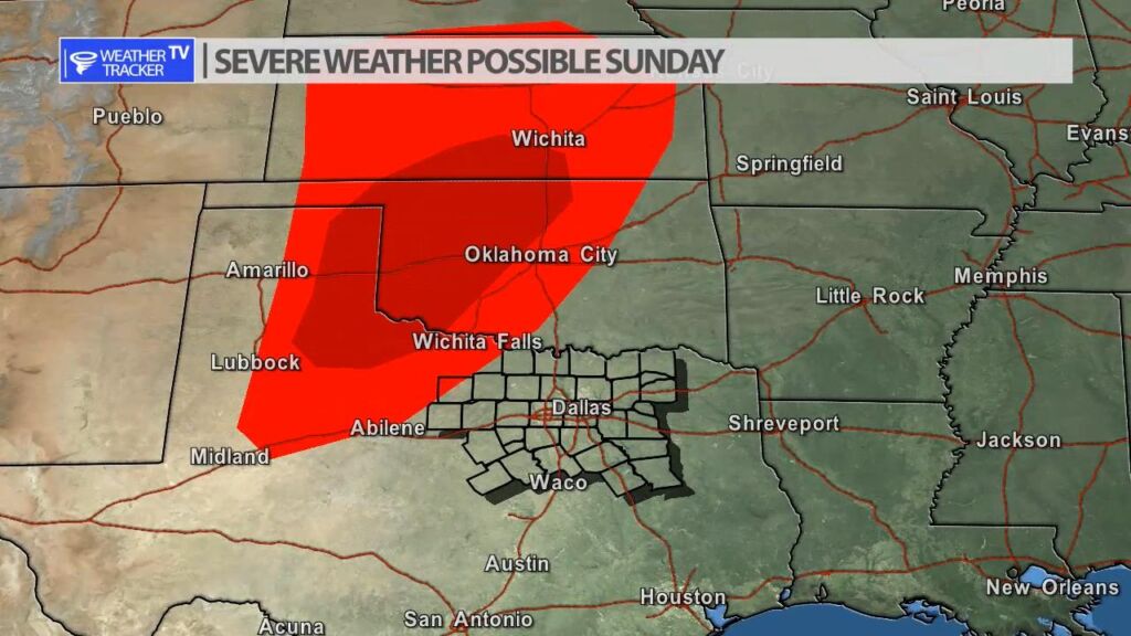
Severe weather will be in the region with a chance of organized severe weather to our north on Sunday.


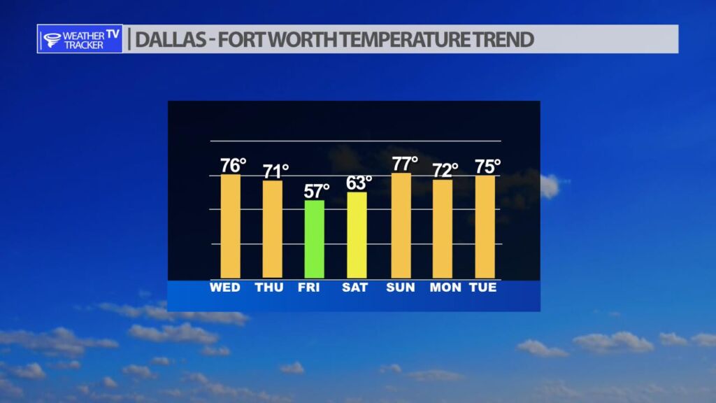
The next cold front arrives in North Texas with temperatures dropping out of the 70s tomorrow. By Friday highs will be sharply chiller in the 50s. We do quickly rebound temperatures by late weekend.
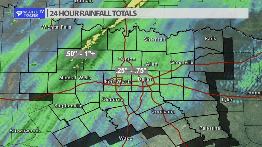
As the morning rain tapers off across North Texas. Radar estimated rainfall looks generous. Most locations received .25″ – .75″. Totals were a little higher – closer to an inch northwest of Dallas – Fort Worth.


William’s North Texas Hazardous Weather Forecast for Wednesday:
T-Storms are possible this morning. A few storms may become strong to marginally severe with a potential for hail and damaging winds, particularly near and north of US 380.