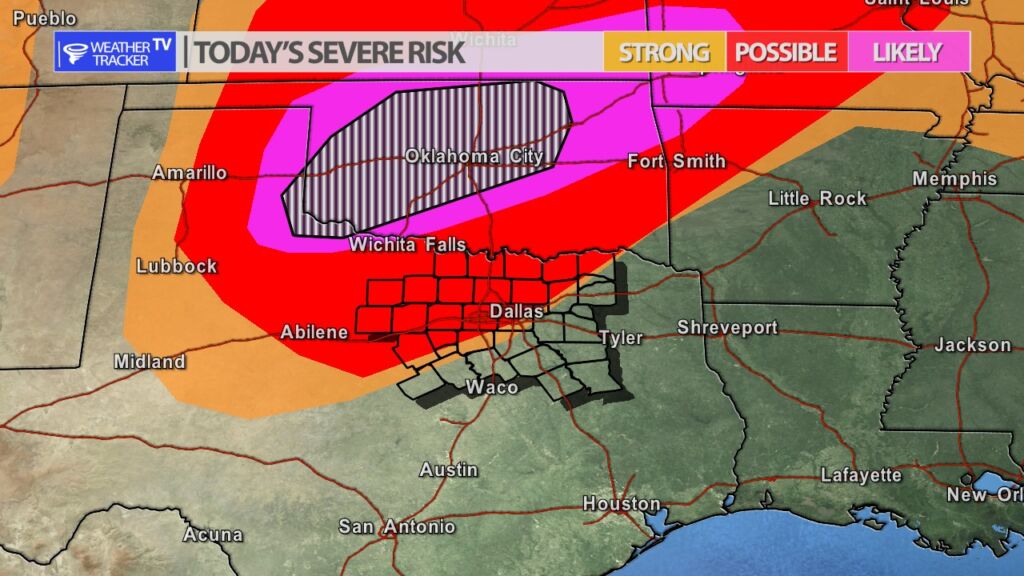
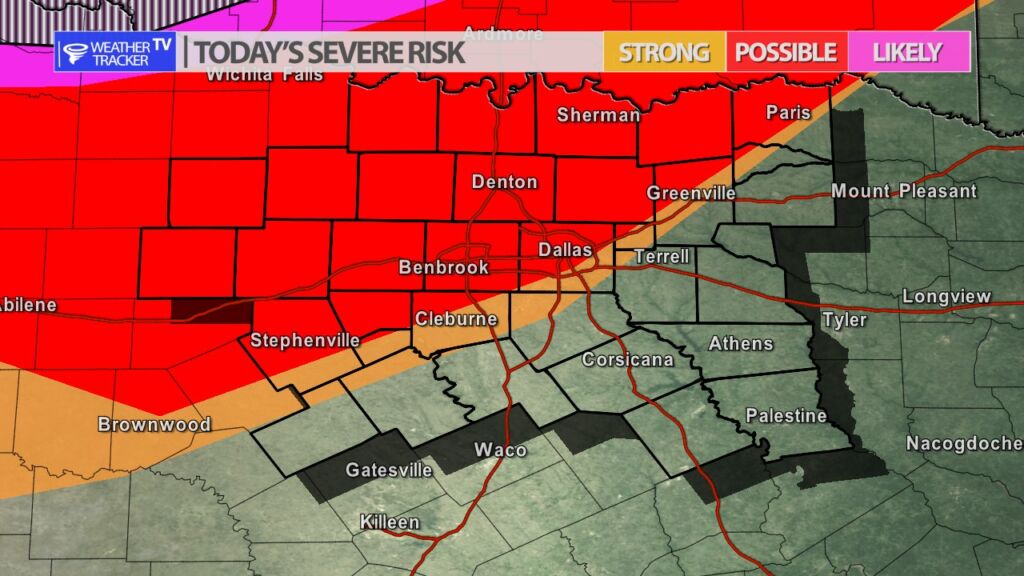
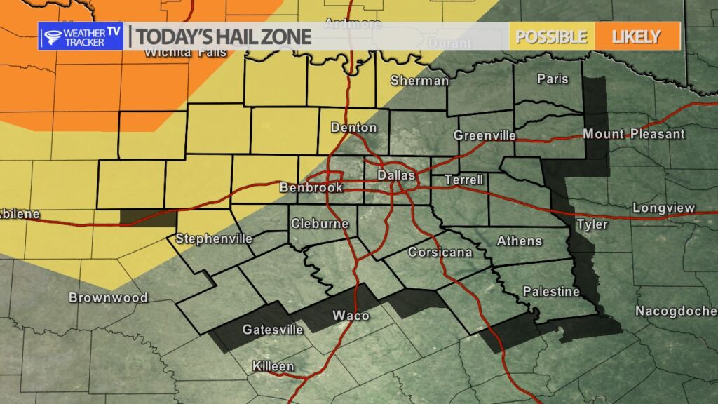
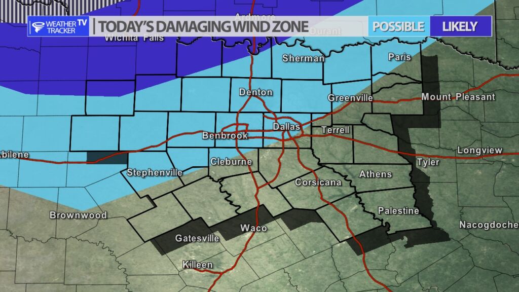
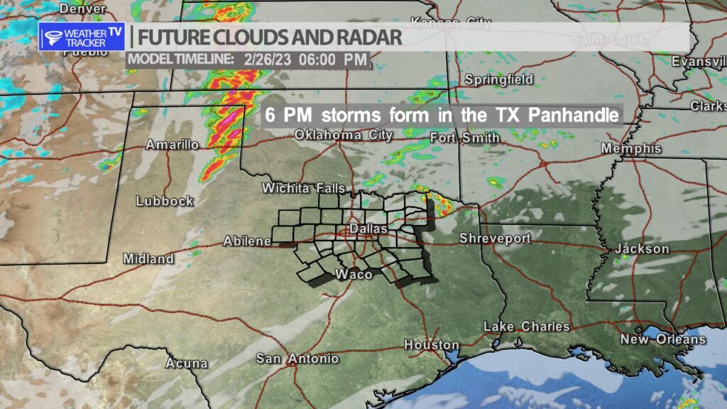
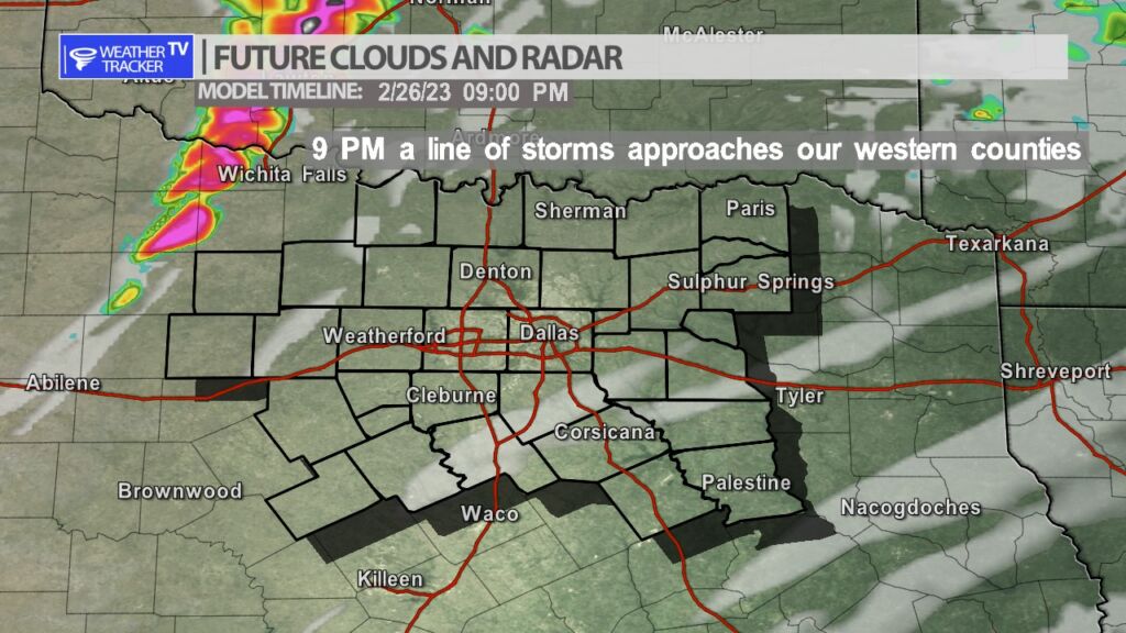
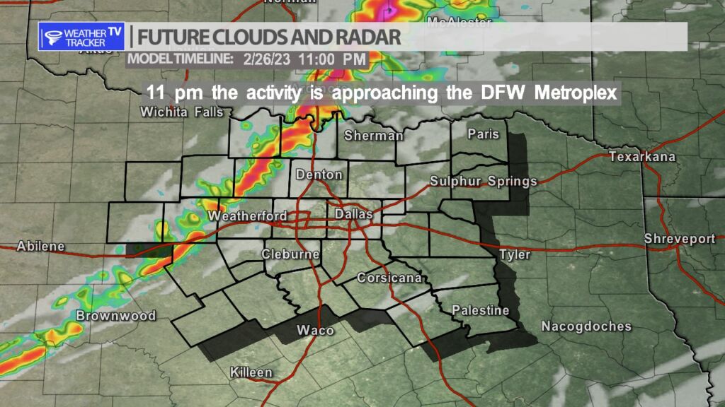
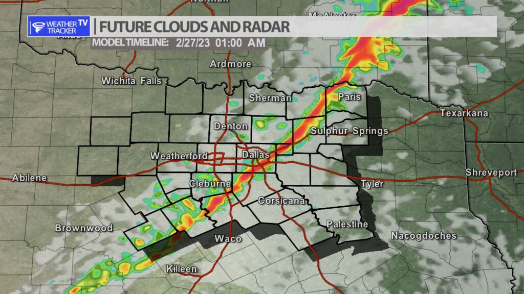
As a strong upper level storm system moves out into the southern plains this evening and tonight – a broken line of storms with embedded supercells will initially develop in our Texas Panhandle by 6 PM. The line will track into western Oklahoma with the greatest threat of severe weather tonight remaining in Oklahoma. The line will back build to the south through the evening and by 9 PM a southerly flank will be approaching our western counites. This southerly section initially could be quite severe – mainly in the Big Country – with rotating supercells possible out there. That activity will continue to form into a line with a weakening trend as it moves into North Texas. The line will approach Dallas – Fort Worth by 11 PM. The primary concern in North Texas will be strait line winds of 60 MPH+. Damaging hail will be possible in our western counties – especially with any rotating storm – and sizes could be up to golf balls. The hail threat will dramatically come down as the line moves deeper into North Texas with quarter sized hail being possible in the Metroplex. The tornado threat for North Texas is low however, anytime you’re dealing with a line of storms and a strong jet stream storm system you always have a concern of quick spin up tornadoes and that is something we will be monitoring tonight. Additional updates will be available here on the mobile app, on the channel and of course live severe weather coverage as needed.

You must be logged in to post a comment.