
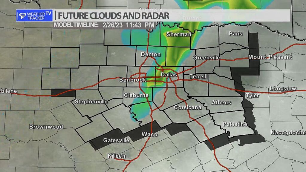
A line of storms is possible late Sunday as a strong upper level storm system moves across the area. Storms will form first in our western counties after 7 pm near a weak cold front – that activity will approach the I-35 corridor by midnight. Severe weather may be possible with the activity including hail, wind and even a tornado warning. We’ll keep you updated on that threat today and through the weekend.
You must be logged in to post a comment.