August 2022
Current Set Up Across the Nation
Wednesday Night Forecast for the Dallas – Fort Worth Metroplex
DFW Early Wednesday Afternoon Update
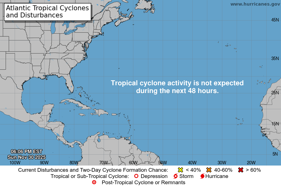
Atlantic Tropical Weather Outlook

From the National Hurricane Center:
For the North Atlantic Caribbean Sea and the Gulf of Mexico:Central Tropical Atlantic:Shower and T-Storm activity associated with an area of lowpressure located several hundred miles east of the Lesser Antilleshas changed little this morning. Although environmental conditionsare only marginally conducive, additional gradual development ofthis system is expected and a tropical depression is likely to formwithin the next couple of days. The disturbance is forecast to moveslowly toward the west-northwest, toward the adjacent waters of thenorthern Leeward Islands. Additional information on this system canbe found in High Seas Forecasts issued by the National WeatherService.* Formation chance through 48 hours medium 60 percent.* Formation chance through 5 days high 80 percent.Eastern Tropical Atlantic:Showers and T-Storms associated with a broad area of lowpressure located between the west coast of Africa and theCabo Verde Islands have become slightly better organized. Somegradual development is possible, and the system could become ashort-lived tropical depression over the far eastern Atlantic duringthe next couple of days. By late this week, environmentalconditions are forecast to become increasingly unfavorable forfurther development. Regardless, the system could bring locallyheavy rainfall to portions of the Cabo Verde Islands throughThursday.* Formation chance through 48 hours medium 40 percent.* Formation chance through 5 days medium 50 percent.Central Subtropical Atlantic:An area of low pressure has formed along a decaying frontal zoneover the central subtropical Atlantic about 850 mileswest-southwest of the westernmost Azores. Environmental conditionsare expected to be conducive for development, and a tropical orsubtropical depression is likely to form during the next few dayswhile the system drifts generally eastward.* Formation chance through 48 hours medium 60 percent.* Formation chance through 5 days high 70 percent.High Seas Forecasts issued by Weather Tracker TVcan be found under AWIPS header NFDHSFAT1, WMO header FZNT01KWBC, and online at ocean.weather.gov/shtml/NFDHSFAT1.phpForecaster Bucci/Pasch
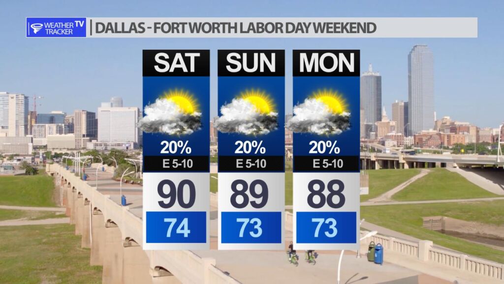
Labor Day Weekend Forecast

Temperatures will actually trend below normal for our North Texas Labor Day weekend. It will not be a washout but low end rain chances will linger.
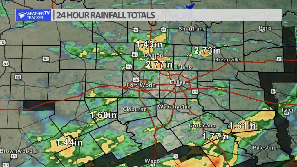
Rainfall Totals

Rainfall totals have been spotty as anticipated over the last 24 hours. Areas that did receive rain 1″ – 2″ amounts were common. Southern Denton county picked up over 3 inches of rain yesterday evening where a flash flood warning was issued.