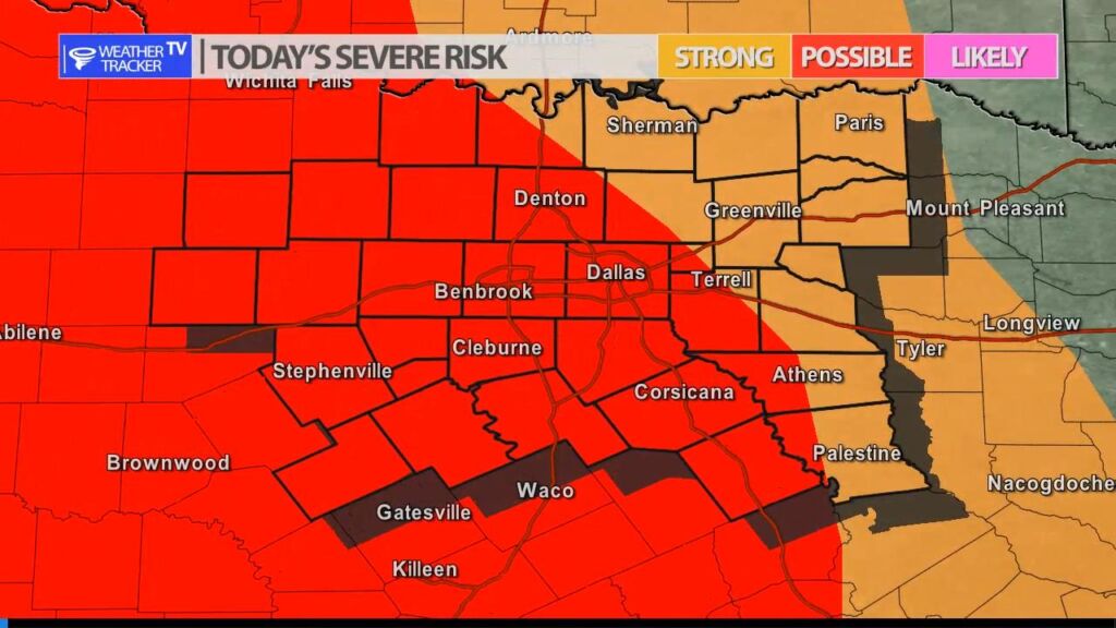
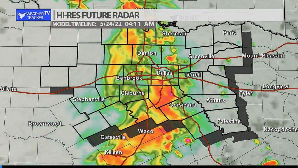
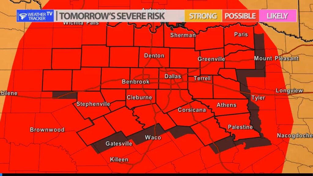
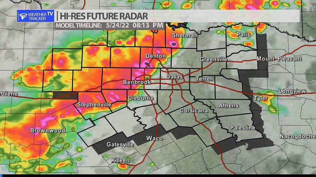
Rain and storm chances are increasing in North Texas to start your work week. We have two distinct opportunities for storms. The first arrives tonight – after midnight in the Metroplex – as a complex of storms moves in from West Texas. The storms will be in a weakening phase but isolated severe weather will be possible with quarter sized hail and wind gusts up to 60 mph. The second opportunity arrives tomorrow evening as our next cold front moves across the area. We’ll see a squall line of storms develop near the front and move from northwest to the southeast impacting the Metroplex by early evening. Severe weather looks quite possible with half dollar sized hail and wind gusts 65 mph+. Showers may linger into Wednesday morning but we tapper things off quickly by Wednesday afternoon.
You must be logged in to post a comment.