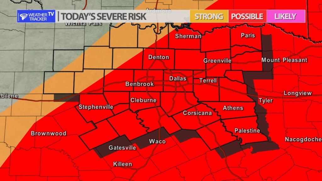
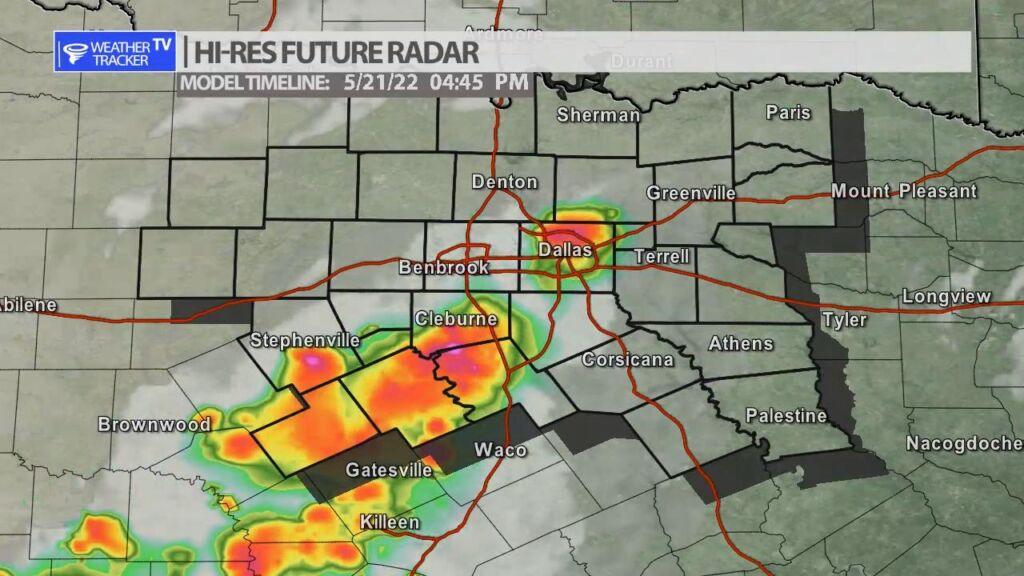
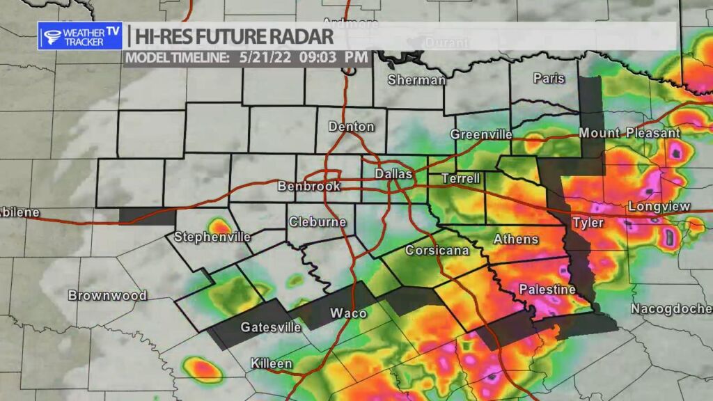
Severe weather is possible across a large portion of North Texas this afternoon and evening. As a cold front moves across the area it will be the trigger for thunderstorms and we go through the afternoon. The activity will initially be scattered near the front, but will eventually gel into a line of storms the further south and it east the activity progresses. Storms will develop initially near and south of the DFW Metroplex around 3 pm. The main concern today is hail up to the size of half dollars and wind gusts up to 65 mph. There may be a few scattered showers through the early part of the afternoon however, that is not the main activity expected.
You must be logged in to post a comment.