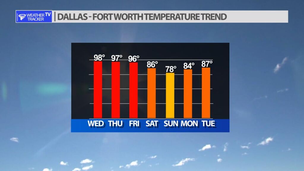
After a very hot stretch of weather in North Texas – daytime highs running 10 – 15 degrees above normal over the last two weeks. A pattern change starts late Friday into the weekend, and it will bring heat relief in the form of a cold front, and also storm chances.
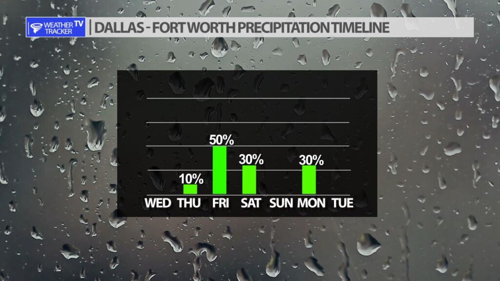
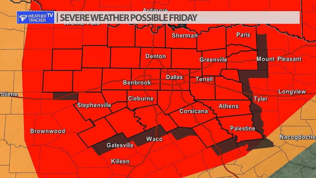
Storm chances are increasing on Friday as the first piece of our pattern change arrives. A dryline will set up in our western counties and late day storms will form. Those initial storms will then push east and fill into a broken line or full line of storms as they cross the I-35 corridor. Severe is possible with any of the activity on Friday. Hail and wind is a concern, but also a few tornado warnings would be possible.
You must be logged in to post a comment.