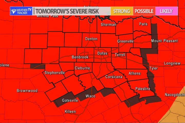
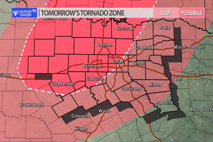
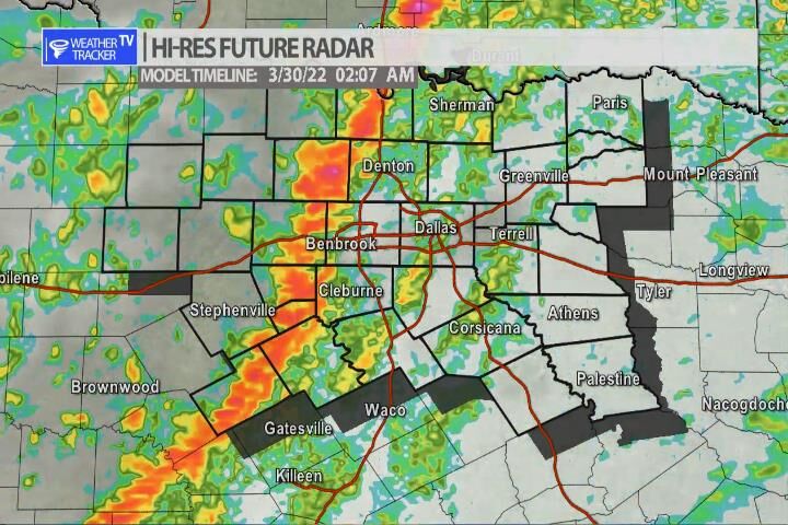
The risk of severe weather returns to North Texas late on Tuesday into early Wednesday morning. As an upper level storm system approaches from the west. A dryline will set up in the Big Country and by late evening storms will rapidly develop out there. Scattered supercells are possible and the activity will push east into our western counties. The storms will then morph into a line and continue pushing east into the overnight arriving in the Metroplex after 1 am – 2am. When the activity initially develops – hail – larger than golf balls will be a concern but as the storms evolve into a line – gusty winds 65 mph+ will be the primary concern into the overnight. There is a tornado threat. The supercells that initially form in the Big Country may pose a tornado threat as they move into our western counites. After the line of storms form – brief spin up tornadoes remain possible into the overnight. We will have more updates throughout the day and as always severe weather coverage tomorrow as needed.
You must be logged in to post a comment.