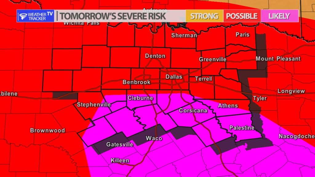
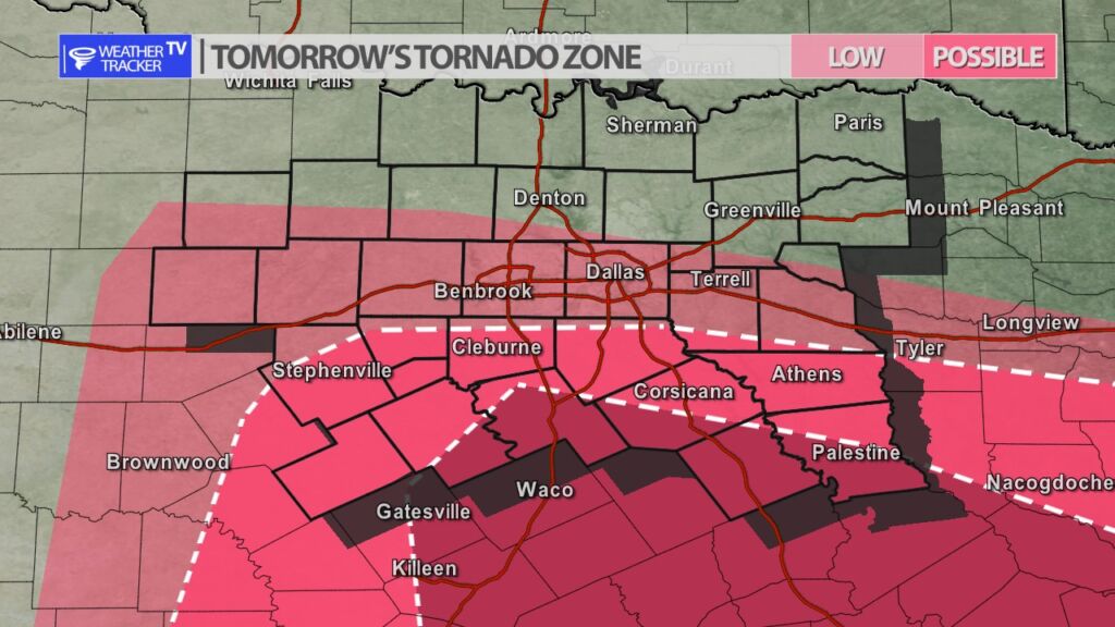
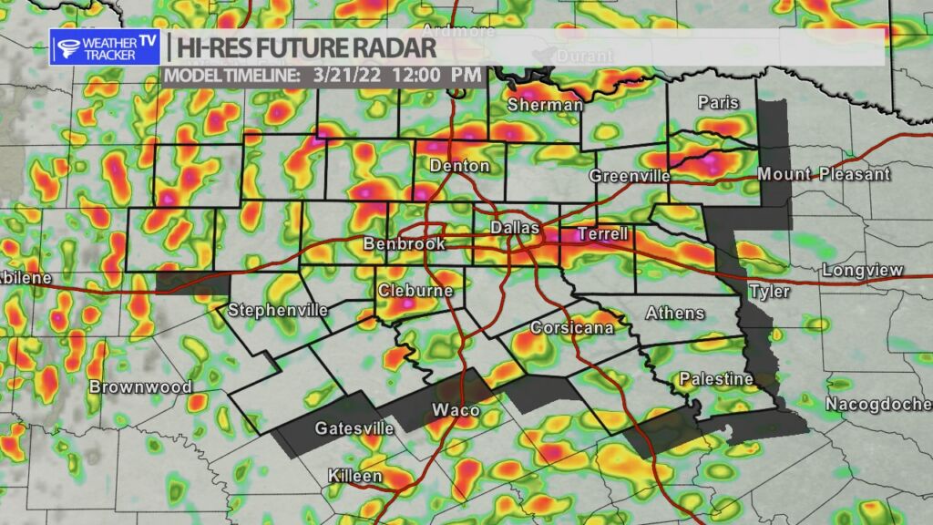
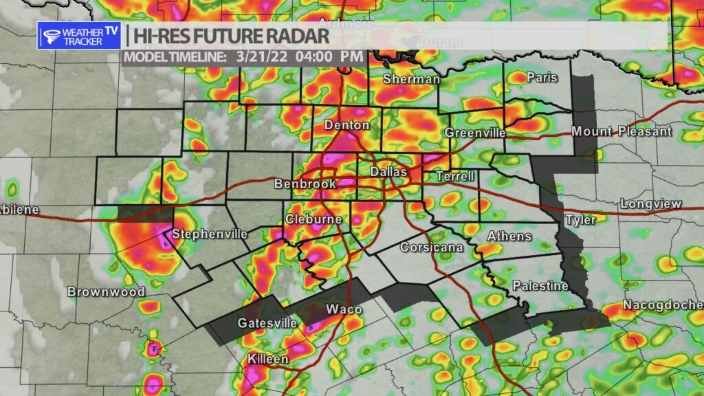
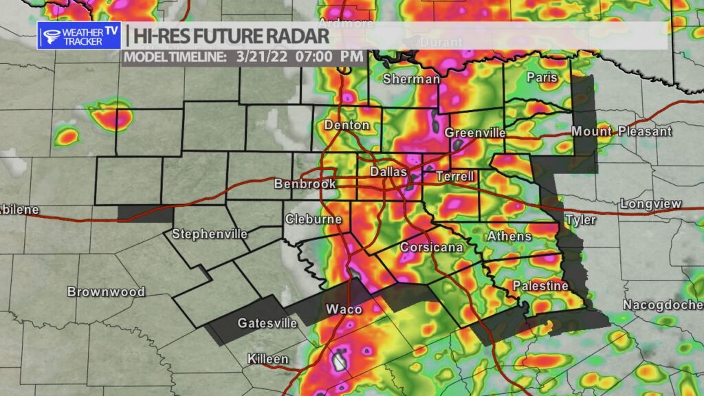
The risk of severe weather returns to North Texas tomorrow (Monday). The risk of heavy rain, hail, wind and even a tornado or two is possible. This is not be the classic everything is quiet until late afternoon set up. Scattered showers and T-Storms will be ongoing during the early afternoon. By late afternoon as the Jetstream begins to strengthen a broken line of storms will form. This is when the main threat of severe will develop. Large hail and wind will be possible but there will be a developing tornado threat as well. The tornado zone appears to be from our southern counties down into parts of central Texas. Hail larger than golf balls is also possible across the area. As always we will have updates here on the mobile app and live severe weather coverage on the channel as needed tomorrow.
You must be logged in to post a comment.