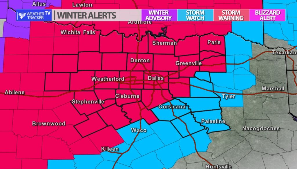
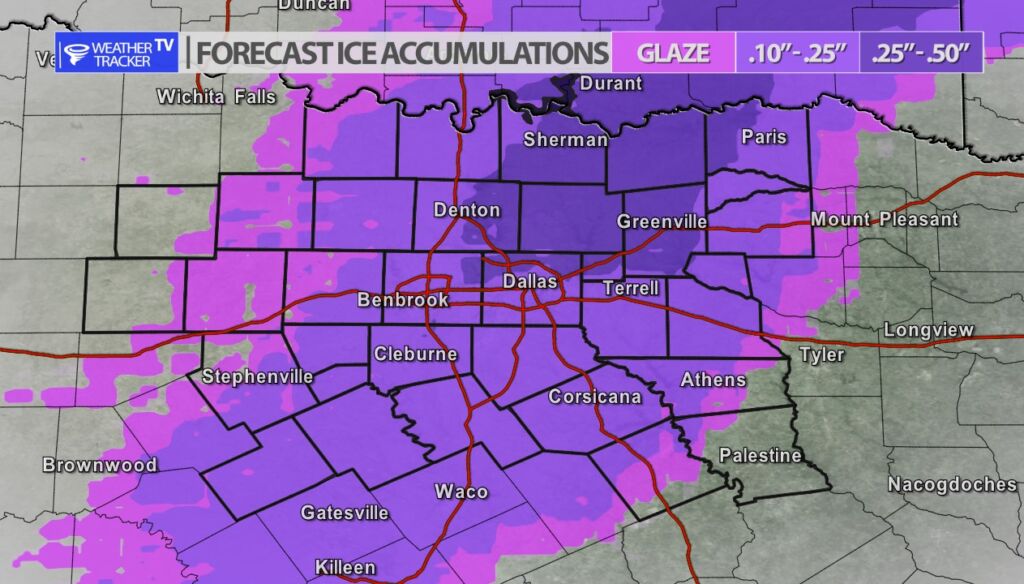
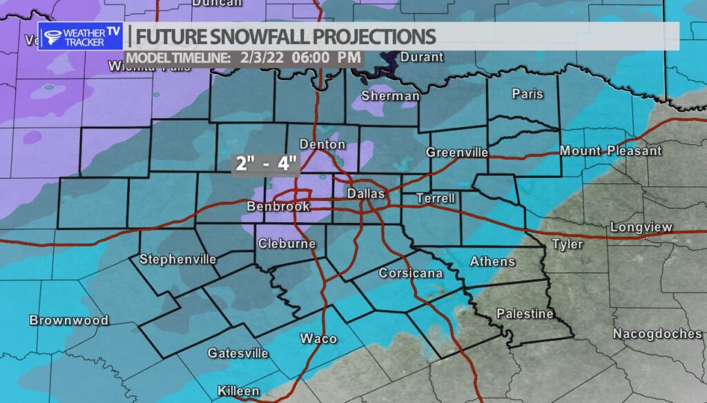
The newest data has just come in this evening. The general trend — the winter storm / ice storm is looking more impactful for North Texas. The timing hasn’t changed. We initially see heavy rain develop during the afternoon tomorrow. Temperatures will be dropping behind an Arctic front and once we hit 32 degrees the rain will transition to a freezing rain – that appears to happen around 6 pm in the Metroplex. Freezing rain is likely in the Metroplex Wednesday evening and Wednesday night. Travel will become extremely hazardous to nearly impossible. The only detail of the forecast that continues to evolve is the chance of snow on Thursday. The newest data this evening transitions the Metroplex Thursday morning from a mix to snow – with snow accumulations of 2″ – 4″+ quite possible. Travel will be extremely hazardous through at least Friday and with icing there is always a risk of power disruptions / extended outages. Make sure you have planned ahead and have plenty of supplies at your home to ride this out for a few days if needed.
You must be logged in to post a comment.